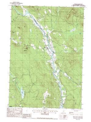
Milan Topo Map New Hampshire
To zoom in, hover over the map of Milan
USGS Topo Quad 44071e2 - 1:24,000 scale
| Topo Map Name: | Milan |
| USGS Topo Quad ID: | 44071e2 |
| Print Size: | ca. 21 1/4" wide x 27" high |
| Southeast Coordinates: | 44.5° N latitude / 71.125° W longitude |
| Map Center Coordinates: | 44.5625° N latitude / 71.1875° W longitude |
| U.S. State: | NH |
| Filename: | o44071e2.jpg |
| Download Map JPG Image: | Milan topo map 1:24,000 scale |
| Map Type: | Topographic |
| Topo Series: | 7.5´ |
| Map Scale: | 1:24,000 |
| Source of Map Images: | United States Geological Survey (USGS) |
| Alternate Map Versions: |
Milan NH 1988, updated 1988 Download PDF Buy paper map Milan NH 1988, updated 1988 Download PDF Buy paper map Milan NH 2012 Download PDF Buy paper map Milan NH 2015 Download PDF Buy paper map |
| FStopo: | US Forest Service topo Milan is available: Download FStopo PDF Download FStopo TIF |
1:24,000 Topo Quads surrounding Milan
> Back to 44071e1 at 1:100,000 scale
> Back to 44070a1 at 1:250,000 scale
> Back to U.S. Topo Maps home
Milan topo map: Gazetteer
Milan: Airports
Berlin Municipal Airport elevation 341m 1118′Milan: Lakes
Head Pond elevation 323m 1059′Mud Pond Lake elevation 393m 1289′
Milan: Parks
Milan Hill State Park elevation 527m 1729′Nansen Wayside Park elevation 336m 1102′
Milan: Populated Places
Copperville elevation 328m 1076′Dummer elevation 358m 1174′
Milan elevation 346m 1135′
Milan: Post Offices
Milan Post Office elevation 347m 1138′Milan: Streams
Chickwolnepy Stream elevation 334m 1095′Horne Brook elevation 334m 1095′
Leavitt Stream elevation 332m 1089′
Robbins Brook elevation 342m 1122′
Stearns Brook elevation 335m 1099′
Milan: Summits
Cates Hill elevation 629m 2063′Closton Hill elevation 573m 1879′
Jodrie Hill elevation 513m 1683′
Little Cambridge Mountain elevation 669m 2194′
Milan Hill elevation 525m 1722′
Oak Hill elevation 562m 1843′
Peabody Hill elevation 547m 1794′
Milan digital topo map on disk
Buy this Milan topo map showing relief, roads, GPS coordinates and other geographical features, as a high-resolution digital map file on DVD:
Maine, New Hampshire, Rhode Island & Eastern Massachusetts
Buy digital topo maps: Maine, New Hampshire, Rhode Island & Eastern Massachusetts


