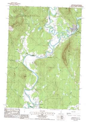
Groveton Topo Map New Hampshire
To zoom in, hover over the map of Groveton
USGS Topo Quad 44071e5 - 1:24,000 scale
| Topo Map Name: | Groveton |
| USGS Topo Quad ID: | 44071e5 |
| Print Size: | ca. 21 1/4" wide x 27" high |
| Southeast Coordinates: | 44.5° N latitude / 71.5° W longitude |
| Map Center Coordinates: | 44.5625° N latitude / 71.5625° W longitude |
| U.S. States: | NH, VT |
| Filename: | o44071e5.jpg |
| Download Map JPG Image: | Groveton topo map 1:24,000 scale |
| Map Type: | Topographic |
| Topo Series: | 7.5´ |
| Map Scale: | 1:24,000 |
| Source of Map Images: | United States Geological Survey (USGS) |
| Alternate Map Versions: |
Groveton NH 1988, updated 1988 Download PDF Buy paper map Groveton NH 2012 Download PDF Buy paper map Groveton NH 2015 Download PDF Buy paper map |
1:24,000 Topo Quads surrounding Groveton
> Back to 44071e1 at 1:100,000 scale
> Back to 44070a1 at 1:250,000 scale
> Back to U.S. Topo Maps home
Groveton topo map: Gazetteer
Groveton: Airports
Lancaster Heliport elevation 263m 862′Groveton: Bridges
Groveton Bridge elevation 263m 862′Groveton: Dams
Connecticut Groveton Dam elevation 329m 1079′Lower Groveton Dam elevation 263m 862′
Upper Ammonoosuc Dam elevation 268m 879′
Upper Groveton Dam elevation 286m 938′
Groveton: Lakes
Baker Pond elevation 261m 856′Kent Pond elevation 261m 856′
Stevens Pond elevation 283m 928′
Groveton: Parks
Eames Wayside Area elevation 274m 898′Guildhall Square elevation 258m 846′
Guildhall Village Historic District elevation 258m 846′
Groveton: Populated Places
Coos Junction elevation 262m 859′Groveton elevation 269m 882′
Guildhall elevation 263m 862′
Northumberland elevation 264m 866′
Stevens elevation 270m 885′
Groveton: Post Offices
Groveton Post Office elevation 271m 889′Guildhall Post Office elevation 270m 885′
Groveton: Reservoirs
Connecticut River Reservoir elevation 329m 1079′Upper Ammonoosuc River Reservoir elevation 263m 862′
Upper Ammonoosuc River Reservoir elevation 268m 879′
Upper Amonoosuc River Reservoir elevation 286m 938′
Groveton: Ridges
Cape Horn elevation 603m 1978′Spalding Hill elevation 358m 1174′
Groveton: Streams
Cutler Mill Brook elevation 259m 849′Dean Brook elevation 262m 859′
Dutton Brook elevation 317m 1040′
Emery Brook elevation 253m 830′
Jones Brook elevation 262m 859′
Moore Brook elevation 317m 1040′
Parks Brook elevation 343m 1125′
Potter Brook elevation 271m 889′
Roaring Brook elevation 263m 862′
Sheridan Brook elevation 254m 833′
Upper Ammonoosuc River elevation 260m 853′
Washburn Brook elevation 253m 830′
Whipple Brook elevation 301m 987′
Groveton: Summits
Bald Mountain elevation 454m 1489′Beech Hill elevation 427m 1400′
Duren Mountain elevation 438m 1437′
Flynn Hill elevation 385m 1263′
Page Hill elevation 379m 1243′
Groveton digital topo map on disk
Buy this Groveton topo map showing relief, roads, GPS coordinates and other geographical features, as a high-resolution digital map file on DVD:
Maine, New Hampshire, Rhode Island & Eastern Massachusetts
Buy digital topo maps: Maine, New Hampshire, Rhode Island & Eastern Massachusetts


