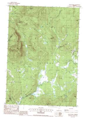
Gallup Mills Topo Map Vermont
To zoom in, hover over the map of Gallup Mills
USGS Topo Quad 44071e7 - 1:24,000 scale
| Topo Map Name: | Gallup Mills |
| USGS Topo Quad ID: | 44071e7 |
| Print Size: | ca. 21 1/4" wide x 27" high |
| Southeast Coordinates: | 44.5° N latitude / 71.75° W longitude |
| Map Center Coordinates: | 44.5625° N latitude / 71.8125° W longitude |
| U.S. State: | VT |
| Filename: | o44071e7.jpg |
| Download Map JPG Image: | Gallup Mills topo map 1:24,000 scale |
| Map Type: | Topographic |
| Topo Series: | 7.5´ |
| Map Scale: | 1:24,000 |
| Source of Map Images: | United States Geological Survey (USGS) |
| Alternate Map Versions: |
Gallup Mills VT 1988, updated 1988 Download PDF Buy paper map Gallup Mills VT 1988, updated 1988 Download PDF Buy paper map Gallup Mills VT 2012 Download PDF Buy paper map Gallup Mills VT 2015 Download PDF Buy paper map |
1:24,000 Topo Quads surrounding Gallup Mills
> Back to 44071e1 at 1:100,000 scale
> Back to 44070a1 at 1:250,000 scale
> Back to U.S. Topo Maps home
Gallup Mills topo map: Gazetteer
Gallup Mills: Forests
Victory State Forest elevation 763m 2503′Gallup Mills: Lakes
Bog Pond elevation 378m 1240′Mud Pond elevation 576m 1889′
Gallup Mills: Populated Places
Damon Crossing elevation 347m 1138′Gallup Mills elevation 407m 1335′
Granby elevation 427m 1400′
Moccasin Mill elevation 445m 1459′
Victory elevation 343m 1125′
Gallup Mills: Ridges
Hobart Ridge elevation 636m 2086′Gallup Mills: Streams
Bog Brook elevation 342m 1122′Cold Brook elevation 340m 1115′
Granby Brook elevation 354m 1161′
Hay Hill Brook elevation 344m 1128′
James Brook elevation 377m 1236′
Jones Brook elevation 410m 1345′
Line Brook elevation 465m 1525′
Lund Brook elevation 414m 1358′
Rogers Brook elevation 349m 1145′
Schoolhouse Brook elevation 372m 1220′
Stanley Brook elevation 323m 1059′
Umpire Brook elevation 388m 1272′
Weir Mill Brook elevation 385m 1263′
Gallup Mills: Summits
Buzzell Hill elevation 577m 1893′East Haven Mountain elevation 924m 3031′
Lees Hill elevation 407m 1335′
Little Roundtop elevation 596m 1955′
Mitchell Knoll elevation 438m 1437′
Mitchell Mountain elevation 729m 2391′
Umpire Mountain elevation 907m 2975′
Gallup Mills digital topo map on disk
Buy this Gallup Mills topo map showing relief, roads, GPS coordinates and other geographical features, as a high-resolution digital map file on DVD:
Maine, New Hampshire, Rhode Island & Eastern Massachusetts
Buy digital topo maps: Maine, New Hampshire, Rhode Island & Eastern Massachusetts


