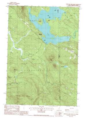
Umbagog Lake South Topo Map New Hampshire
To zoom in, hover over the map of Umbagog Lake South
USGS Topo Quad 44071f1 - 1:24,000 scale
| Topo Map Name: | Umbagog Lake South |
| USGS Topo Quad ID: | 44071f1 |
| Print Size: | ca. 21 1/4" wide x 27" high |
| Southeast Coordinates: | 44.625° N latitude / 71° W longitude |
| Map Center Coordinates: | 44.6875° N latitude / 71.0625° W longitude |
| U.S. States: | NH, ME |
| Filename: | o44071f1.jpg |
| Download Map JPG Image: | Umbagog Lake South topo map 1:24,000 scale |
| Map Type: | Topographic |
| Topo Series: | 7.5´ |
| Map Scale: | 1:24,000 |
| Source of Map Images: | United States Geological Survey (USGS) |
| Alternate Map Versions: |
Umbagog Lake South NH 1976, updated 1983 Download PDF Buy paper map Umbagog Lake South NH 1988, updated 1988 Download PDF Buy paper map Umbagog Lake South NH 1988, updated 1988 Download PDF Buy paper map Umbagog Lake South NH 1995, updated 1999 Download PDF Buy paper map Umbagog Lake South NH 2012 Download PDF Buy paper map Umbagog Lake South NH 2015 Download PDF Buy paper map |
1:24,000 Topo Quads surrounding Umbagog Lake South
> Back to 44071e1 at 1:100,000 scale
> Back to 44070a1 at 1:250,000 scale
> Back to U.S. Topo Maps home
Umbagog Lake South topo map: Gazetteer
Umbagog Lake South: Bays
Sargent Cove elevation 379m 1243′Thurston Cove elevation 379m 1243′
Tyler Cove elevation 379m 1243′
Umbagog Lake South: Capes
Tidswell Point elevation 387m 1269′Umbagog Lake South: Islands
Bear Island elevation 379m 1243′Big Island elevation 396m 1299′
Blake Island elevation 379m 1243′
Metallak Island elevation 380m 1246′
Umbagog Lake South: Lakes
Mollidgewock Pond elevation 507m 1663′Mud Pond elevation 467m 1532′
Umbagog Lake South: Populated Places
Upton elevation 530m 1738′Umbagog Lake South: Streams
Dead Cambridge River elevation 383m 1256′Tyler Brook elevation 379m 1243′
Umbagog Lake South: Summits
Cambridge Black Mountain elevation 821m 2693′Hampshire Hills elevation 648m 2125′
Little Roundtop Mountain elevation 569m 1866′
Mill Mountain elevation 659m 2162′
Roundtop Mountain elevation 572m 1876′
Umbagog Lake South digital topo map on disk
Buy this Umbagog Lake South topo map showing relief, roads, GPS coordinates and other geographical features, as a high-resolution digital map file on DVD:
Maine, New Hampshire, Rhode Island & Eastern Massachusetts
Buy digital topo maps: Maine, New Hampshire, Rhode Island & Eastern Massachusetts


