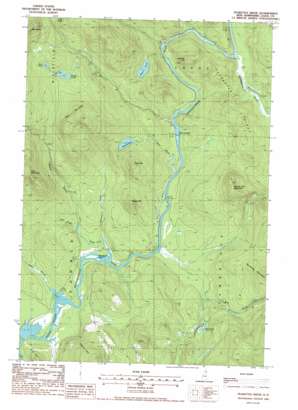
Teakettle Ridge Topo Map New Hampshire
To zoom in, hover over the map of Teakettle Ridge
USGS Topo Quad 44071f2 - 1:24,000 scale
| Topo Map Name: | Teakettle Ridge |
| USGS Topo Quad ID: | 44071f2 |
| Print Size: | ca. 21 1/4" wide x 27" high |
| Southeast Coordinates: | 44.625° N latitude / 71.125° W longitude |
| Map Center Coordinates: | 44.6875° N latitude / 71.1875° W longitude |
| U.S. State: | NH |
| Filename: | o44071f2.jpg |
| Download Map JPG Image: | Teakettle Ridge topo map 1:24,000 scale |
| Map Type: | Topographic |
| Topo Series: | 7.5´ |
| Map Scale: | 1:24,000 |
| Source of Map Images: | United States Geological Survey (USGS) |
| Alternate Map Versions: |
Teakettle Ridge NH 1988, updated 1988 Download PDF Buy paper map Teakettle Ridge NH 1988, updated 1988 Download PDF Buy paper map Teakettle Ridge NH 2000, updated 2001 Download PDF Buy paper map Teakettle Ridge NH 2012 Download PDF Buy paper map Teakettle Ridge NH 2015 Download PDF Buy paper map |
1:24,000 Topo Quads surrounding Teakettle Ridge
> Back to 44071e1 at 1:100,000 scale
> Back to 44070a1 at 1:250,000 scale
> Back to U.S. Topo Maps home
Teakettle Ridge topo map: Gazetteer
Teakettle Ridge: Dams
Pontook Reservoir Dam elevation 354m 1161′Teakettle Ridge: Islands
Seven Islands elevation 359m 1177′Wentworth Island elevation 355m 1164′
Teakettle Ridge: Lakes
Moose Pond elevation 557m 1827′Mud Pond elevation 386m 1266′
Munn Pond elevation 431m 1414′
Rock Pond elevation 577m 1893′
Sessions Pond elevation 423m 1387′
Teakettle Ridge: Parks
Androscoggin Wayside Park elevation 370m 1213′Teakettle Ridge: Reservoirs
Pontook Reservoir elevation 354m 1161′Teakettle Ridge: Ridges
Teakettle Ridge elevation 476m 1561′Teakettle Ridge: Streams
Bear Brook elevation 363m 1190′Bog Brook elevation 358m 1174′
Island Brook elevation 356m 1167′
Lord Brook elevation 361m 1184′
Mollidgewock Brook elevation 367m 1204′
Newell Brook elevation 356m 1167′
Sessions Brook elevation 358m 1174′
Smoky Camp Brook elevation 365m 1197′
Teakettle Ridge: Summits
Deer Mountain elevation 695m 2280′Double Top Mountain elevation 566m 1856′
Holt Hill elevation 434m 1423′
Jackknife Hill elevation 485m 1591′
Pond Hill elevation 530m 1738′
Sugar Hill elevation 504m 1653′
Veezey Hill elevation 536m 1758′
Teakettle Ridge: Swamps
Goose Pond elevation 360m 1181′Teakettle Ridge: Woods
Thirteen Mile Woods elevation 363m 1190′Teakettle Ridge digital topo map on disk
Buy this Teakettle Ridge topo map showing relief, roads, GPS coordinates and other geographical features, as a high-resolution digital map file on DVD:
Maine, New Hampshire, Rhode Island & Eastern Massachusetts
Buy digital topo maps: Maine, New Hampshire, Rhode Island & Eastern Massachusetts


