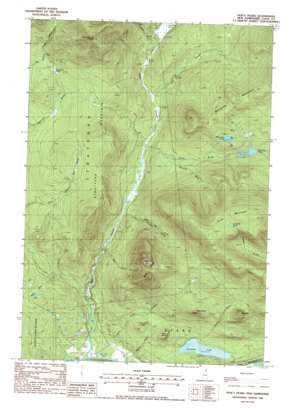
Percy Peaks Topo Map New Hampshire
To zoom in, hover over the map of Percy Peaks
USGS Topo Quad 44071f4 - 1:24,000 scale
| Topo Map Name: | Percy Peaks |
| USGS Topo Quad ID: | 44071f4 |
| Print Size: | ca. 21 1/4" wide x 27" high |
| Southeast Coordinates: | 44.625° N latitude / 71.375° W longitude |
| Map Center Coordinates: | 44.6875° N latitude / 71.4375° W longitude |
| U.S. State: | NH |
| Filename: | o44071f4.jpg |
| Download Map JPG Image: | Percy Peaks topo map 1:24,000 scale |
| Map Type: | Topographic |
| Topo Series: | 7.5´ |
| Map Scale: | 1:24,000 |
| Source of Map Images: | United States Geological Survey (USGS) |
| Alternate Map Versions: |
Percy Peaks NH 1988, updated 1988 Download PDF Buy paper map Percy Peaks NH 1988, updated 1988 Download PDF Buy paper map Percy Peaks NH 1996, updated 2000 Download PDF Buy paper map Percy Peaks NH 2012 Download PDF Buy paper map Percy Peaks NH 2015 Download PDF Buy paper map |
| FStopo: | US Forest Service topo Percy Peaks is available: Download FStopo PDF Download FStopo TIF |
1:24,000 Topo Quads surrounding Percy Peaks
> Back to 44071e1 at 1:100,000 scale
> Back to 44070a1 at 1:250,000 scale
> Back to U.S. Topo Maps home
Percy Peaks topo map: Gazetteer
Percy Peaks: Dams
Little Bog Pond Dam elevation 638m 2093′Percy Peaks: Lakes
Christine Lake elevation 367m 1204′Long Mountain Pond elevation 1041m 3415′
Sugarloaf Pond elevation 565m 1853′
Whitcomb Pond elevation 693m 2273′
Percy Peaks: Reservoirs
Little Bog Pond elevation 638m 2093′Percy Peaks: Ridges
Long Mountain elevation 1113m 3651′Stratford Mountain elevation 718m 2355′
Percy Peaks: Streams
East Branch Nash Stream elevation 431m 1414′Jimmy Cole Brook elevation 282m 925′
Long Mountain Brook elevation 423m 1387′
Nash Stream elevation 283m 928′
Pond Brook elevation 420m 1377′
Roaring Brook elevation 282m 925′
Silver Brook elevation 476m 1561′
Slide Brook elevation 380m 1246′
Waterhole Brook elevation 496m 1627′
Percy Peaks: Summits
Bag Hill elevation 464m 1522′Bald Mountain elevation 707m 2319′
Jimmy Cole Ledge elevation 462m 1515′
North Percy Peak elevation 1030m 3379′
Percy Peaks elevation 1030m 3379′
Potters Ledge elevation 496m 1627′
South Percy Peak elevation 970m 3182′
Sugarloaf elevation 1112m 3648′
Victor Head elevation 673m 2208′
Percy Peaks: Valleys
Boman Valley elevation 403m 1322′Percy Peaks digital topo map on disk
Buy this Percy Peaks topo map showing relief, roads, GPS coordinates and other geographical features, as a high-resolution digital map file on DVD:
Maine, New Hampshire, Rhode Island & Eastern Massachusetts
Buy digital topo maps: Maine, New Hampshire, Rhode Island & Eastern Massachusetts


