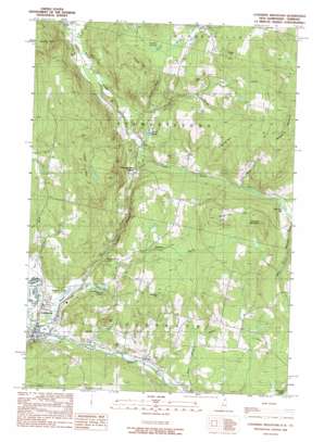
Lovering Mountain Topo Map New Hampshire
To zoom in, hover over the map of Lovering Mountain
USGS Topo Quad 44071h4 - 1:24,000 scale
| Topo Map Name: | Lovering Mountain |
| USGS Topo Quad ID: | 44071h4 |
| Print Size: | ca. 21 1/4" wide x 27" high |
| Southeast Coordinates: | 44.875° N latitude / 71.375° W longitude |
| Map Center Coordinates: | 44.9375° N latitude / 71.4375° W longitude |
| U.S. States: | NH, VT |
| Filename: | o44071h4.jpg |
| Download Map JPG Image: | Lovering Mountain topo map 1:24,000 scale |
| Map Type: | Topographic |
| Topo Series: | 7.5´ |
| Map Scale: | 1:24,000 |
| Source of Map Images: | United States Geological Survey (USGS) |
| Alternate Map Versions: |
Lovering Mountain NH 1989, updated 1989 Download PDF Buy paper map Lovering Mountain NH 1989, updated 1989 Download PDF Buy paper map Lovering Mountain NH 1996, updated 2000 Download PDF Buy paper map Lovering Mountain NH 2012 Download PDF Buy paper map Lovering Mountain NH 2015 Download PDF Buy paper map |
| FStopo: | US Forest Service topo Lovering Mountain is available: Download FStopo PDF Download FStopo TIF |
1:24,000 Topo Quads surrounding Lovering Mountain
> Back to 44071e1 at 1:100,000 scale
> Back to 44070a1 at 1:250,000 scale
> Back to U.S. Topo Maps home
Lovering Mountain topo map: Gazetteer
Lovering Mountain: Airports
Colebrook Airport elevation 386m 1266′Lovering Mountain: Falls
Beaver Brook Falls elevation 349m 1145′Lovering Mountain: Lakes
Ladd Pond elevation 383m 1256′Lombard Pond elevation 347m 1138′
Matthews Pond elevation 317m 1040′
Lovering Mountain: Populated Places
Colebrook elevation 312m 1023′Kidderville elevation 409m 1341′
Stewartstown Hollow elevation 392m 1286′
Lovering Mountain: Post Offices
Colebrook Post Office elevation 316m 1036′Lovering Mountain: Ridges
Piper Hill elevation 622m 2040′Lovering Mountain: Streams
Beaver Brook elevation 336m 1102′Cedar Brook elevation 374m 1227′
Dyer Brook elevation 311m 1020′
Gulch Brook elevation 393m 1289′
Haines Brook elevation 496m 1627′
North Branch Beaver Brook elevation 337m 1105′
North Branch Mohawk River elevation 336m 1102′
Pond Brook elevation 334m 1095′
Read Brook elevation 350m 1148′
Lovering Mountain: Summits
Collins Hill elevation 572m 1876′Dearth Hill elevation 561m 1840′
Kidder Hill elevation 643m 2109′
Lang Hill elevation 537m 1761′
Lovering Mountain elevation 643m 2109′
Mudget Mountain elevation 761m 2496′
North Hill elevation 623m 2043′
South Hill elevation 644m 2112′
Stevens Hill elevation 572m 1876′
Lovering Mountain: Swamps
Bear Rock Bog elevation 529m 1735′Hurlbert Swamp elevation 467m 1532′
Lovering Mountain digital topo map on disk
Buy this Lovering Mountain topo map showing relief, roads, GPS coordinates and other geographical features, as a high-resolution digital map file on DVD:
Maine, New Hampshire, Rhode Island & Eastern Massachusetts
Buy digital topo maps: Maine, New Hampshire, Rhode Island & Eastern Massachusetts


