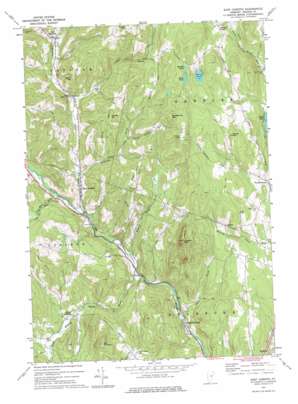
East Corinth Topo Map Vermont
To zoom in, hover over the map of East Corinth
USGS Topo Quad 44072a2 - 1:24,000 scale
| Topo Map Name: | East Corinth |
| USGS Topo Quad ID: | 44072a2 |
| Print Size: | ca. 21 1/4" wide x 27" high |
| Southeast Coordinates: | 44° N latitude / 72.125° W longitude |
| Map Center Coordinates: | 44.0625° N latitude / 72.1875° W longitude |
| U.S. State: | VT |
| Filename: | o44072a2.jpg |
| Download Map JPG Image: | East Corinth topo map 1:24,000 scale |
| Map Type: | Topographic |
| Topo Series: | 7.5´ |
| Map Scale: | 1:24,000 |
| Source of Map Images: | United States Geological Survey (USGS) |
| Alternate Map Versions: |
East Corinth VT 1973, updated 1975 Download PDF Buy paper map East Corinth VT 2012 Download PDF Buy paper map East Corinth VT 2015 Download PDF Buy paper map |
1:24,000 Topo Quads surrounding East Corinth
> Back to 44072a1 at 1:100,000 scale
> Back to 44072a1 at 1:250,000 scale
> Back to U.S. Topo Maps home
East Corinth topo map: Gazetteer
East Corinth: Basins
Devils Den elevation 384m 1259′East Corinth: Dams
Halls Lake Dam elevation 301m 987′East Corinth: Lakes
Long Pond elevation 421m 1381′Muddy Pond elevation 424m 1391′
Round Pond elevation 378m 1240′
East Corinth: Parks
West Newbury Village Historic District elevation 281m 921′East Corinth: Pillars
Iras Pinnacle elevation 468m 1535′East Corinth: Populated Places
Bradford Center elevation 160m 524′East Corinth elevation 214m 702′
East Topsham elevation 287m 941′
Goshen elevation 334m 1095′
Newbury Center elevation 310m 1017′
South Corinth elevation 240m 787′
Topsham Four Corners elevation 244m 800′
East Corinth: Reservoirs
Halls Lake elevation 301m 987′East Corinth: Streams
Chase Brook elevation 169m 554′Hedgehog Brook elevation 216m 708′
Levi Brook elevation 243m 797′
Meadow Brook elevation 187m 613′
Pike Hill Brook elevation 225m 738′
South Branch Waits River elevation 183m 600′
Tabor Branch elevation 206m 675′
East Corinth: Summits
Brock Hill elevation 427m 1400′Currier Hill elevation 417m 1368′
Page Hill elevation 409m 1341′
Taplin Hill elevation 431m 1414′
Tucker Mountain elevation 515m 1689′
Woodchuck Mountain elevation 531m 1742′
Wrights Mountain elevation 555m 1820′
East Corinth: Trails
Wrights Mountain Trail elevation 473m 1551′East Corinth digital topo map on disk
Buy this East Corinth topo map showing relief, roads, GPS coordinates and other geographical features, as a high-resolution digital map file on DVD:
New York, Vermont, Connecticut & Western Massachusetts
Buy digital topo maps: New York, Vermont, Connecticut & Western Massachusetts


