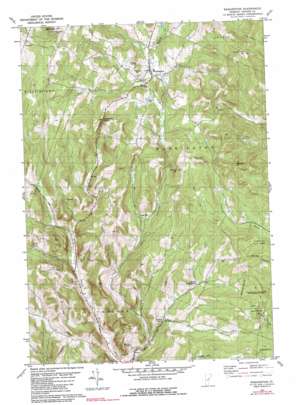
Washington Topo Map Vermont
To zoom in, hover over the map of Washington
USGS Topo Quad 44072a4 - 1:24,000 scale
| Topo Map Name: | Washington |
| USGS Topo Quad ID: | 44072a4 |
| Print Size: | ca. 21 1/4" wide x 27" high |
| Southeast Coordinates: | 44° N latitude / 72.375° W longitude |
| Map Center Coordinates: | 44.0625° N latitude / 72.4375° W longitude |
| U.S. State: | VT |
| Filename: | o44072a4.jpg |
| Download Map JPG Image: | Washington topo map 1:24,000 scale |
| Map Type: | Topographic |
| Topo Series: | 7.5´ |
| Map Scale: | 1:24,000 |
| Source of Map Images: | United States Geological Survey (USGS) |
| Alternate Map Versions: |
Washington VT 1981, updated 1981 Download PDF Buy paper map Washington VT 1981, updated 1990 Download PDF Buy paper map Washington VT 2012 Download PDF Buy paper map Washington VT 2015 Download PDF Buy paper map |
1:24,000 Topo Quads surrounding Washington
> Back to 44072a1 at 1:100,000 scale
> Back to 44072a1 at 1:250,000 scale
> Back to U.S. Topo Maps home
Washington topo map: Gazetteer
Washington: Airports
Carriers Sky Park elevation 475m 1558′Washington: Basins
Devils Den elevation 340m 1115′Washington: Forests
Washington State Forest elevation 545m 1788′Washington Town Forest elevation 632m 2073′
Washington Town Forest elevation 464m 1522′
Washington: Gaps
The Notch elevation 622m 2040′Washington: Lakes
Jones Pond elevation 402m 1318′Washington: Parks
Washington Wildlife Management Area elevation 574m 1883′Washington: Populated Places
Kennedy Corners elevation 351m 1151′South Washington elevation 421m 1381′
Washington elevation 390m 1279′
Washington Heights elevation 507m 1663′
Washington: Post Offices
Washington Post Office elevation 392m 1286′Washington: Summits
Boyce Hill elevation 637m 2089′Lyme Emery Hill elevation 705m 2312′
Michigan Hill elevation 719m 2358′
Mount Pleasant elevation 625m 2050′
Washington digital topo map on disk
Buy this Washington topo map showing relief, roads, GPS coordinates and other geographical features, as a high-resolution digital map file on DVD:
New York, Vermont, Connecticut & Western Massachusetts
Buy digital topo maps: New York, Vermont, Connecticut & Western Massachusetts


