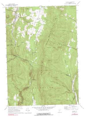
Warren Topo Map Vermont
To zoom in, hover over the map of Warren
USGS Topo Quad 44072a7 - 1:24,000 scale
| Topo Map Name: | Warren |
| USGS Topo Quad ID: | 44072a7 |
| Print Size: | ca. 21 1/4" wide x 27" high |
| Southeast Coordinates: | 44° N latitude / 72.75° W longitude |
| Map Center Coordinates: | 44.0625° N latitude / 72.8125° W longitude |
| U.S. State: | VT |
| Filename: | o44072a7.jpg |
| Download Map JPG Image: | Warren topo map 1:24,000 scale |
| Map Type: | Topographic |
| Topo Series: | 7.5´ |
| Map Scale: | 1:24,000 |
| Source of Map Images: | United States Geological Survey (USGS) |
| Alternate Map Versions: |
Warren VT 1970, updated 1972 Download PDF Buy paper map Warren VT 1970, updated 1977 Download PDF Buy paper map Warren VT 1970, updated 1991 Download PDF Buy paper map Warren VT 1997, updated 2000 Download PDF Buy paper map Warren VT 2012 Download PDF Buy paper map Warren VT 2015 Download PDF Buy paper map |
| FStopo: | US Forest Service topo Warren is available: Download FStopo PDF Download FStopo TIF |
1:24,000 Topo Quads surrounding Warren
> Back to 44072a1 at 1:100,000 scale
> Back to 44072a1 at 1:250,000 scale
> Back to U.S. Topo Maps home
Warren topo map: Gazetteer
Warren: Airports
Warren Sugarbush Airport elevation 448m 1469′Warren-Sugarbush Airport elevation 448m 1469′
Warren: Bridges
Warren Covered Bridge elevation 269m 882′Warren: Dams
Warren Lake Dam elevation 478m 1568′Warren: Falls
Moss Glen Falls elevation 375m 1230′Warren: Gaps
Granville Notch elevation 430m 1410′Roxbury Gap elevation 730m 2395′
Warren: Parks
Granville State Reservation elevation 420m 1377′Warren: Pillars
Warren Pinnacle elevation 508m 1666′Warren: Populated Places
Alpine Village elevation 506m 1660′East Granville elevation 262m 859′
East Warren elevation 423m 1387′
Warren elevation 279m 915′
Warren: Reservoirs
Blueberry Lake elevation 492m 1614′Lak Robinson elevation 468m 1535′
Warren Lake elevation 478m 1568′
Warren: Streams
Austin Brook elevation 367m 1204′Bradley Brook elevation 269m 882′
Deer Hollow Brook elevation 353m 1158′
East Granville Brook elevation 257m 843′
Freeman Brook elevation 261m 856′
Lincoln Brook elevation 278m 912′
Mills Brook elevation 335m 1099′
Sandusky Brook elevation 259m 849′
Stetson Brook elevation 323m 1059′
Warren: Summits
Adams Mountain elevation 973m 3192′Burnt Mountain elevation 831m 2726′
Lost Mountain elevation 783m 2568′
Rice Mountain elevation 933m 3061′
Sugarloaf Mountain elevation 641m 2103′
Warren digital topo map on disk
Buy this Warren topo map showing relief, roads, GPS coordinates and other geographical features, as a high-resolution digital map file on DVD:
New York, Vermont, Connecticut & Western Massachusetts
Buy digital topo maps: New York, Vermont, Connecticut & Western Massachusetts


