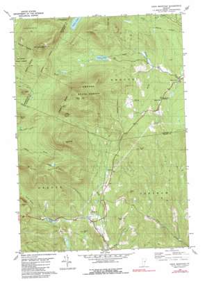
Knox Mountain Topo Map Vermont
To zoom in, hover over the map of Knox Mountain
USGS Topo Quad 44072b3 - 1:24,000 scale
| Topo Map Name: | Knox Mountain |
| USGS Topo Quad ID: | 44072b3 |
| Print Size: | ca. 21 1/4" wide x 27" high |
| Southeast Coordinates: | 44.125° N latitude / 72.25° W longitude |
| Map Center Coordinates: | 44.1875° N latitude / 72.3125° W longitude |
| U.S. State: | VT |
| Filename: | o44072b3.jpg |
| Download Map JPG Image: | Knox Mountain topo map 1:24,000 scale |
| Map Type: | Topographic |
| Topo Series: | 7.5´ |
| Map Scale: | 1:24,000 |
| Source of Map Images: | United States Geological Survey (USGS) |
| Alternate Map Versions: |
Knox Mountain VT 1981, updated 1981 Download PDF Buy paper map Knox Mountain VT 1981, updated 1991 Download PDF Buy paper map Knox Mountain VT 2012 Download PDF Buy paper map Knox Mountain VT 2015 Download PDF Buy paper map |
1:24,000 Topo Quads surrounding Knox Mountain
> Back to 44072a1 at 1:100,000 scale
> Back to 44072a1 at 1:250,000 scale
> Back to U.S. Topo Maps home
Knox Mountain topo map: Gazetteer
Knox Mountain: Dams
Noyes Pond Dam elevation 543m 1781′Knox Mountain: Forests
Groton State Forest elevation 785m 2575′L R Jones State Forest elevation 626m 2053′
Knox Mountain: Gaps
Foster Notch elevation 536m 1758′Knox Mountain: Lakes
Pigeon Pond elevation 595m 1952′Riddel Pond elevation 483m 1584′
Knox Mountain: Pillars
William Scott Memorial Monument elevation 451m 1479′Knox Mountain: Reservoirs
Noyes Pond elevation 543m 1781′Knox Mountain: Streams
Health Brook elevation 389m 1276′Perry Brook elevation 387m 1269′
Knox Mountain: Summits
Allen Hill elevation 617m 2024′Burnt Mountain elevation 945m 3100′
Butterfield Mountain elevation 952m 3123′
Colby Hill elevation 691m 2267′
Fuller Hill elevation 709m 2326′
Haden Hill elevation 564m 1850′
Hannah Hill elevation 639m 2096′
Knox Mountain elevation 934m 3064′
Saint Cyr Mountain elevation 679m 2227′
Signal Mountain elevation 1013m 3323′
Spruce Mountain elevation 902m 2959′
Willey Hill elevation 671m 2201′
Knox Mountain digital topo map on disk
Buy this Knox Mountain topo map showing relief, roads, GPS coordinates and other geographical features, as a high-resolution digital map file on DVD:
New York, Vermont, Connecticut & Western Massachusetts
Buy digital topo maps: New York, Vermont, Connecticut & Western Massachusetts


