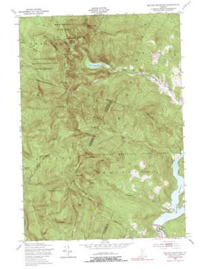
Bolton Mountain Topo Map Vermont
To zoom in, hover over the map of Bolton Mountain
USGS Topo Quad 44072d7 - 1:24,000 scale
| Topo Map Name: | Bolton Mountain |
| USGS Topo Quad ID: | 44072d7 |
| Print Size: | ca. 21 1/4" wide x 27" high |
| Southeast Coordinates: | 44.375° N latitude / 72.75° W longitude |
| Map Center Coordinates: | 44.4375° N latitude / 72.8125° W longitude |
| U.S. State: | VT |
| Filename: | o44072d7.jpg |
| Download Map JPG Image: | Bolton Mountain topo map 1:24,000 scale |
| Map Type: | Topographic |
| Topo Series: | 7.5´ |
| Map Scale: | 1:24,000 |
| Source of Map Images: | United States Geological Survey (USGS) |
| Alternate Map Versions: |
Bolton Mountain VT 1948, updated 1953 Download PDF Buy paper map Bolton Mountain VT 1948, updated 1966 Download PDF Buy paper map Bolton Mountain VT 1948, updated 1974 Download PDF Buy paper map Bolton Mountain VT 1948, updated 1985 Download PDF Buy paper map Bolton Mountain VT 1948, updated 1991 Download PDF Buy paper map Bolton Mountain VT 2012 Download PDF Buy paper map Bolton Mountain VT 2015 Download PDF Buy paper map |
1:24,000 Topo Quads surrounding Bolton Mountain
> Back to 44072a1 at 1:100,000 scale
> Back to 44072a1 at 1:250,000 scale
> Back to U.S. Topo Maps home
Bolton Mountain topo map: Gazetteer
Bolton Mountain: Dams
Lake Mansfield Dam elevation 347m 1138′Waterbury Dam elevation 190m 623′
Bolton Mountain: Gaps
Nebraska Notch elevation 575m 1886′Bolton Mountain: Lakes
Goose Pond elevation 851m 2791′Bolton Mountain: Parks
Little River State Park elevation 507m 1663′Bolton Mountain: Reservoirs
Lake Mansfield elevation 347m 1138′Waterbury Reservoir elevation 190m 623′
Bolton Mountain: Streams
Cotton Brook elevation 181m 593′Stevenson Brook elevation 180m 590′
Bolton Mountain: Summits
Bolton Mountain elevation 1123m 3684′Bone Mountain elevation 889m 2916′
Dewey Mountain elevation 1013m 3323′
Feigel Hill elevation 526m 1725′
Mount Clark elevation 903m 2962′
Mount Mayo elevation 952m 3123′
Ricker Mountain elevation 1035m 3395′
Sugarloaf elevation 658m 2158′
Woodward Mountain elevation 940m 3083′
Bolton Mountain: Trails
Dalley Loop Trail elevation 435m 1427′Hedgehop Hill Loop Trail elevation 360m 1181′
Sawmill Loop Trail elevation 579m 1899′
Stevenson Brook Trail elevation 296m 971′
Bolton Mountain digital topo map on disk
Buy this Bolton Mountain topo map showing relief, roads, GPS coordinates and other geographical features, as a high-resolution digital map file on DVD:
New York, Vermont, Connecticut & Western Massachusetts
Buy digital topo maps: New York, Vermont, Connecticut & Western Massachusetts


