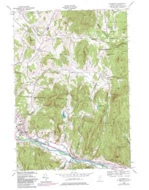
Richmond Topo Map Vermont
To zoom in, hover over the map of Richmond
USGS Topo Quad 44072d8 - 1:24,000 scale
| Topo Map Name: | Richmond |
| USGS Topo Quad ID: | 44072d8 |
| Print Size: | ca. 21 1/4" wide x 27" high |
| Southeast Coordinates: | 44.375° N latitude / 72.875° W longitude |
| Map Center Coordinates: | 44.4375° N latitude / 72.9375° W longitude |
| U.S. State: | VT |
| Filename: | o44072d8.jpg |
| Download Map JPG Image: | Richmond topo map 1:24,000 scale |
| Map Type: | Topographic |
| Topo Series: | 7.5´ |
| Map Scale: | 1:24,000 |
| Source of Map Images: | United States Geological Survey (USGS) |
| Alternate Map Versions: |
Richmond VT 1948, updated 1948 Download PDF Buy paper map Richmond VT 1948, updated 1969 Download PDF Buy paper map Richmond VT 1948, updated 1976 Download PDF Buy paper map Richmond VT 1948, updated 1981 Download PDF Buy paper map Richmond VT 1948, updated 1981 Download PDF Buy paper map Richmond VT 2012 Download PDF Buy paper map Richmond VT 2015 Download PDF Buy paper map |
1:24,000 Topo Quads surrounding Richmond
> Back to 44072a1 at 1:100,000 scale
> Back to 44072a1 at 1:250,000 scale
> Back to U.S. Topo Maps home
Richmond topo map: Gazetteer
Richmond: Bridges
Edmond Bridge elevation 98m 321′Richmond: Cliffs
Birnies Nose elevation 403m 1322′Richmond: Flats
Marr Flat elevation 450m 1476′Richmond: Lakes
Preston Pond elevation 349m 1145′Richmond Pond elevation 192m 629′
Richmond: Parks
Vermont Research Forest Agriculture Experiment StatiON elevation 231m 757′Richmond: Populated Places
Jericho Center elevation 231m 757′Jonesville elevation 99m 324′
Nashville elevation 231m 757′
Richmond elevation 105m 344′
West Bolton elevation 287m 941′
Richmond: Post Offices
Richmond Post Office elevation 93m 305′Richmond: Ridges
Starbird Ridge elevation 427m 1400′Richmond: Streams
Duck Brook elevation 92m 301′Huntington River elevation 92m 301′
Preston Brook elevation 91m 298′
Snipe Island Brook elevation 93m 305′
Richmond: Summits
Bald Hill elevation 584m 1916′Birch Hill elevation 372m 1220′
Cushing Hill elevation 354m 1161′
Huckleberry Hill elevation 503m 1650′
Laisdell Hill elevation 315m 1033′
Mayers Dome elevation 421m 1381′
O P Hill elevation 448m 1469′
Stimson Mountain elevation 608m 1994′
The Cobble elevation 388m 1272′
Richmond: Valleys
Talbot Hollow elevation 269m 882′Richmond digital topo map on disk
Buy this Richmond topo map showing relief, roads, GPS coordinates and other geographical features, as a high-resolution digital map file on DVD:
New York, Vermont, Connecticut & Western Massachusetts
Buy digital topo maps: New York, Vermont, Connecticut & Western Massachusetts


