Albany Topo Map Vermont
To zoom in, hover over the map of Albany
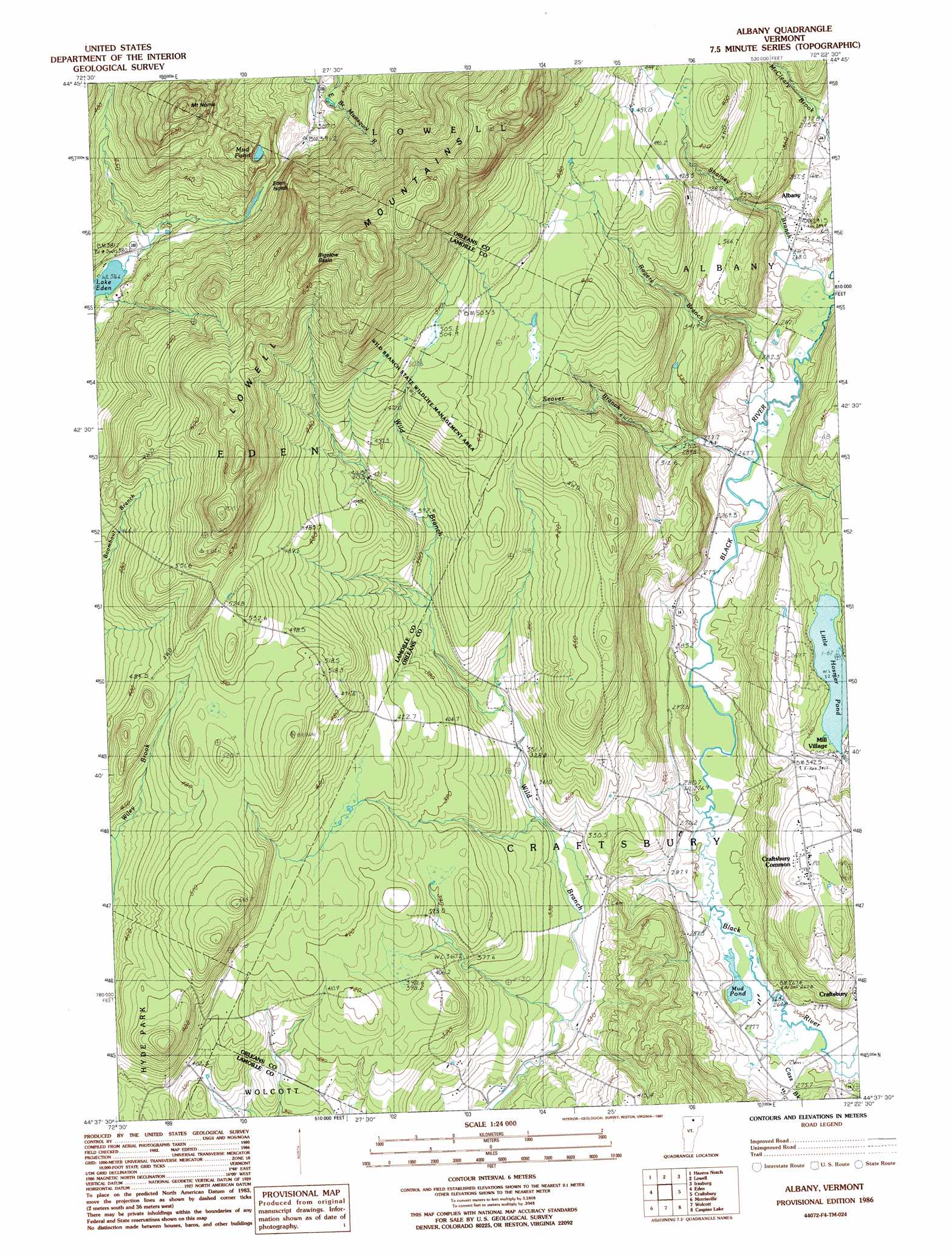
USGS Topo Quad 44072f4 - 1:24,000 scale
| Topo Map Name: | Albany |
| USGS Topo Quad ID: | 44072f4 |
| Print Size: | ca. 21 1/4" wide x 27" high |
| Southeast Coordinates: | 44.625° N latitude / 72.375° W longitude |
| Map Center Coordinates: | 44.6875° N latitude / 72.4375° W longitude |
| U.S. State: | VT |
| Filename: | o44072f4.jpg |
| Download Map JPG Image: | Albany topo map 1:24,000 scale |
| Map Type: | Topographic |
| Topo Series: | 7.5´ |
| Map Scale: | 1:24,000 |
| Source of Map Images: | United States Geological Survey (USGS) |
| Alternate Map Versions: |
Albany VT 1986, updated 1987 Download PDF Buy paper map Albany VT 1986, updated 1987 Download PDF Buy paper map Albany VT 2012 Download PDF Buy paper map Albany VT 2015 Download PDF Buy paper map |
1:24,000 Topo Quads surrounding Albany
Richford |
Jay Peak |
North Troy |
Newport Center |
Newport |
Cold Hollow Mountains |
Hazens Notch |
Lowell |
Irasburg |
Orleans |
Johnson |
Eden |
Albany |
Craftsbury |
Crystal Lake |
Whiteface Mountain |
Morrisville |
W0Lcott |
Caspian Lake |
Stannard |
Stowe |
Mount Worcester |
Woodbury |
Cabot |
> Back to 44072e1 at 1:100,000 scale
> Back to 44072a1 at 1:250,000 scale
> Back to U.S. Topo Maps home
Albany topo map: Gazetteer
Albany: Basins
Bigelow Basin elevation 721m 2365′Albany: Capes
Tromp Point elevation 272m 892′Albany: Dams
Little Hosmer Pond Dam elevation 383m 1256′Albany: Gaps
Eden Notch elevation 424m 1391′Albany: Lakes
Mud Pond elevation 516m 1692′Mud Pond elevation 265m 869′
Albany: Parks
Craftsbury Common elevation 385m 1263′Albany: Populated Places
Albany elevation 293m 961′Craftsbury Common elevation 385m 1263′
Mill Village elevation 328m 1076′
Albany: Post Offices
Albany Post Office elevation 298m 977′Craftsbury Common Post Office elevation 380m 1246′
Albany: Reservoirs
Little Hosmer Pond elevation 325m 1066′Albany: Streams
Cass Brook elevation 271m 889′Rogers Branch elevation 265m 869′
Seaver Branch elevation 260m 853′
Shalney Branch elevation 258m 846′
Albany: Summits
Mount Norris elevation 760m 2493′Albany digital topo map on disk
Buy this Albany topo map showing relief, roads, GPS coordinates and other geographical features, as a high-resolution digital map file on DVD:
New York, Vermont, Connecticut & Western Massachusetts
Buy digital topo maps: New York, Vermont, Connecticut & Western Massachusetts