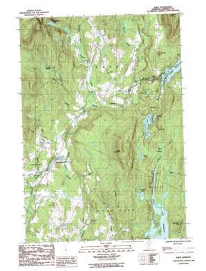
Eden Topo Map Vermont
To zoom in, hover over the map of Eden
USGS Topo Quad 44072f5 - 1:24,000 scale
| Topo Map Name: | Eden |
| USGS Topo Quad ID: | 44072f5 |
| Print Size: | ca. 21 1/4" wide x 27" high |
| Southeast Coordinates: | 44.625° N latitude / 72.5° W longitude |
| Map Center Coordinates: | 44.6875° N latitude / 72.5625° W longitude |
| U.S. State: | VT |
| Filename: | o44072f5.jpg |
| Download Map JPG Image: | Eden topo map 1:24,000 scale |
| Map Type: | Topographic |
| Topo Series: | 7.5´ |
| Map Scale: | 1:24,000 |
| Source of Map Images: | United States Geological Survey (USGS) |
| Alternate Map Versions: |
Eden VT 1986, updated 1986 Download PDF Buy paper map Eden VT 2012 Download PDF Buy paper map Eden VT 2015 Download PDF Buy paper map |
1:24,000 Topo Quads surrounding Eden
> Back to 44072e1 at 1:100,000 scale
> Back to 44072a1 at 1:250,000 scale
> Back to U.S. Topo Maps home
Eden topo map: Gazetteer
Eden: Dams
Green River Dam elevation 406m 1332′Lake Eden Dam elevation 378m 1240′
South Pond Dam elevation 365m 1197′
Eden: Flats
Beaver Meadow elevation 397m 1302′Lanpher Meadow elevation 408m 1338′
Eden: Gaps
Devils Gap elevation 400m 1312′Eden: Lakes
Gut Pond elevation 366m 1200′Mud Pond elevation 371m 1217′
Ritterbush Pond elevation 318m 1043′
Round Pond elevation 371m 1217′
Rush Pond elevation 393m 1289′
Schofield Pond elevation 383m 1256′
Eden: Populated Places
Eden elevation 343m 1125′Eden Mills elevation 350m 1148′
North Hyde Park elevation 267m 875′
Eden: Post Offices
North Hyde Park Post Office elevation 260m 853′Eden: Reservoirs
Green River Reservoir elevation 370m 1213′Lake Eden elevation 382m 1253′
South Pond elevation 365m 1197′
Eden: Streams
Beaver Meadow Brook elevation 261m 856′Boomhour Branch elevation 420m 1377′
Dark Branch elevation 328m 1076′
Fryingpan Brook elevation 283m 928′
Hutchins Brook elevation 345m 1131′
Stony Brook elevation 266m 872′
White Branch elevation 275m 902′
Wild Brook elevation 255m 836′
Wiley Brook elevation 373m 1223′
Eden: Summits
Bean Mountain elevation 671m 2201′McKinstry Hill elevation 573m 1879′
The Knob elevation 521m 1709′
Umbrella Hill elevation 507m 1663′
Upper Diggings elevation 412m 1351′
Eden digital topo map on disk
Buy this Eden topo map showing relief, roads, GPS coordinates and other geographical features, as a high-resolution digital map file on DVD:
New York, Vermont, Connecticut & Western Massachusetts
Buy digital topo maps: New York, Vermont, Connecticut & Western Massachusetts


