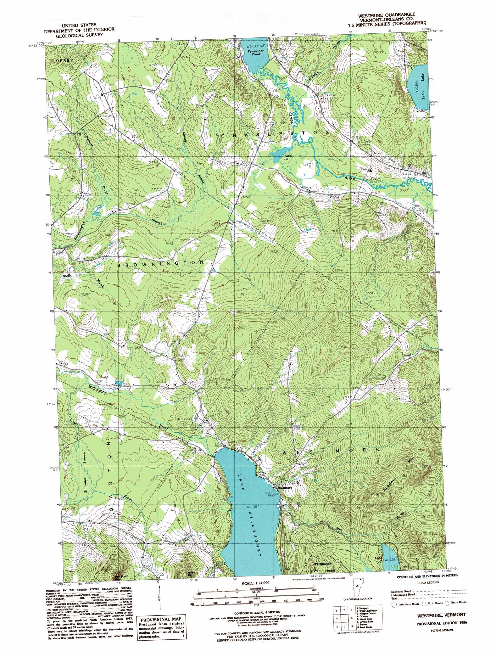
Westmore Topo Map Vermont
To zoom in, hover over the map of Westmore
USGS Topo Quad 44072g1 - 1:24,000 scale
| Topo Map Name: | Westmore |
| USGS Topo Quad ID: | 44072g1 |
| Print Size: | ca. 21 1/4" wide x 27" high |
| Southeast Coordinates: | 44.75° N latitude / 72° W longitude |
| Map Center Coordinates: | 44.8125° N latitude / 72.0625° W longitude |
| U.S. State: | VT |
| Filename: | o44072g1.jpg |
| Download Map JPG Image: | Westmore topo map 1:24,000 scale |
| Map Type: | Topographic |
| Topo Series: | 7.5´ |
| Map Scale: | 1:24,000 |
| Source of Map Images: | United States Geological Survey (USGS) |
| Alternate Map Versions: |
Westmore VT 1986, updated 1986 Download PDF Buy paper map Westmore VT 1986, updated 1986 Download PDF Buy paper map Westmore VT 2012 Download PDF Buy paper map Westmore VT 2015 Download PDF Buy paper map |
1:24,000 Topo Quads surrounding Westmore
Newport Center |
Newport |
West Charleston |
Morgan Center |
Norton Pond |
Irasburg |
Orleans |
Westmore |
Island Pond |
Spectacle Pond |
Craftsbury |
Crystal Lake |
Sutton |
West Burke |
Seneca Mountain |
Caspian Lake |
Stannard |
Lyndonville |
Burke Mountain |
Gallup Mills |
> Back to 44072e1 at 1:100,000 scale
> Back to 44072a1 at 1:250,000 scale
> Back to U.S. Topo Maps home
Westmore topo map: Gazetteer
Westmore: Dams
West Charleston Dam elevation 351m 1151′Westmore: Lakes
Lake Willoughby elevation 357m 1171′Long Pond elevation 555m 1820′
Pensioner Pond elevation 347m 1138′
Toad Pond elevation 348m 1141′
Westmore: Populated Places
East Brownington elevation 422m 1384′Westmore elevation 362m 1187′
Westmore: Reservoirs
Lubber Lake elevation 351m 1151′Westmore: Streams
Bassett Brook elevation 334m 1095′Lord Brook elevation 353m 1158′
Mill Brook elevation 358m 1174′
Moody Brook elevation 350m 1148′
Nutting Brook elevation 352m 1154′
Stumpf Brook elevation 350m 1148′
Westmore: Summits
Goodwin Mountain elevation 852m 2795′May Pond Mountain elevation 637m 2089′
Pierce Hill elevation 613m 2011′
Valley Mountain elevation 570m 1870′
Westmore: Swamps
Stillwater Swamp elevation 396m 1299′Westmore digital topo map on disk
Buy this Westmore topo map showing relief, roads, GPS coordinates and other geographical features, as a high-resolution digital map file on DVD:
New York, Vermont, Connecticut & Western Massachusetts
Buy digital topo maps: New York, Vermont, Connecticut & Western Massachusetts