Orleans Topo Map Vermont
To zoom in, hover over the map of Orleans
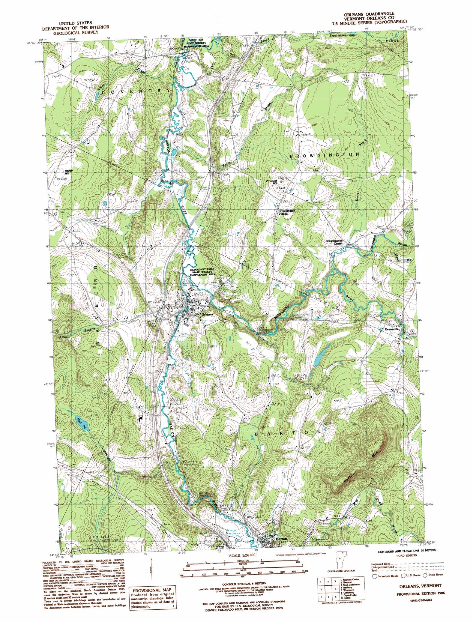
USGS Topo Quad 44072g2 - 1:24,000 scale
| Topo Map Name: | Orleans |
| USGS Topo Quad ID: | 44072g2 |
| Print Size: | ca. 21 1/4" wide x 27" high |
| Southeast Coordinates: | 44.75° N latitude / 72.125° W longitude |
| Map Center Coordinates: | 44.8125° N latitude / 72.1875° W longitude |
| U.S. State: | VT |
| Filename: | o44072g2.jpg |
| Download Map JPG Image: | Orleans topo map 1:24,000 scale |
| Map Type: | Topographic |
| Topo Series: | 7.5´ |
| Map Scale: | 1:24,000 |
| Source of Map Images: | United States Geological Survey (USGS) |
| Alternate Map Versions: |
Orleans VT 1986, updated 1986 Download PDF Buy paper map Orleans VT 2012 Download PDF Buy paper map Orleans VT 2015 Download PDF Buy paper map |
1:24,000 Topo Quads surrounding Orleans
North Troy |
Newport Center |
Newport |
West Charleston |
Morgan Center |
Lowell |
Irasburg |
Orleans |
Westmore |
Island Pond |
Albany |
Craftsbury |
Crystal Lake |
Sutton |
West Burke |
W0Lcott |
Caspian Lake |
Stannard |
Lyndonville |
Burke Mountain |
> Back to 44072e1 at 1:100,000 scale
> Back to 44072a1 at 1:250,000 scale
> Back to U.S. Topo Maps home
Orleans topo map: Gazetteer
Orleans: Crossings
Interchange 26 elevation 253m 830′Orleans: Dams
Paine Site Number 1 Dam elevation 369m 1210′Paine Site Number Two Dam elevation 393m 1289′
Orleans: Lakes
Mud Pond elevation 373m 1223′Orleans: Parks
Brownington Village Historic District elevation 410m 1345′South Bay State Wildlife Management Area elevation 208m 682′
Willoughby Falls State Wildlife Management Area elevation 225m 738′
Orleans: Populated Places
Brownington Center elevation 302m 990′Brownington Village elevation 379m 1243′
Evansville elevation 345m 1131′
Orleans elevation 363m 1190′
Orleans: Post Offices
Orleans Post Office elevation 234m 767′Orleans: Streams
Alder Brook elevation 211m 692′Brownington Branch elevation 298m 977′
Day Brook elevation 205m 672′
Dutton Brook elevation 301m 987′
Hogtrough Brook elevation 241m 790′
Trout Brook elevation 212m 695′
Wells Brook elevation 330m 1082′
Willoughby River elevation 222m 728′
Orleans: Summits
Barton Mountain elevation 685m 2247′Butternut Hill elevation 461m 1512′
Prospect Hill elevation 421m 1381′
Revoir Hill elevation 347m 1138′
Orleans digital topo map on disk
Buy this Orleans topo map showing relief, roads, GPS coordinates and other geographical features, as a high-resolution digital map file on DVD:
New York, Vermont, Connecticut & Western Massachusetts
Buy digital topo maps: New York, Vermont, Connecticut & Western Massachusetts