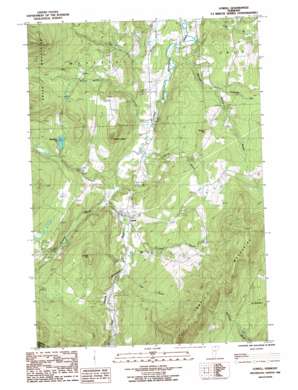
Lowell Topo Map Vermont
To zoom in, hover over the map of Lowell
USGS Topo Quad 44072g4 - 1:24,000 scale
| Topo Map Name: | Lowell |
| USGS Topo Quad ID: | 44072g4 |
| Print Size: | ca. 21 1/4" wide x 27" high |
| Southeast Coordinates: | 44.75° N latitude / 72.375° W longitude |
| Map Center Coordinates: | 44.8125° N latitude / 72.4375° W longitude |
| U.S. State: | VT |
| Filename: | o44072g4.jpg |
| Download Map JPG Image: | Lowell topo map 1:24,000 scale |
| Map Type: | Topographic |
| Topo Series: | 7.5´ |
| Map Scale: | 1:24,000 |
| Source of Map Images: | United States Geological Survey (USGS) |
| Alternate Map Versions: |
Lowell VT 1986, updated 1987 Download PDF Buy paper map Lowell VT 2012 Download PDF Buy paper map Lowell VT 2015 Download PDF Buy paper map |
1:24,000 Topo Quads surrounding Lowell
> Back to 44072e1 at 1:100,000 scale
> Back to 44072a1 at 1:250,000 scale
> Back to U.S. Topo Maps home
Lowell topo map: Gazetteer
Lowell: Forests
Lowell Municipal Forest elevation 540m 1771′Lowell: Populated Places
Lowell elevation 295m 967′Lowell: Post Offices
Lowell Post Office (historical) elevation 280m 918′Lowell: Ranges
Lowell Mountains elevation 646m 2119′Lowell: Reservoirs
McAllister Pond elevation 397m 1302′Lowell: Streams
Ace Brook elevation 295m 967′Burgess Branch elevation 244m 800′
East Branch Missisquoi River elevation 246m 807′
Le Clair Brook elevation 244m 800′
Mineral Spring Brook elevation 235m 770′
Snider Brook elevation 237m 777′
Tamarack Brook elevation 313m 1026′
Truland Brook elevation 289m 948′
Lowell: Summits
Browns Ledges elevation 467m 1532′Farman Hill elevation 436m 1430′
Leland Hill elevation 510m 1673′
Lowell digital topo map on disk
Buy this Lowell topo map showing relief, roads, GPS coordinates and other geographical features, as a high-resolution digital map file on DVD:
New York, Vermont, Connecticut & Western Massachusetts
Buy digital topo maps: New York, Vermont, Connecticut & Western Massachusetts


