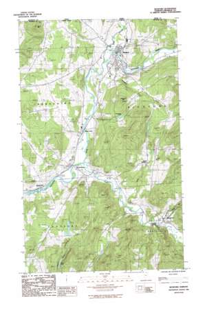
Richford Topo Map Vermont
To zoom in, hover over the map of Richford
USGS Topo Quad 44072h6 - 1:24,000 scale
| Topo Map Name: | Richford |
| USGS Topo Quad ID: | 44072h6 |
| Print Size: | ca. 21 1/4" wide x 27" high |
| Southeast Coordinates: | 44.875° N latitude / 72.625° W longitude |
| Map Center Coordinates: | 44.9375° N latitude / 72.6875° W longitude |
| U.S. State: | VT |
| Filename: | o44072h6.jpg |
| Download Map JPG Image: | Richford topo map 1:24,000 scale |
| Map Type: | Topographic |
| Topo Series: | 7.5´ |
| Map Scale: | 1:24,000 |
| Source of Map Images: | United States Geological Survey (USGS) |
| Alternate Map Versions: |
Richford VT 1986, updated 1987 Download PDF Buy paper map Richford VT 2012 Download PDF Buy paper map Richford VT 2015 Download PDF Buy paper map |
1:24,000 Topo Quads surrounding Richford
Sheldon Springs |
Enosburg Falls |
Richford |
Jay Peak |
North Troy |
Fairfield |
Bakersfield |
Cold Hollow Mountains |
Hazens Notch |
Lowell |
Gilson Mountain |
Jeffersonville |
Johnson |
Eden |
Albany |
> Back to 44072e1 at 1:100,000 scale
> Back to 44072a1 at 1:250,000 scale
> Back to U.S. Topo Maps home
Richford topo map: Gazetteer
Richford: Bridges
Comstock Covered Bridge elevation 150m 492′Fuller Covered Bridge elevation 151m 495′
Hopkins Covered Bridge elevation 135m 442′
Longley Covered Bridge elevation 136m 446′
Missisquoi River Bridge elevation 138m 452′
Richford: Forests
Berkshire Municipal Forest elevation 233m 764′Enosburg Town Forest elevation 353m 1158′
Richford: Lakes
Adams Pond elevation 271m 889′Guillmettes Pond elevation 233m 764′
Richford: Parks
Downtown Richford Historic District elevation 140m 459′Richford: Populated Places
East Berkshire elevation 126m 413′Montgomery elevation 155m 508′
Richford elevation 141m 462′
Samsonville elevation 119m 390′
South Richford elevation 243m 797′
Richford: Streams
Black Falls Brook elevation 148m 485′Loveland Brook elevation 134m 439′
North Branch Missisquoi River elevation 137m 449′
Trout River elevation 122m 400′
West Hill Brook elevation 146m 479′
Whittaker Brook elevation 142m 465′
Richford: Summits
Hardwood Hill elevation 354m 1161′Richford digital topo map on disk
Buy this Richford topo map showing relief, roads, GPS coordinates and other geographical features, as a high-resolution digital map file on DVD:
New York, Vermont, Connecticut & Western Massachusetts
Buy digital topo maps: New York, Vermont, Connecticut & Western Massachusetts


