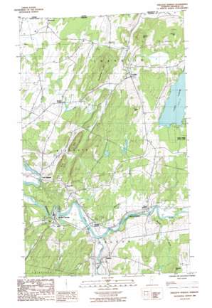
Sheldon Springs Topo Map Vermont
To zoom in, hover over the map of Sheldon Springs
USGS Topo Quad 44072h8 - 1:24,000 scale
| Topo Map Name: | Sheldon Springs |
| USGS Topo Quad ID: | 44072h8 |
| Print Size: | ca. 21 1/4" wide x 27" high |
| Southeast Coordinates: | 44.875° N latitude / 72.875° W longitude |
| Map Center Coordinates: | 44.9375° N latitude / 72.9375° W longitude |
| U.S. State: | VT |
| Filename: | o44072h8.jpg |
| Download Map JPG Image: | Sheldon Springs topo map 1:24,000 scale |
| Map Type: | Topographic |
| Topo Series: | 7.5´ |
| Map Scale: | 1:24,000 |
| Source of Map Images: | United States Geological Survey (USGS) |
| Alternate Map Versions: |
Sheldon Springs VT 1986, updated 1987 Download PDF Buy paper map Sheldon Springs VT 2012 Download PDF Buy paper map Sheldon Springs VT 2015 Download PDF Buy paper map |
1:24,000 Topo Quads surrounding Sheldon Springs
> Back to 44072e1 at 1:100,000 scale
> Back to 44072a1 at 1:250,000 scale
> Back to U.S. Topo Maps home
Sheldon Springs topo map: Gazetteer
Sheldon Springs: Dams
Bullis Pond Dam elevation 91m 298′Sheldon Springs Dam elevation 106m 347′
Sheldon Springs: Populated Places
Browns Corners elevation 97m 318′Camp Grounds elevation 115m 377′
East Highgate elevation 66m 216′
Franklin elevation 137m 449′
North Sheldon elevation 131m 429′
Shawville elevation 120m 393′
Sheldon elevation 104m 341′
Sheldon Junction elevation 105m 344′
Sheldon Springs elevation 91m 298′
Sheldon Springs: Post Offices
Franklin Post Office elevation 136m 446′Sheldon Springs: Reservoirs
Bullis Pond elevation 91m 298′Bullis Pond elevation 91m 298′
Sheldon Springs: Streams
Black Creek elevation 102m 334′McGowan Brook elevation 102m 334′
Morrow Brook elevation 111m 364′
Sheldon Springs: Summits
Bridgeman Hill elevation 220m 721′Gates Hill elevation 253m 830′
Rice Hill elevation 222m 728′
Sheldon Hill elevation 271m 889′
Sheldon Springs digital topo map on disk
Buy this Sheldon Springs topo map showing relief, roads, GPS coordinates and other geographical features, as a high-resolution digital map file on DVD:
New York, Vermont, Connecticut & Western Massachusetts
Buy digital topo maps: New York, Vermont, Connecticut & Western Massachusetts


