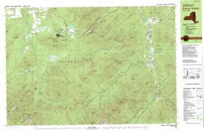
Keene Valley Topo Map New York
To zoom in, hover over the map of Keene Valley
USGS Topo Quad 44073b7 - 1:25,000 scale
| Topo Map Name: | Keene Valley |
| USGS Topo Quad ID: | 44073b7 |
| Print Size: | ca. 39" wide x 24" high |
| Southeast Coordinates: | 44.125° N latitude / 73.75° W longitude |
| Map Center Coordinates: | 44.1875° N latitude / 73.875° W longitude |
| U.S. State: | NY |
| Filename: | k44073b7.jpg |
| Download Map JPG Image: | Keene Valley topo map 1:25,000 scale |
| Map Type: | Topographic |
| Topo Series: | 7.5´x15´ |
| Map Scale: | 1:25,000 |
| Source of Map Images: | United States Geological Survey (USGS) |
| Alternate Map Versions: |
Keene Valley NY 1979, updated 1979 Download PDF Buy paper map Keene Valley NY 1979, updated 1979 Download PDF Buy paper map Keene Valley NY 1999, updated 2001 Download PDF Buy paper map |
1:24,000 Topo Quads surrounding Keene Valley
> Back to 44073a1 at 1:100,000 scale
> Back to 44072a1 at 1:250,000 scale
> Back to U.S. Topo Maps home
Keene Valley topo map: Gazetteer
Keene Valley: Airports
Marcy Field elevation 309m 1013′Keene Valley: Areas
Biathalon Area elevation 613m 2011′Keene Valley: Basins
Hull Basin elevation 770m 2526′Pelkey Basin elevation 844m 2769′
Walton Basin elevation 770m 2526′
Keene Valley: Benches
Beede Ledge elevation 510m 1673′Keene Valley: Cliffs
Lost Lookout elevation 743m 2437′Keene Valley: Dams
Marcy Dam elevation 720m 2362′Keene Valley: Falls
Artists Falls elevation 540m 1771′Beaver Meadows Falls elevation 577m 1893′
Bushnell Falls elevation 815m 2673′
Hulls Falls elevation 292m 958′
Indian Falls elevation 1093m 3585′
Phelps Falls elevation 349m 1145′
Rocky Falls elevation 633m 2076′
Russell Falls elevation 400m 1312′
Keene Valley: Gaps
Avalanche Pass elevation 932m 3057′Caribou Pass elevation 1044m 3425′
Hi-Notch elevation 740m 2427′
Klondike Notch elevation 972m 3188′
Railroad Notch elevation 882m 2893′
Keene Valley: Lakes
Avalanche Lake elevation 873m 2864′Heart Lake elevation 660m 2165′
Lower Cascade Lake elevation 618m 2027′
Mud Pond elevation 656m 2152′
Round Lake elevation 635m 2083′
Upper Cascade Lake elevation 620m 2034′
Keene Valley: Parks
Mount Van Hoevenburg Recreation Area elevation 634m 2080′Keene Valley: Pillars
The Chimney elevation 707m 2319′Keene Valley: Populated Places
Keene Valley elevation 312m 1023′North Elba elevation 599m 1965′
Saint Huberts elevation 349m 1145′
Shady Corner Curve elevation 688m 2257′
Keene Valley: Ranges
Cascade Range elevation 851m 2791′Keene Valley: Reservoirs
Lake Arnold elevation 1140m 3740′Keene Valley: Streams
Alder Brook elevation 531m 1742′Basin Brook elevation 968m 3175′
Bear Brook elevation 496m 1627′
Beede Brook elevation 332m 1089′
Bennies Brook elevation 618m 2027′
Black Brook elevation 676m 2217′
Chicken Coop Brook elevation 835m 2739′
Crystal Brook elevation 336m 1102′
Deer Brook elevation 327m 1072′
Deer Brook elevation 535m 1755′
Dickey Brook elevation 442m 1450′
Dry Brook elevation 606m 1988′
Flume Brook elevation 311m 1020′
Gill Brook elevation 428m 1404′
Hogback Brook elevation 756m 2480′
Hopkins Brook elevation 311m 1020′
Hull Basin Brook elevation 280m 918′
Icy Brook elevation 385m 1263′
Indian Pass Brook elevation 550m 1804′
Johns Brook elevation 300m 984′
Johns Brook elevation 679m 2227′
Klondike Brook elevation 639m 2096′
MacIntyre Brook elevation 626m 2053′
Marcy Brook elevation 617m 2024′
Mossy Cascade Brook elevation 320m 1049′
North Meadow Brook elevation 541m 1774′
Norton Brook elevation 291m 954′
Ore Bed Brook elevation 675m 2214′
Pelkey Brook elevation 635m 2083′
Phelps Brook elevation 678m 2224′
Phelps Brook elevation 301m 987′
Porter Brook elevation 295m 967′
Putnam Brook elevation 378m 1240′
Pyramid Brook elevation 430m 1410′
Roaring Brook elevation 386m 1266′
Rock Cut Brook elevation 583m 1912′
Rooster Comb Brook elevation 479m 1571′
Slide Brook elevation 333m 1092′
Slide Mountain Brook elevation 676m 2217′
South Meadow Brook elevation 617m 2024′
Spruce Hill Brook elevation 353m 1158′
Walton Brook elevation 271m 889′
Wedge Brook elevation 516m 1692′
Wolfjaw Brook elevation 640m 2099′
Keene Valley: Summits
Algonquin Peak elevation 1555m 5101′Armstrong Mountain elevation 1320m 4330′
Avalanche Mountain elevation 1161m 3809′
Baxter Mountain elevation 739m 2424′
Bear Cubby elevation 727m 2385′
Beede Hill elevation 434m 1423′
Big Slide Mountain elevation 1280m 4199′
Blueberry Mountain elevation 883m 2896′
Boundary Peak elevation 1471m 4826′
Cascade Mountain elevation 1241m 4071′
Cathedral Rocks elevation 512m 1679′
Gooseberry Mountain elevation 1086m 3562′
Gothics elevation 1425m 4675′
Hedgehog Mountain elevation 1029m 3375′
Howard Mountain elevation 1170m 3838′
Iroquois Peak elevation 1472m 4829′
Laramore Mountain elevation 1008m 3307′
Little Porter Mountain elevation 847m 2778′
Lower Wolfjaw Mountain elevation 1273m 4176′
Mount Colden elevation 1436m 4711′
Mount Jo elevation 869m 2851′
Mount Van Hoevenberg elevation 895m 2936′
Noonmark Mountain elevation 1058m 3471′
Oak Hill elevation 543m 1781′
Owls Head elevation 627m 2057′
Peacock Mountain elevation 772m 2532′
Phelps Mountain elevation 1262m 4140′
Pitchoff Mountain elevation 1063m 3487′
Porter Mountain elevation 1151m 3776′
Rooster Comb elevation 791m 2595′
Round Mountain elevation 940m 3083′
Round Top elevation 687m 2253′
Saddleback Mountain elevation 1376m 4514′
Scotts Cobble elevation 777m 2549′
Snow Mountain elevation 720m 2362′
Spread Eagle Mountain elevation 859m 2818′
Sugarloaf Mountain elevation 740m 2427′
T R Mountain elevation 1165m 3822′
Table Top Mountain elevation 1306m 4284′
The Brothers elevation 828m 2716′
Upper Wolfjaw Mountain elevation 1269m 4163′
Whales Tail Mountain elevation 893m 2929′
Wright Peak elevation 1389m 4557′
Yard Mountain elevation 1216m 3989′
Keene Valley: Swamps
Little Meadows elevation 888m 2913′North Meadow elevation 565m 1853′
South Meadow elevation 634m 2080′
Keene Valley: Trails
East River Trail elevation 495m 1624′Hopkins Trail elevation 1005m 3297′
Johns Brook Trail elevation 635m 2083′
Leach Trail elevation 710m 2329′
Phelps Trail elevation 997m 3270′
Southside Trail elevation 603m 1978′
Stimson Trail elevation 895m 2936′
Weston Trail elevation 586m 1922′
White Trail elevation 923m 3028′
Keene Valley: Valleys
Keene Valley elevation 290m 951′Keene Valley digital topo map on disk
Buy this Keene Valley topo map showing relief, roads, GPS coordinates and other geographical features, as a high-resolution digital map file on DVD:
New York, Vermont, Connecticut & Western Massachusetts
Buy digital topo maps: New York, Vermont, Connecticut & Western Massachusetts


