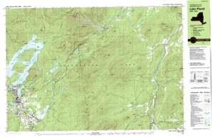
Keene Topo Map New York
To zoom in, hover over the map of Keene
USGS Topo Quad 44073c7 - 1:25,000 scale
| Topo Map Name: | Keene |
| USGS Topo Quad ID: | 44073c7 |
| Print Size: | ca. 39" wide x 24" high |
| Southeast Coordinates: | 44.25° N latitude / 73.75° W longitude |
| Map Center Coordinates: | 44.3125° N latitude / 73.875° W longitude |
| U.S. State: | NY |
| Filename: | k44073c7.jpg |
| Download Map JPG Image: | Keene topo map 1:25,000 scale |
| Map Type: | Topographic |
| Topo Series: | 7.5´x15´ |
| Map Scale: | 1:25,000 |
| Source of Map Images: | United States Geological Survey (USGS) |
| Alternate Map Versions: |
Lake Placid NY 1979, updated 1979 Download PDF Buy paper map Lake Placid NY 1999, updated 2001 Download PDF Buy paper map |
1:24,000 Topo Quads surrounding Keene
Loon Lake |
Alder Brook |
Redford |
Peasleeville |
Peru |
Bloomingdale |
Wilmington |
Clintonville |
||
Mckenzie Mountain |
Keene |
Lewis |
||
Street Mountain |
Keene Valley |
Elizabethtown |
||
Mount Adams |
Dix Mountain |
Witherbee |
> Back to 44073a1 at 1:100,000 scale
> Back to 44072a1 at 1:250,000 scale
> Back to U.S. Topo Maps home
Keene topo map: Gazetteer
Keene: Airports
Lake Placid Airport elevation 533m 1748′Keene: Bays
Barrel Bay elevation 566m 1856′Echo Bay elevation 566m 1856′
McLenathan Bay elevation 566m 1856′
Paradox Bay elevation 566m 1856′
West Bay elevation 566m 1856′
Whiteface Bay elevation 566m 1856′
Keene: Capes
Cape Marie elevation 566m 1856′Grays Point elevation 566m 1856′
Hopping Bear Point elevation 566m 1856′
Indian Point elevation 567m 1860′
Mainland Point elevation 575m 1886′
Paddy Point elevation 569m 1866′
Pulpit Rock elevation 588m 1929′
Rocky Point elevation 571m 1873′
Sand Point elevation 566m 1856′
Keene: Channels
Shelter Strait elevation 566m 1856′Sunset Strait elevation 566m 1856′
Keene: Cliffs
Moss Cliff elevation 877m 2877′Keene: Falls
Clifford Falls elevation 409m 1341′High Falls elevation 411m 1348′
Monument Falls elevation 492m 1614′
The Flume Fall elevation 325m 1066′
Keene: Gaps
High Falls Gorge elevation 411m 1348′North Notch elevation 924m 3031′
South Notch elevation 862m 2828′
Sunrise Notch elevation 732m 2401′
Wilmington Notch elevation 469m 1538′
Keene: Islands
Buck Island elevation 623m 2043′Hawk Island elevation 570m 1870′
Moose Island elevation 650m 2132′
Keene: Lakes
Big Cherrypatch Pond elevation 504m 1653′Clements Pond elevation 503m 1650′
Coldspring Pond elevation 534m 1751′
Connery Pond elevation 506m 1660′
Copperas Pond elevation 551m 1807′
East Lake elevation 566m 1856′
Echo Lake elevation 574m 1883′
Holcomb Pond elevation 514m 1686′
Little Cherrypatch Pond elevation 504m 1653′
Loch Bonnie elevation 906m 2972′
Long Pond elevation 514m 1686′
Marsh Pond elevation 568m 1863′
Mirror Lake elevation 566m 1856′
Owen Pond elevation 514m 1686′
Tom Peck Pond elevation 526m 1725′
Warren Pond elevation 554m 1817′
West Lake elevation 566m 1856′
Winch Pond elevation 564m 1850′
Keene: Populated Places
Keene elevation 256m 839′Lake Placid elevation 549m 1801′
Undercliff elevation 569m 1866′
Upper Jay elevation 205m 672′
Whiteface Landing elevation 570m 1870′
Keene: Ranges
Sentinel Range elevation 834m 2736′Keene: Reservoirs
Lake Placid elevation 563m 1847′Keene: Ridges
Oak Ridge elevation 752m 2467′Keene: Streams
Cascade Brook elevation 240m 787′Chubb River elevation 500m 1640′
Clifford Brook elevation 367m 1204′
Dart Brook elevation 247m 810′
Falls Brook elevation 566m 1856′
Gulf Brook elevation 309m 1013′
Jones Brook elevation 240m 787′
Lewis Brook elevation 200m 656′
Liscomb Brook elevation 222m 728′
Minnow Brook elevation 566m 1856′
Nichols Brook elevation 230m 754′
Outlet Brook elevation 556m 1824′
Phelps Brook elevation 221m 725′
Roaring Brook elevation 504m 1653′
Styles Brook elevation 230m 754′
Two Brooks elevation 566m 1856′
Whiteface Brook elevation 568m 1863′
Keene: Summits
Bassett Mountain elevation 599m 1965′Black Mountain elevation 901m 2956′
Brown Mountain elevation 641m 2103′
Cobble Hill elevation 712m 2335′
Corliss Mountain elevation 531m 1742′
Eagle Eyrie elevation 802m 2631′
East Hill elevation 507m 1663′
Ebenezer Mountain elevation 604m 1981′
Eisenglass Mountain elevation 506m 1660′
Hiccock Mountain elevation 591m 1938′
Kilburn Mountain elevation 1182m 3877′
Little Whiteface Mountain elevation 1111m 3645′
Mount Alton elevation 974m 3195′
Mount Whitney elevation 804m 2637′
Owls Head Mountain elevation 513m 1683′
Pine Mountain elevation 630m 2066′
Rattlesnake Knob elevation 571m 1873′
Red Rock elevation 762m 2500′
Sentinel Mountain elevation 1174m 3851′
Slide Mountain elevation 1091m 3579′
Stewart Mountain elevation 1104m 3622′
The Cobble Mountain elevation 641m 2103′
Wainwright Mountain elevation 504m 1653′
Whiteface Mountain elevation 1466m 4809′
Winch Mountain elevation 591m 1938′
Keene digital topo map on disk
Buy this Keene topo map showing relief, roads, GPS coordinates and other geographical features, as a high-resolution digital map file on DVD:
New York, Vermont, Connecticut & Western Massachusetts
Buy digital topo maps: New York, Vermont, Connecticut & Western Massachusetts


