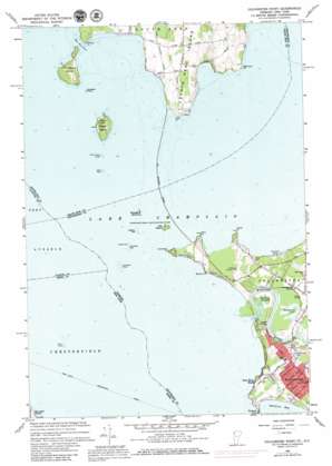
Colchester Point Topo Map Vermont
To zoom in, hover over the map of Colchester Point
USGS Topo Quad 44073e3 - 1:24,000 scale
| Topo Map Name: | Colchester Point |
| USGS Topo Quad ID: | 44073e3 |
| Print Size: | ca. 21 1/4" wide x 27" high |
| Southeast Coordinates: | 44.5° N latitude / 73.25° W longitude |
| Map Center Coordinates: | 44.5625° N latitude / 73.3125° W longitude |
| U.S. States: | VT, NY |
| Filename: | o44073e3.jpg |
| Download Map JPG Image: | Colchester Point topo map 1:24,000 scale |
| Map Type: | Topographic |
| Topo Series: | 7.5´ |
| Map Scale: | 1:24,000 |
| Source of Map Images: | United States Geological Survey (USGS) |
| Alternate Map Versions: |
Colchester Point VT 1966, updated 1968 Download PDF Buy paper map Colchester Point VT 1966, updated 1973 Download PDF Buy paper map Colchester Point VT 1966, updated 1979 Download PDF Buy paper map Colchester Point VT 2012 Download PDF Buy paper map Colchester Point VT 2012 Download PDF Buy paper map Colchester Point VT 2015 Download PDF Buy paper map |
1:24,000 Topo Quads surrounding Colchester Point
> Back to 44073e1 at 1:100,000 scale
> Back to 44072a1 at 1:250,000 scale
> Back to U.S. Topo Maps home
Colchester Point topo map: Gazetteer
Colchester Point: Airports
Champlain Landing Field elevation 37m 121′Stave Island Seaplane Base elevation 29m 95′
Colchester Point: Bars
Colchester Reef elevation 29m 95′Colchester Shoal elevation 29m 95′
Hogback Reef elevation 29m 95′
Jones Rock elevation 29m 95′
Stave Island Ledge elevation 29m 95′
Colchester Point: Bays
Halfmoon Cove elevation 29m 95′Colchester Point: Bridges
Heineberg Bridge elevation 29m 95′Colchester Point: Capes
Allen Point elevation 31m 101′Barney Point elevation 31m 101′
Colchester Point elevation 36m 118′
Mills Point elevation 29m 95′
Phelps Point elevation 31m 101′
Porter Point elevation 29m 95′
Robinson Point elevation 29m 95′
Colchester Point: Channels
The Narrows elevation 29m 95′Colchester Point: Islands
Carleton Prize elevation 29m 95′Derway Island elevation 30m 98′
Ferris Rock elevation 29m 95′
Law Island elevation 34m 111′
Providence Island elevation 42m 137′
Stave Island elevation 40m 131′
Sunset Island elevation 29m 95′
Colchester Point: Lakes
Lake Champlain elevation 29m 95′Colchester Point: Populated Places
Bernard J Leddy Park elevation 37m 121′Starr Farm Beach elevation 36m 118′
Thayer Beach elevation 36m 118′
Colchester Point: Streams
Winooski River elevation 29m 95′Colchester Point: Trails
Port Kent Burlington Ferry elevation 29m 95′Colchester Point digital topo map on disk
Buy this Colchester Point topo map showing relief, roads, GPS coordinates and other geographical features, as a high-resolution digital map file on DVD:
New York, Vermont, Connecticut & Western Massachusetts
Buy digital topo maps: New York, Vermont, Connecticut & Western Massachusetts


