Peru Topo Map New York
To zoom in, hover over the map of Peru
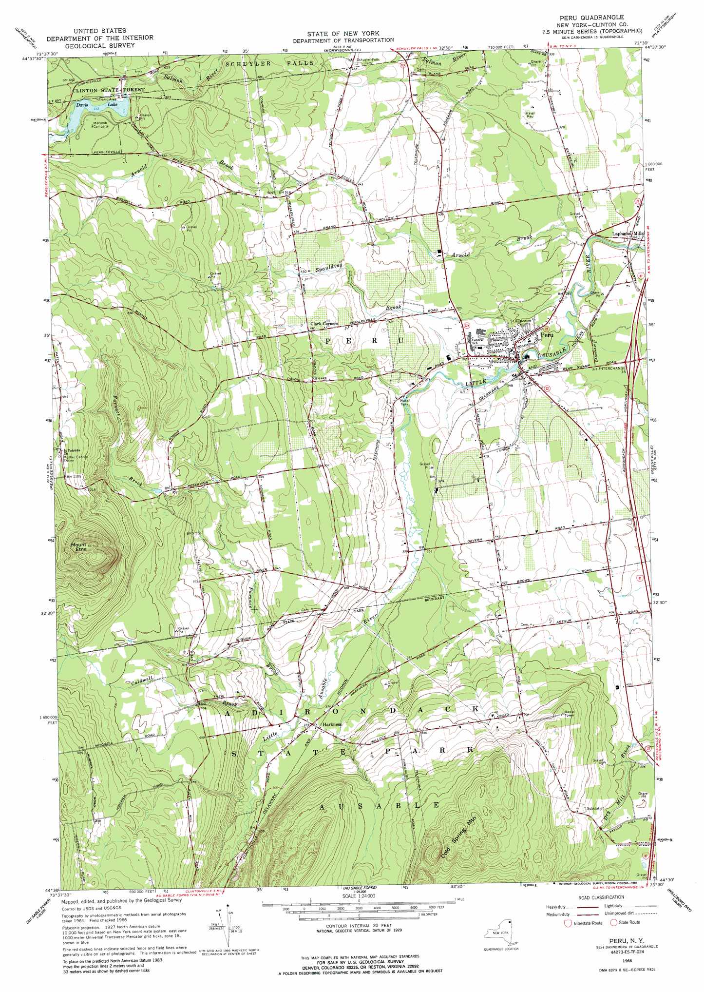
USGS Topo Quad 44073e5 - 1:24,000 scale
| Topo Map Name: | Peru |
| USGS Topo Quad ID: | 44073e5 |
| Print Size: | ca. 21 1/4" wide x 27" high |
| Southeast Coordinates: | 44.5° N latitude / 73.5° W longitude |
| Map Center Coordinates: | 44.5625° N latitude / 73.5625° W longitude |
| U.S. State: | NY |
| Filename: | o44073e5.jpg |
| Download Map JPG Image: | Peru topo map 1:24,000 scale |
| Map Type: | Topographic |
| Topo Series: | 7.5´ |
| Map Scale: | 1:24,000 |
| Source of Map Images: | United States Geological Survey (USGS) |
| Alternate Map Versions: |
Peru NY 1966, updated 1968 Download PDF Buy paper map Peru NY 1966, updated 1988 Download PDF Buy paper map Peru NY 2010 Download PDF Buy paper map Peru NY 2013 Download PDF Buy paper map Peru NY 2016 Download PDF Buy paper map |
1:24,000 Topo Quads surrounding Peru
Ellenburg Mountain |
Jericho |
West Chazy |
Beekmantown |
North Hero |
Moffitsville |
Dannemora |
Morrisonville |
Plattsburgh |
South Hero |
Redford |
Peasleeville |
Peru |
Keeseville |
Colchester Point |
Wilmington |
Clintonville |
Juniper Island |
||
Keene |
Lewis |
Charlotte |
> Back to 44073e1 at 1:100,000 scale
> Back to 44072a1 at 1:250,000 scale
> Back to U.S. Topo Maps home
Peru topo map: Gazetteer
Peru: Crossings
Interchange 35 elevation 97m 318′Peru: Lakes
Davis Lake elevation 196m 643′Peru: Populated Places
Harkness elevation 115m 377′Laphams Mills elevation 88m 288′
Peru elevation 102m 334′
Peru: Streams
Arnold Brook elevation 80m 262′Caldwell Brook elevation 109m 357′
Furnace Brook elevation 109m 357′
Spaulding Brook elevation 84m 275′
Peru: Summits
Cold Spring Mountain elevation 329m 1079′Mount Etna elevation 457m 1499′
Peru digital topo map on disk
Buy this Peru topo map showing relief, roads, GPS coordinates and other geographical features, as a high-resolution digital map file on DVD:
New York, Vermont, Connecticut & Western Massachusetts
Buy digital topo maps: New York, Vermont, Connecticut & Western Massachusetts