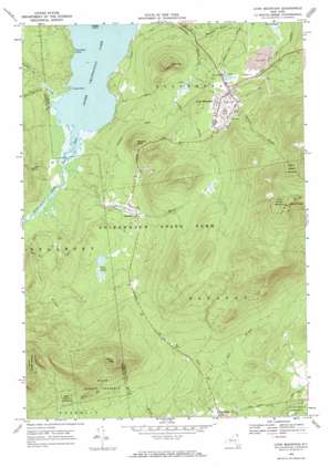
Lyon Mountain Topo Map New York
To zoom in, hover over the map of Lyon Mountain
USGS Topo Quad 44073f8 - 1:24,000 scale
| Topo Map Name: | Lyon Mountain |
| USGS Topo Quad ID: | 44073f8 |
| Print Size: | ca. 21 1/4" wide x 27" high |
| Southeast Coordinates: | 44.625° N latitude / 73.875° W longitude |
| Map Center Coordinates: | 44.6875° N latitude / 73.9375° W longitude |
| U.S. State: | NY |
| Filename: | o44073f8.jpg |
| Download Map JPG Image: | Lyon Mountain topo map 1:24,000 scale |
| Map Type: | Topographic |
| Topo Series: | 7.5´ |
| Map Scale: | 1:24,000 |
| Source of Map Images: | United States Geological Survey (USGS) |
| Alternate Map Versions: |
Lyon Mountain NY 1968, updated 1970 Download PDF Buy paper map Lyon Mountain NY 2010 Download PDF Buy paper map Lyon Mountain NY 2013 Download PDF Buy paper map Lyon Mountain NY 2016 Download PDF Buy paper map |
1:24,000 Topo Quads surrounding Lyon Mountain
> Back to 44073e1 at 1:100,000 scale
> Back to 44072a1 at 1:250,000 scale
> Back to U.S. Topo Maps home
Lyon Mountain topo map: Gazetteer
Lyon Mountain: Bays
South Inlet elevation 399m 1309′Lyon Mountain: Capes
Indian Point elevation 399m 1309′Split Rock Point elevation 400m 1312′
Lyon Mountain: Lakes
Twin Ponds elevation 536m 1758′Upper Chateaugay Lake elevation 399m 1309′
Lyon Mountain: Populated Places
High Bank elevation 448m 1469′Lyon Mountain elevation 548m 1797′
Standish elevation 518m 1699′
Lyon Mountain: Ridges
Piney Ridge elevation 509m 1669′Lyon Mountain: Streams
Bradley Brook elevation 425m 1394′Brandy Brook elevation 494m 1620′
East Branch Cold Brook elevation 446m 1463′
Middle Kiln Brook elevation 399m 1309′
Mountain Pond Stream elevation 399m 1309′
Rocky Brook elevation 400m 1312′
Rocky Brook elevation 399m 1309′
Standish Brook elevation 400m 1312′
Lyon Mountain: Summits
Averill Peak elevation 1159m 3802′Birch Hill elevation 648m 2125′
Norton Peak elevation 876m 2874′
Parsons Knob elevation 643m 2109′
Lyon Mountain digital topo map on disk
Buy this Lyon Mountain topo map showing relief, roads, GPS coordinates and other geographical features, as a high-resolution digital map file on DVD:
New York, Vermont, Connecticut & Western Massachusetts
Buy digital topo maps: New York, Vermont, Connecticut & Western Massachusetts


