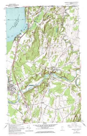
Highgate Center Topo Map Vermont
To zoom in, hover over the map of Highgate Center
USGS Topo Quad 44073h1 - 1:24,000 scale
| Topo Map Name: | Highgate Center |
| USGS Topo Quad ID: | 44073h1 |
| Print Size: | ca. 21 1/4" wide x 27" high |
| Southeast Coordinates: | 44.875° N latitude / 73° W longitude |
| Map Center Coordinates: | 44.9375° N latitude / 73.0625° W longitude |
| U.S. State: | VT |
| Filename: | o44073h1.jpg |
| Download Map JPG Image: | Highgate Center topo map 1:24,000 scale |
| Map Type: | Topographic |
| Topo Series: | 7.5´ |
| Map Scale: | 1:24,000 |
| Source of Map Images: | United States Geological Survey (USGS) |
| Alternate Map Versions: |
Highgate Center VT 1964, updated 1965 Download PDF Buy paper map Highgate Center VT 1964, updated 1973 Download PDF Buy paper map Highgate Center VT 1964, updated 1987 Download PDF Buy paper map Highgate Center VT 2012 Download PDF Buy paper map Highgate Center VT 2015 Download PDF Buy paper map |
1:24,000 Topo Quads surrounding Highgate Center
Rouses Point |
East Alburg |
Highgate Center |
Sheldon Springs |
Enosburg Falls |
North Hero |
Saint Albans Bay |
Saint Albans |
Fairfield |
Bakersfield |
South Hero |
Georgia Plains |
Milton |
Gilson Mountain |
Jeffersonville |
> Back to 44073e1 at 1:100,000 scale
> Back to 44072a1 at 1:250,000 scale
> Back to U.S. Topo Maps home
Highgate Center topo map: Gazetteer
Highgate Center: Airports
Franklin County State Airport elevation 70m 229′Franklin County State Airport elevation 70m 229′
Highgate Center: Bays
Phelps Bay elevation 29m 95′Rock River Bay elevation 29m 95′
Highgate Center: Bridges
Highgate Falls Parabolic Truss Bridge elevation 46m 150′Rock River Bridge elevation 42m 137′
Highgate Center: Capes
Limekiln Point elevation 36m 118′Highgate Center: Crossings
Interchange 21 elevation 51m 167′Highgate Center: Dams
Highate Falls Dam elevation 59m 193′Highgate Center: Falls
Highgate Falls elevation 39m 127′Highgate Center: Lakes
Cutler Pond elevation 76m 249′Highgate Center: Populated Places
Beaulieus Corner elevation 99m 324′Highgate Center elevation 92m 301′
Highgate Falls elevation 71m 232′
Highgate Springs elevation 37m 121′
Skeels Corner elevation 98m 321′
Swanton elevation 45m 147′
Swanton Junction elevation 58m 190′
Highgate Center: Post Offices
Swanton Post Office elevation 44m 144′Highgate Center: Streams
Carman Brook elevation 30m 98′Hungerford Brook elevation 35m 114′
Kelly Brook elevation 34m 111′
Rock River elevation 29m 95′
Saxe Brook elevation 30m 98′
Steele Brook elevation 71m 232′
Youngman Brook elevation 30m 98′
Highgate Center: Summits
Carter Hill elevation 122m 400′Highgate Center digital topo map on disk
Buy this Highgate Center topo map showing relief, roads, GPS coordinates and other geographical features, as a high-resolution digital map file on DVD:
New York, Vermont, Connecticut & Western Massachusetts
Buy digital topo maps: New York, Vermont, Connecticut & Western Massachusetts


