Kempshall Mountain Topo Map New York
To zoom in, hover over the map of Kempshall Mountain
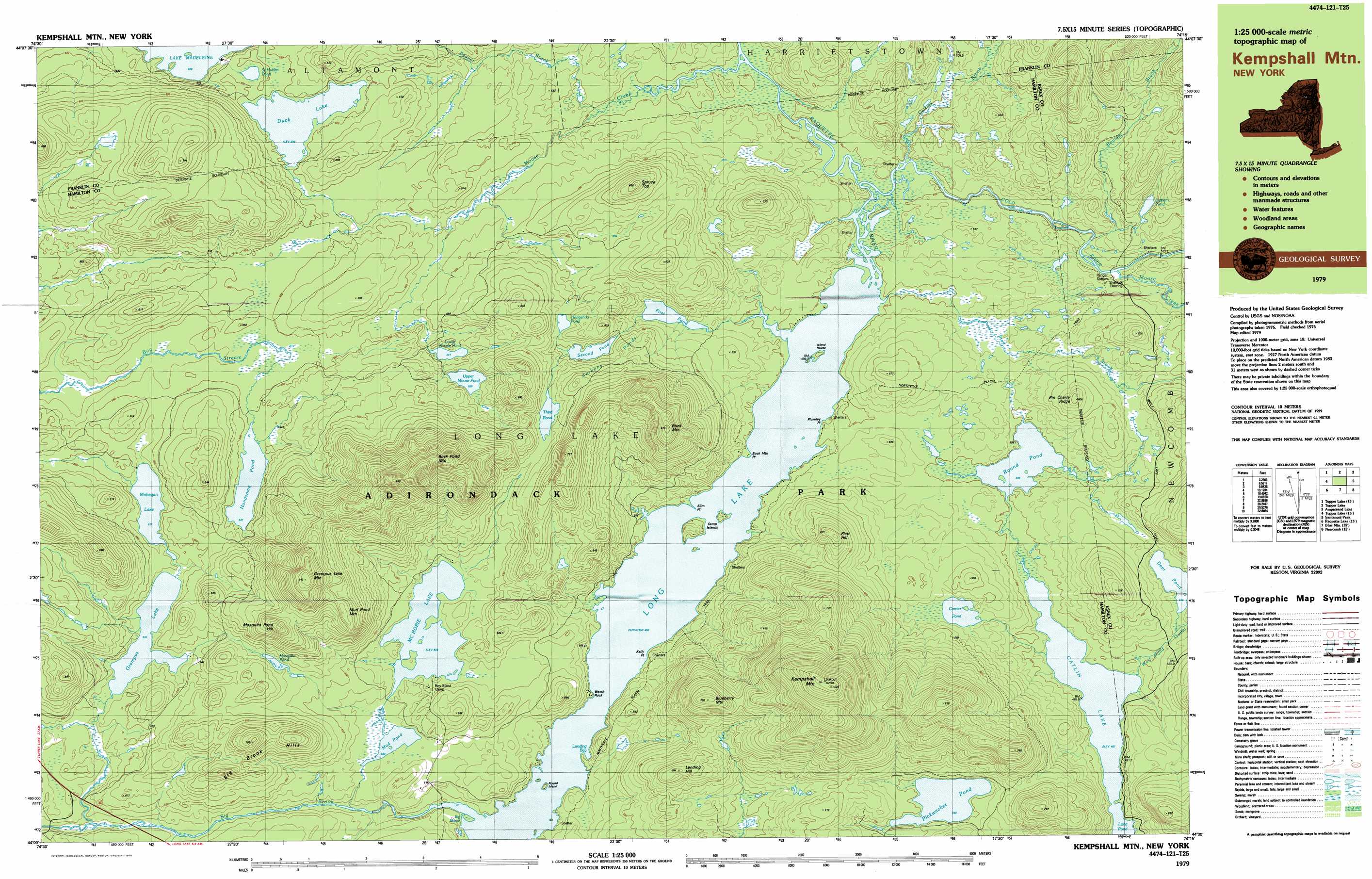
USGS Topo Quad 44074a3 - 1:25,000 scale
| Topo Map Name: | Kempshall Mountain |
| USGS Topo Quad ID: | 44074a3 |
| Print Size: | ca. 39" wide x 24" high |
| Southeast Coordinates: | 44° N latitude / 74.25° W longitude |
| Map Center Coordinates: | 44.0625° N latitude / 74.375° W longitude |
| U.S. State: | NY |
| Filename: | k44074a3.jpg |
| Download Map JPG Image: | Kempshall Mountain topo map 1:25,000 scale |
| Map Type: | Topographic |
| Topo Series: | 7.5´x15´ |
| Map Scale: | 1:25,000 |
| Source of Map Images: | United States Geological Survey (USGS) |
| Alternate Map Versions: |
Kempshall Mtn NY 1979, updated 1979 Download PDF Buy paper map Kempshall Mtn NY 1979, updated 1979 Download PDF Buy paper map Kempshall Mtn NY 1999, updated 2001 Download PDF Buy paper map |
1:24,000 Topo Quads surrounding Kempshall Mountain
Mount Matumbla |
Upper Saranac Lake |
Mckenzie Mountain |
||
Pierce Field |
Stony Creek Mountain |
Street Mountain |
||
Slim Pond |
Kempshall Mountain |
Mount Adams |
||
Forked Lake |
Dunbrook Mountain |
Vanderwhacker Mountain |
||
Sargent Ponds |
Burgess Mountain |
Starbuck Mountain |
> Back to 44074a1 at 1:100,000 scale
> Back to 44074a1 at 1:250,000 scale
> Back to U.S. Topo Maps home
Kempshall Mountain topo map: Gazetteer
Kempshall Mountain: Bays
Landing Bay elevation 496m 1627′Kempshall Mountain: Capes
Buck Mountain Point elevation 497m 1630′Kelly Point elevation 496m 1627′
Plumley Point elevation 496m 1627′
Slim Point elevation 496m 1627′
Watch Rock elevation 498m 1633′
Kempshall Mountain: Flats
Shattuck Clearing elevation 519m 1702′Kempshall Mountain: Islands
Camp Islands elevation 501m 1643′Island House elevation 500m 1640′
Round Island elevation 500m 1640′
Kempshall Mountain: Lakes
Anthony Ponds elevation 578m 1896′Catlin Lake elevation 487m 1597′
Comer Pond elevation 523m 1715′
Corner Pond elevation 526m 1725′
Deer Pond elevation 509m 1669′
Duck Lake elevation 545m 1788′
First Pond elevation 515m 1689′
Grampus Lake elevation 532m 1745′
Handsome Pond elevation 541m 1774′
Hedgehog Pond elevation 566m 1856′
Lake Madeleine elevation 528m 1732′
Latham Pond elevation 525m 1722′
Long Lake elevation 496m 1627′
Lower Moose Pond elevation 541m 1774′
McRorie Lake elevation 523m 1715′
Mohegan Lake elevation 537m 1761′
Mosquito Pond elevation 567m 1860′
Mud Pond elevation 522m 1712′
Pickwacket Pond elevation 546m 1791′
Round Pond elevation 498m 1633′
Saint Hubert Pond elevation 545m 1788′
Second Pond elevation 547m 1794′
Third Pond elevation 575m 1886′
Upper Moose Pond elevation 559m 1833′
Kempshall Mountain: Ranges
Adirondack Mountains elevation 544m 1784′Kempshall Mountain: Ridges
Pin Cherry Ridge elevation 595m 1952′Kempshall Mountain: Streams
Beaver Brook elevation 497m 1630′Big Brook elevation 496m 1627′
Boulder Brook elevation 501m 1643′
Calkins Brook elevation 490m 1607′
Cold River elevation 490m 1607′
Moose Creek elevation 490m 1607′
Moose Creek elevation 500m 1640′
Pine Brook elevation 496m 1627′
Wolf Pond Outlet elevation 488m 1601′
Kempshall Mountain: Summits
Big Brook Hills elevation 702m 2303′Blueberry Mountain elevation 794m 2604′
Buck Mountain elevation 812m 2664′
Grampus Lake Mountain elevation 845m 2772′
Kempshall Mountain elevation 1021m 3349′
Landing Hill elevation 681m 2234′
Mosquito Pond Hill elevation 744m 2440′
Mud Pond Mountain elevation 730m 2395′
Platt Hill elevation 667m 2188′
Rock Pond Mountain elevation 841m 2759′
Spruce Top elevation 662m 2171′
Kempshall Mountain: Swamps
Big Marsh elevation 496m 1627′Kempshall Mountain digital topo map on disk
Buy this Kempshall Mountain topo map showing relief, roads, GPS coordinates and other geographical features, as a high-resolution digital map file on DVD:
New York, Vermont, Connecticut & Western Massachusetts
Buy digital topo maps: New York, Vermont, Connecticut & Western Massachusetts