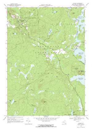
Stark Topo Map New York
To zoom in, hover over the map of Stark
USGS Topo Quad 44074d7 - 1:24,000 scale
| Topo Map Name: | Stark |
| USGS Topo Quad ID: | 44074d7 |
| Print Size: | ca. 21 1/4" wide x 27" high |
| Southeast Coordinates: | 44.375° N latitude / 74.75° W longitude |
| Map Center Coordinates: | 44.4375° N latitude / 74.8125° W longitude |
| U.S. State: | NY |
| Filename: | o44074d7.jpg |
| Download Map JPG Image: | Stark topo map 1:24,000 scale |
| Map Type: | Topographic |
| Topo Series: | 7.5´ |
| Map Scale: | 1:24,000 |
| Source of Map Images: | United States Geological Survey (USGS) |
| Alternate Map Versions: |
Stark NY 1968, updated 1971 Download PDF Buy paper map Stark NY 2010 Download PDF Buy paper map Stark NY 2013 Download PDF Buy paper map Stark NY 2016 Download PDF Buy paper map |
1:24,000 Topo Quads surrounding Stark
> Back to 44074a1 at 1:100,000 scale
> Back to 44074a1 at 1:250,000 scale
> Back to U.S. Topo Maps home
Stark topo map: Gazetteer
Stark: Dams
Stark Falls Dam elevation 413m 1354′Stark: Flats
The Plains elevation 367m 1204′Stark: Lakes
Barney Pond elevation 387m 1269′Blue Pond elevation 393m 1289′
Church Pond elevation 474m 1555′
Cold Pond elevation 408m 1338′
French Lake elevation 417m 1368′
Long Pond elevation 449m 1473′
Mud Pond elevation 444m 1456′
Ormsbee Pond elevation 411m 1348′
Round Pond elevation 462m 1515′
Stark: Populated Places
Irish Settlement elevation 371m 1217′Stark elevation 392m 1286′
Stark: Reservoirs
Stark Falls Reservoir elevation 413m 1354′Stark: Streams
Felton Brook elevation 422m 1384′Stark: Summits
Baldface Mountain elevation 571m 1873′Brunner Hill elevation 521m 1709′
Catamount Mountain elevation 553m 1814′
Peaked Hill elevation 455m 1492′
Stark: Swamps
Fox Marsh elevation 471m 1545′Stark digital topo map on disk
Buy this Stark topo map showing relief, roads, GPS coordinates and other geographical features, as a high-resolution digital map file on DVD:
New York, Vermont, Connecticut & Western Massachusetts
Buy digital topo maps: New York, Vermont, Connecticut & Western Massachusetts


