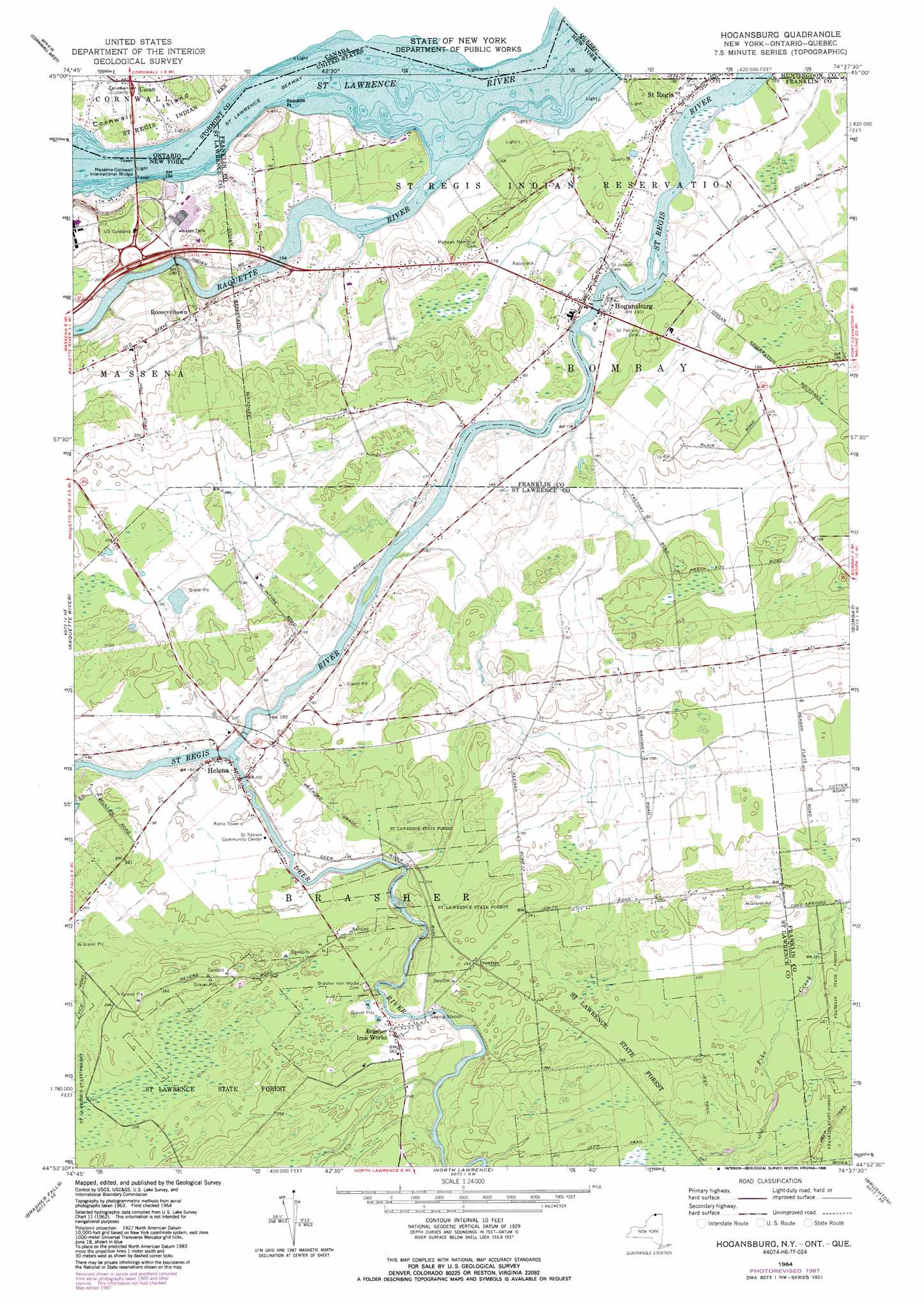
Hogansburg Topo Map New York
To zoom in, hover over the map of Hogansburg
USGS Topo Quad 44074h6 - 1:24,000 scale
| Topo Map Name: | Hogansburg |
| USGS Topo Quad ID: | 44074h6 |
| Print Size: | ca. 21 1/4" wide x 27" high |
| Southeast Coordinates: | 44.875° N latitude / 74.625° W longitude |
| Map Center Coordinates: | 44.9375° N latitude / 74.6875° W longitude |
| U.S. State: | NY |
| Filename: | o44074h6.jpg |
| Download Map JPG Image: | Hogansburg topo map 1:24,000 scale |
| Map Type: | Topographic |
| Topo Series: | 7.5´ |
| Map Scale: | 1:24,000 |
| Source of Map Images: | United States Geological Survey (USGS) |
| Alternate Map Versions: |
Hogansburg NY 1964, updated 1966 Download PDF Buy paper map Hogansburg NY 1964, updated 1980 Download PDF Buy paper map Hogansburg NY 1964, updated 1988 Download PDF Buy paper map Hogansburg NY 2010 Download PDF Buy paper map Hogansburg NY 2013 Download PDF Buy paper map Hogansburg NY 2016 Download PDF Buy paper map |
1:24,000 Topo Quads surrounding Hogansburg
Cornwall West |
||||
Massena |
Raquette River |
Hogansburg |
Bombay |
Fort Covington |
Norfolk |
Brasher Falls |
North Lawrence |
Brushton |
Bangor |
Potsdam |
Parishville |
Nicholville |
Saint Regis Falls |
Santa Clara |
> Back to 44074e1 at 1:100,000 scale
> Back to 44074a1 at 1:250,000 scale
> Back to U.S. Topo Maps home
Hogansburg topo map: Gazetteer
Hogansburg: Bridges
Massena-Cornwall International Bridge elevation 46m 150′Three Nations Crossing elevation 47m 154′
Hogansburg: Capes
Raquette Point elevation 51m 167′Hogansburg: Populated Places
Brasher Iron Works elevation 76m 249′Helena elevation 58m 190′
Hogansburg elevation 52m 170′
Ironton elevation 75m 246′
Rooseveltown elevation 63m 206′
Saint Regis elevation 52m 170′
Hogansburg: Streams
Deer River elevation 52m 170′Raquette River elevation 46m 150′
Hogansburg digital topo map on disk
Buy this Hogansburg topo map showing relief, roads, GPS coordinates and other geographical features, as a high-resolution digital map file on DVD:
New York, Vermont, Connecticut & Western Massachusetts
Buy digital topo maps: New York, Vermont, Connecticut & Western Massachusetts