Harrisville Topo Map New York
To zoom in, hover over the map of Harrisville
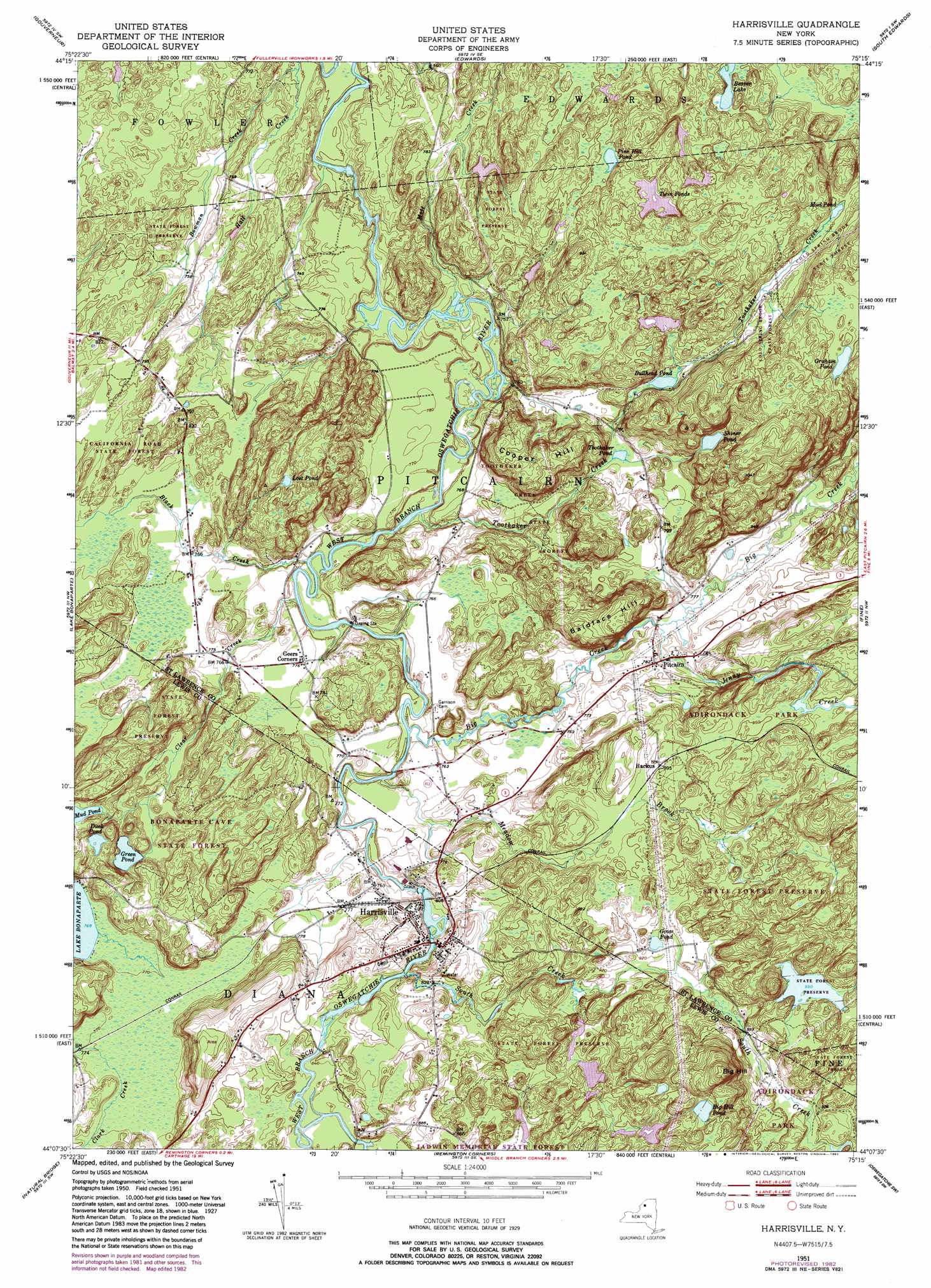
USGS Topo Quad 44075b3 - 1:24,000 scale
| Topo Map Name: | Harrisville |
| USGS Topo Quad ID: | 44075b3 |
| Print Size: | ca. 21 1/4" wide x 27" high |
| Southeast Coordinates: | 44.125° N latitude / 75.25° W longitude |
| Map Center Coordinates: | 44.1875° N latitude / 75.3125° W longitude |
| U.S. State: | NY |
| Filename: | o44075b3.jpg |
| Download Map JPG Image: | Harrisville topo map 1:24,000 scale |
| Map Type: | Topographic |
| Topo Series: | 7.5´ |
| Map Scale: | 1:24,000 |
| Source of Map Images: | United States Geological Survey (USGS) |
| Alternate Map Versions: |
Harrisville NY 1951, updated 1952 Download PDF Buy paper map Harrisville NY 1951, updated 1966 Download PDF Buy paper map Harrisville NY 1951, updated 1973 Download PDF Buy paper map Harrisville NY 1951, updated 1983 Download PDF Buy paper map Harrisville NY 2010 Download PDF Buy paper map Harrisville NY 2013 Download PDF Buy paper map Harrisville NY 2016 Download PDF Buy paper map |
1:24,000 Topo Quads surrounding Harrisville
Pope Mills |
Richville |
Bigelow |
Hermon |
West Pierrepont |
Natural Dam |
Gouverneur |
Edwards |
South Edwards |
Degrasse |
Antwerp |
Lake Bonaparte |
Harrisville |
Fine |
Oswegatchie |
North Wilna |
Natural Bridge |
Remington Corners |
Oswegatchie Sw |
Oswegatchie Se |
Carthage |
Croghan |
Belfort |
Stillwater Reservoir West |
> Back to 44075a1 at 1:100,000 scale
> Back to 44074a1 at 1:250,000 scale
> Back to U.S. Topo Maps home
Harrisville topo map: Gazetteer
Harrisville: Lakes
Beaver Lake elevation 256m 839′Big Hill Pond elevation 324m 1062′
Bullhead Pond elevation 257m 843′
Duck Pond elevation 263m 862′
Goose Pond elevation 282m 925′
Graham Pond elevation 315m 1033′
Green Pond elevation 245m 803′
Lost Pond elevation 285m 935′
Mud Pond elevation 273m 895′
Mud Pond elevation 263m 862′
Pine Hill Pond elevation 257m 843′
Shiner Pond elevation 267m 875′
Toothaker Pond elevation 236m 774′
Twin Ponds elevation 282m 925′
Harrisville: Populated Places
Backus elevation 274m 898′Geers Corners elevation 235m 770′
Harrisville elevation 246m 807′
Pitcairn elevation 238m 780′
Harrisville: Streams
Big Creek elevation 225m 738′Black Creek elevation 222m 728′
Bowman Creek elevation 212m 695′
Clear Creek elevation 222m 728′
Jenny Creek elevation 229m 751′
Meadow Brook elevation 227m 744′
South Creek elevation 240m 787′
Toothaker Creek elevation 219m 718′
Harrisville: Summits
Baldface Hill elevation 311m 1020′Big Hill elevation 388m 1272′
Cooper Hill elevation 311m 1020′
Harrisville digital topo map on disk
Buy this Harrisville topo map showing relief, roads, GPS coordinates and other geographical features, as a high-resolution digital map file on DVD:
New York, Vermont, Connecticut & Western Massachusetts
Buy digital topo maps: New York, Vermont, Connecticut & Western Massachusetts