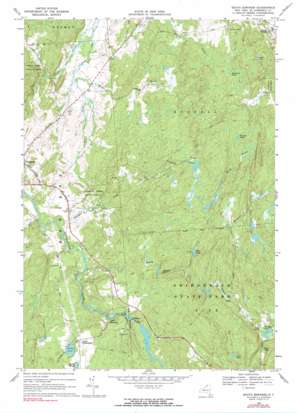
South Edwards Topo Map New York
To zoom in, hover over the map of South Edwards
USGS Topo Quad 44075c2 - 1:24,000 scale
| Topo Map Name: | South Edwards |
| USGS Topo Quad ID: | 44075c2 |
| Print Size: | ca. 21 1/4" wide x 27" high |
| Southeast Coordinates: | 44.25° N latitude / 75.125° W longitude |
| Map Center Coordinates: | 44.3125° N latitude / 75.1875° W longitude |
| U.S. State: | NY |
| Filename: | o44075c2.jpg |
| Download Map JPG Image: | South Edwards topo map 1:24,000 scale |
| Map Type: | Topographic |
| Topo Series: | 7.5´ |
| Map Scale: | 1:24,000 |
| Source of Map Images: | United States Geological Survey (USGS) |
| Alternate Map Versions: |
South Edwards NY 1969, updated 1971 Download PDF Buy paper map South Edwards NY 1969, updated 1990 Download PDF Buy paper map South Edwards NY 2010 Download PDF Buy paper map South Edwards NY 2013 Download PDF Buy paper map South Edwards NY 2016 Download PDF Buy paper map |
1:24,000 Topo Quads surrounding South Edwards
> Back to 44075a1 at 1:100,000 scale
> Back to 44074a1 at 1:250,000 scale
> Back to U.S. Topo Maps home
South Edwards topo map: Gazetteer
South Edwards: Forests
Stammer Creek State Forest elevation 235m 770′Trout Lake State Forest elevation 275m 902′
South Edwards: Lakes
Carr Pond elevation 347m 1138′Hall Lake elevation 271m 889′
Jones Pond elevation 242m 793′
Little Lake elevation 274m 898′
Mud Pond elevation 313m 1026′
Partlow Pond elevation 299m 980′
Smith Pond elevation 240m 787′
Stockwell Pond elevation 266m 872′
Warden Pond elevation 290m 951′
South Edwards: Populated Places
Pond Settlement elevation 250m 820′South Edwards elevation 223m 731′
South Russell elevation 213m 698′
South Edwards: Streams
Birch Brook elevation 268m 879′Cedar Lake Stream elevation 176m 577′
Mill Brook elevation 177m 580′
Paddy Brown Brook elevation 210m 688′
Stammer Creek elevation 198m 649′
South Edwards: Summits
Dana Hill elevation 308m 1010′South Edwards digital topo map on disk
Buy this South Edwards topo map showing relief, roads, GPS coordinates and other geographical features, as a high-resolution digital map file on DVD:
New York, Vermont, Connecticut & Western Massachusetts
Buy digital topo maps: New York, Vermont, Connecticut & Western Massachusetts


