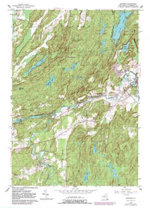
Edwards Topo Map New York
To zoom in, hover over the map of Edwards
USGS Topo Quad 44075c3 - 1:24,000 scale
| Topo Map Name: | Edwards |
| USGS Topo Quad ID: | 44075c3 |
| Print Size: | ca. 21 1/4" wide x 27" high |
| Southeast Coordinates: | 44.25° N latitude / 75.25° W longitude |
| Map Center Coordinates: | 44.3125° N latitude / 75.3125° W longitude |
| U.S. State: | NY |
| Filename: | o44075c3.jpg |
| Download Map JPG Image: | Edwards topo map 1:24,000 scale |
| Map Type: | Topographic |
| Topo Series: | 7.5´ |
| Map Scale: | 1:24,000 |
| Source of Map Images: | United States Geological Survey (USGS) |
| Alternate Map Versions: |
Edwards NY 1956, updated 1958 Download PDF Buy paper map Edwards NY 1956, updated 1983 Download PDF Buy paper map Edwards NY 2010 Download PDF Buy paper map Edwards NY 2013 Download PDF Buy paper map Edwards NY 2016 Download PDF Buy paper map |
1:24,000 Topo Quads surrounding Edwards
> Back to 44075a1 at 1:100,000 scale
> Back to 44074a1 at 1:250,000 scale
> Back to U.S. Topo Maps home
Edwards topo map: Gazetteer
Edwards: Lakes
Bonner Lake elevation 242m 793′Cedar Lake elevation 209m 685′
Chub Lake elevation 176m 577′
Clear Lake elevation 244m 800′
Huckleberry Lake elevation 227m 744′
Little Mud Pond elevation 215m 705′
Moon Lake elevation 248m 813′
Trout Lake elevation 228m 748′
Wolf Lake elevation 243m 797′
Edwards: Populated Places
Edwards elevation 204m 669′Emeryville elevation 184m 603′
Fullerville elevation 216m 708′
Talcville elevation 198m 649′
Edwards: Streams
Bennett Brook elevation 208m 682′Hall Creek elevation 208m 682′
Mott Creek elevation 243m 797′
Pork Creek elevation 186m 610′
West Branch Oswegatchie River elevation 181m 593′
Edwards: Summits
Fullerville Sands elevation 220m 721′Edwards digital topo map on disk
Buy this Edwards topo map showing relief, roads, GPS coordinates and other geographical features, as a high-resolution digital map file on DVD:
New York, Vermont, Connecticut & Western Massachusetts
Buy digital topo maps: New York, Vermont, Connecticut & Western Massachusetts


