Bigelow Topo Map New York
To zoom in, hover over the map of Bigelow
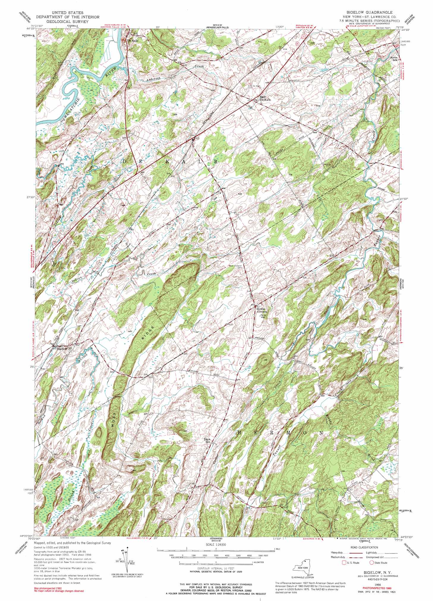
USGS Topo Quad 44075d3 - 1:24,000 scale
| Topo Map Name: | Bigelow |
| USGS Topo Quad ID: | 44075d3 |
| Print Size: | ca. 21 1/4" wide x 27" high |
| Southeast Coordinates: | 44.375° N latitude / 75.25° W longitude |
| Map Center Coordinates: | 44.4375° N latitude / 75.3125° W longitude |
| U.S. State: | NY |
| Filename: | o44075d3.jpg |
| Download Map JPG Image: | Bigelow topo map 1:24,000 scale |
| Map Type: | Topographic |
| Topo Series: | 7.5´ |
| Map Scale: | 1:24,000 |
| Source of Map Images: | United States Geological Survey (USGS) |
| Alternate Map Versions: |
Bigelow NY 1956, updated 1958 Download PDF Buy paper map Bigelow NY 1956, updated 1992 Download PDF Buy paper map Bigelow NY 2010 Download PDF Buy paper map Bigelow NY 2013 Download PDF Buy paper map Bigelow NY 2016 Download PDF Buy paper map |
1:24,000 Topo Quads surrounding Bigelow
Ogdensburg West |
Ogdensburg East |
Lisbon |
Morley |
West Potsdam |
Edwardsville |
Heuvelton |
Rensselaer Falls |
Canton |
Pierrepont |
Pope Mills |
Richville |
Bigelow |
Hermon |
West Pierrepont |
Natural Dam |
Gouverneur |
Edwards |
South Edwards |
Degrasse |
Antwerp |
Lake Bonaparte |
Harrisville |
Fine |
Oswegatchie |
> Back to 44075a1 at 1:100,000 scale
> Back to 44074a1 at 1:250,000 scale
> Back to U.S. Topo Maps home
Bigelow topo map: Gazetteer
Bigelow: Populated Places
Bigelow elevation 137m 449′De Kalb elevation 101m 331′
East De Kalb elevation 143m 469′
Kents Corners elevation 194m 636′
Bigelow: Ridges
Moss Ridge elevation 171m 561′Bigelow: Streams
Anderson Creek elevation 92m 301′Brandy Brook elevation 169m 554′
Carter Creek elevation 149m 488′
Bigelow digital topo map on disk
Buy this Bigelow topo map showing relief, roads, GPS coordinates and other geographical features, as a high-resolution digital map file on DVD:
New York, Vermont, Connecticut & Western Massachusetts
Buy digital topo maps: New York, Vermont, Connecticut & Western Massachusetts