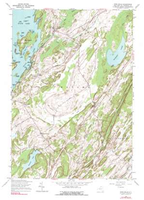
Pope Mills Topo Map New York
To zoom in, hover over the map of Pope Mills
USGS Topo Quad 44075d5 - 1:24,000 scale
| Topo Map Name: | Pope Mills |
| USGS Topo Quad ID: | 44075d5 |
| Print Size: | ca. 21 1/4" wide x 27" high |
| Southeast Coordinates: | 44.375° N latitude / 75.5° W longitude |
| Map Center Coordinates: | 44.4375° N latitude / 75.5625° W longitude |
| U.S. State: | NY |
| Filename: | o44075d5.jpg |
| Download Map JPG Image: | Pope Mills topo map 1:24,000 scale |
| Map Type: | Topographic |
| Topo Series: | 7.5´ |
| Map Scale: | 1:24,000 |
| Source of Map Images: | United States Geological Survey (USGS) |
| Alternate Map Versions: |
Pope Mills NY 1951 Download PDF Buy paper map Pope Mills NY 1961, updated 1964 Download PDF Buy paper map Pope Mills NY 1961, updated 1976 Download PDF Buy paper map Pope Mills NY 1961, updated 1976 Download PDF Buy paper map Pope Mills NY 2010 Download PDF Buy paper map Pope Mills NY 2013 Download PDF Buy paper map Pope Mills NY 2016 Download PDF Buy paper map |
1:24,000 Topo Quads surrounding Pope Mills
> Back to 44075a1 at 1:100,000 scale
> Back to 44074a1 at 1:250,000 scale
> Back to U.S. Topo Maps home
Pope Mills topo map: Gazetteer
Pope Mills: Bays
Brown Bay elevation 83m 272′Conger Bay elevation 83m 272′
Lower Deep Bay elevation 83m 272′
Middle Point Bay elevation 83m 272′
Orchard Bay elevation 83m 272′
Red Point Bay elevation 83m 272′
Rollway Bay elevation 83m 272′
Upper Deep Bay elevation 83m 272′
Pope Mills: Capes
Drury Point elevation 85m 278′Hague Point elevation 93m 305′
Pope Mills: Islands
Baily Island elevation 83m 272′Bay Island elevation 83m 272′
Belle Island elevation 83m 272′
Big Island elevation 84m 275′
Conger Island elevation 93m 305′
Crab Island elevation 83m 272′
Elizabeth Island elevation 110m 360′
Limestone Island elevation 88m 288′
Pin Island elevation 83m 272′
Prince Island elevation 83m 272′
Snake Island elevation 84m 275′
Thompson Island elevation 89m 291′
Wood Island elevation 86m 282′
Pope Mills: Lakes
Hickory Lake elevation 96m 314′Pleasant Lake elevation 102m 334′
Pope Mills: Populated Places
Brasie Corners elevation 117m 383′Pope Mills elevation 85m 278′
Ruby Corner elevation 94m 308′
Pope Mills: Streams
Birch Creek elevation 83m 272′Fish Creek elevation 83m 272′
Pope Mills digital topo map on disk
Buy this Pope Mills topo map showing relief, roads, GPS coordinates and other geographical features, as a high-resolution digital map file on DVD:
New York, Vermont, Connecticut & Western Massachusetts
Buy digital topo maps: New York, Vermont, Connecticut & Western Massachusetts


