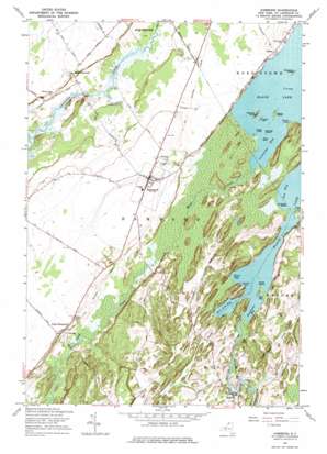
Hammond Topo Map New York
To zoom in, hover over the map of Hammond
USGS Topo Quad 44075d6 - 1:24,000 scale
| Topo Map Name: | Hammond |
| USGS Topo Quad ID: | 44075d6 |
| Print Size: | ca. 21 1/4" wide x 27" high |
| Southeast Coordinates: | 44.375° N latitude / 75.625° W longitude |
| Map Center Coordinates: | 44.4375° N latitude / 75.6875° W longitude |
| U.S. State: | NY |
| Filename: | o44075d6.jpg |
| Download Map JPG Image: | Hammond topo map 1:24,000 scale |
| Map Type: | Topographic |
| Topo Series: | 7.5´ |
| Map Scale: | 1:24,000 |
| Source of Map Images: | United States Geological Survey (USGS) |
| Alternate Map Versions: |
Hammond NY 1951 Download PDF Buy paper map Hammond NY 1951 Download PDF Buy paper map Hammond NY 1961, updated 1964 Download PDF Buy paper map Hammond NY 1961, updated 1976 Download PDF Buy paper map Hammond NY 2011 Download PDF Buy paper map Hammond NY 2013 Download PDF Buy paper map Hammond NY 2016 Download PDF Buy paper map |
1:24,000 Topo Quads surrounding Hammond
> Back to 44075a1 at 1:100,000 scale
> Back to 44074a1 at 1:250,000 scale
> Back to U.S. Topo Maps home
Hammond topo map: Gazetteer
Hammond: Airports
Hammond Airport (historical) elevation 120m 393′Hammond: Bays
Big Bay elevation 83m 272′Black Bay elevation 83m 272′
Grindstone Bay elevation 83m 272′
Lonesome Bay elevation 83m 272′
Mile Arm Bay elevation 83m 272′
Sitts Bay elevation 83m 272′
Hammond: Capes
Chapman Point elevation 83m 272′Elwood Point elevation 83m 272′
Hammond: Islands
Apple Island elevation 84m 275′Bowman Island elevation 85m 278′
Bullhead Island elevation 83m 272′
Emery Island elevation 90m 295′
Hogback Island elevation 83m 272′
Jennies Island elevation 83m 272′
Lookout Island elevation 83m 272′
Raspberry Island elevation 85m 278′
Tavern Island elevation 83m 272′
Watch Island elevation 83m 272′
Hammond: Lakes
Black Lake elevation 83m 272′Hammond: Populated Places
Black Lake (historical) elevation 95m 311′Cedars elevation 95m 311′
Hammond elevation 109m 357′
North Hammond elevation 113m 370′
Oakvale elevation 91m 298′
Rossie elevation 84m 275′
South Hammond elevation 106m 347′
Hammond: Streams
Black Creek elevation 83m 272′Bostwick Creek elevation 83m 272′
Grass Creek elevation 83m 272′
Indian River elevation 88m 288′
Hammond digital topo map on disk
Buy this Hammond topo map showing relief, roads, GPS coordinates and other geographical features, as a high-resolution digital map file on DVD:
New York, Vermont, Connecticut & Western Massachusetts
Buy digital topo maps: New York, Vermont, Connecticut & Western Massachusetts


