Canton Topo Map New York
To zoom in, hover over the map of Canton
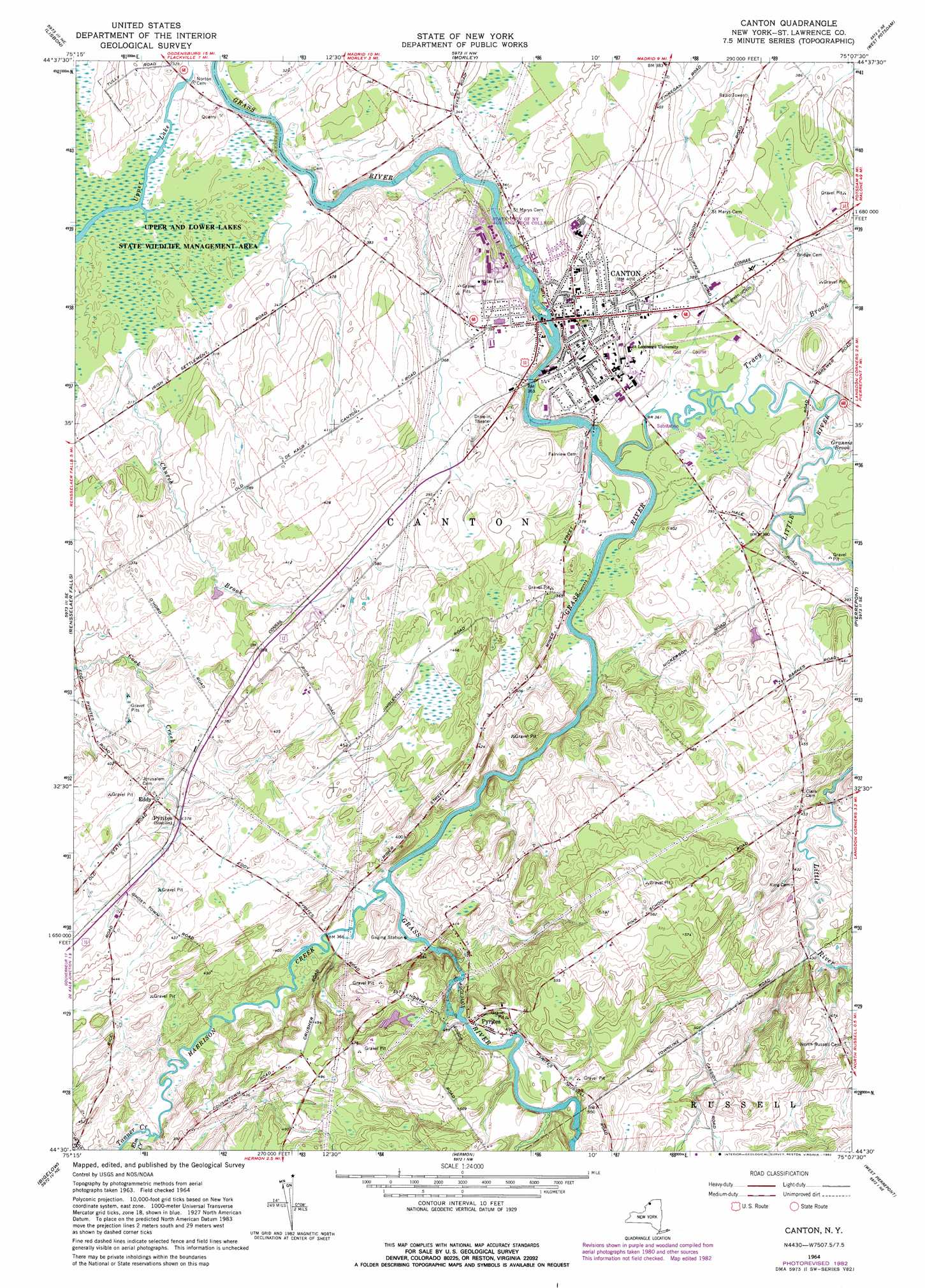
USGS Topo Quad 44075e2 - 1:24,000 scale
| Topo Map Name: | Canton |
| USGS Topo Quad ID: | 44075e2 |
| Print Size: | ca. 21 1/4" wide x 27" high |
| Southeast Coordinates: | 44.5° N latitude / 75.125° W longitude |
| Map Center Coordinates: | 44.5625° N latitude / 75.1875° W longitude |
| U.S. State: | NY |
| Filename: | o44075e2.jpg |
| Download Map JPG Image: | Canton topo map 1:24,000 scale |
| Map Type: | Topographic |
| Topo Series: | 7.5´ |
| Map Scale: | 1:24,000 |
| Source of Map Images: | United States Geological Survey (USGS) |
| Alternate Map Versions: |
Canton NY 1964, updated 1966 Download PDF Buy paper map Canton NY 1964, updated 1982 Download PDF Buy paper map Canton NY 2010 Download PDF Buy paper map Canton NY 2013 Download PDF Buy paper map Canton NY 2016 Download PDF Buy paper map |
1:24,000 Topo Quads surrounding Canton
Red Mills |
Sparrowhawk Point |
Waddington |
Chase Mills |
Norfolk |
Ogdensburg East |
Lisbon |
Morley |
West Potsdam |
Potsdam |
Heuvelton |
Rensselaer Falls |
Canton |
Pierrepont |
Colton |
Richville |
Bigelow |
Hermon |
West Pierrepont |
Albert Marsh |
Gouverneur |
Edwards |
South Edwards |
Degrasse |
Tooley Pond |
> Back to 44075e1 at 1:100,000 scale
> Back to 44074a1 at 1:250,000 scale
> Back to U.S. Topo Maps home
Canton topo map: Gazetteer
Canton: Airports
Hurlbut Field elevation 144m 472′Canton: Falls
Rushton Falls elevation 98m 321′Canton: Lakes
Upper Lake elevation 91m 298′Canton: Populated Places
Canton elevation 115m 377′Eddy elevation 122m 400′
Pyrites elevation 153m 501′
Canton: Streams
Church Brook elevation 94m 308′Elm Creek elevation 108m 354′
Grannis Brook elevation 107m 351′
Harrison Creek elevation 107m 351′
Little River elevation 104m 341′
Tanner Creek elevation 107m 351′
Tracy Brook elevation 107m 351′
Canton digital topo map on disk
Buy this Canton topo map showing relief, roads, GPS coordinates and other geographical features, as a high-resolution digital map file on DVD:
New York, Vermont, Connecticut & Western Massachusetts
Buy digital topo maps: New York, Vermont, Connecticut & Western Massachusetts