West Potsdam Topo Map New York
To zoom in, hover over the map of West Potsdam
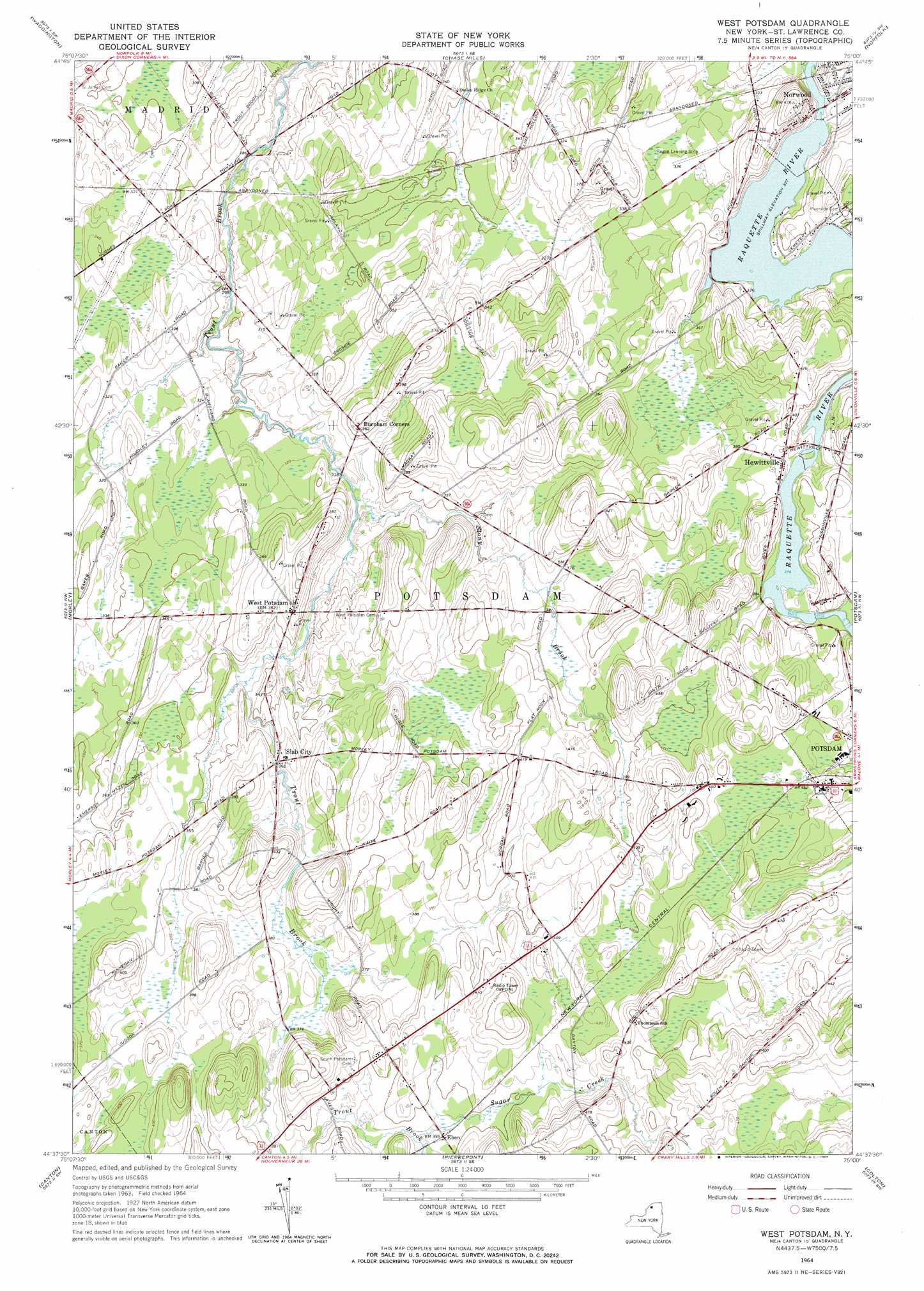
USGS Topo Quad 44075f1 - 1:24,000 scale
| Topo Map Name: | West Potsdam |
| USGS Topo Quad ID: | 44075f1 |
| Print Size: | ca. 21 1/4" wide x 27" high |
| Southeast Coordinates: | 44.625° N latitude / 75° W longitude |
| Map Center Coordinates: | 44.6875° N latitude / 75.0625° W longitude |
| U.S. State: | NY |
| Filename: | o44075f1.jpg |
| Download Map JPG Image: | West Potsdam topo map 1:24,000 scale |
| Map Type: | Topographic |
| Topo Series: | 7.5´ |
| Map Scale: | 1:24,000 |
| Source of Map Images: | United States Geological Survey (USGS) |
| Alternate Map Versions: |
West Potsdam NY 1964, updated 1965 Download PDF Buy paper map West Potsdam NY 2010 Download PDF Buy paper map West Potsdam NY 2013 Download PDF Buy paper map West Potsdam NY 2016 Download PDF Buy paper map |
1:24,000 Topo Quads surrounding West Potsdam
Morrisburg |
Louisville |
Massena |
Raquette River |
|
Sparrowhawk Point |
Waddington |
Chase Mills |
Norfolk |
Brasher Falls |
Lisbon |
Morley |
West Potsdam |
Potsdam |
Parishville |
Rensselaer Falls |
Canton |
Pierrepont |
Colton |
Rainbow Falls |
Bigelow |
Hermon |
West Pierrepont |
Albert Marsh |
Stark |
> Back to 44075e1 at 1:100,000 scale
> Back to 44074a1 at 1:250,000 scale
> Back to U.S. Topo Maps home
West Potsdam topo map: Gazetteer
West Potsdam: Populated Places
Eben elevation 120m 393′Hewittville elevation 115m 377′
Slab City elevation 106m 347′
West Potsdam elevation 116m 380′
West Potsdam: Streams
Stony Brook elevation 95m 311′Sugar Creek elevation 118m 387′
West Potsdam digital topo map on disk
Buy this West Potsdam topo map showing relief, roads, GPS coordinates and other geographical features, as a high-resolution digital map file on DVD:
New York, Vermont, Connecticut & Western Massachusetts
Buy digital topo maps: New York, Vermont, Connecticut & Western Massachusetts