Red Mills Topo Map New York
To zoom in, hover over the map of Red Mills
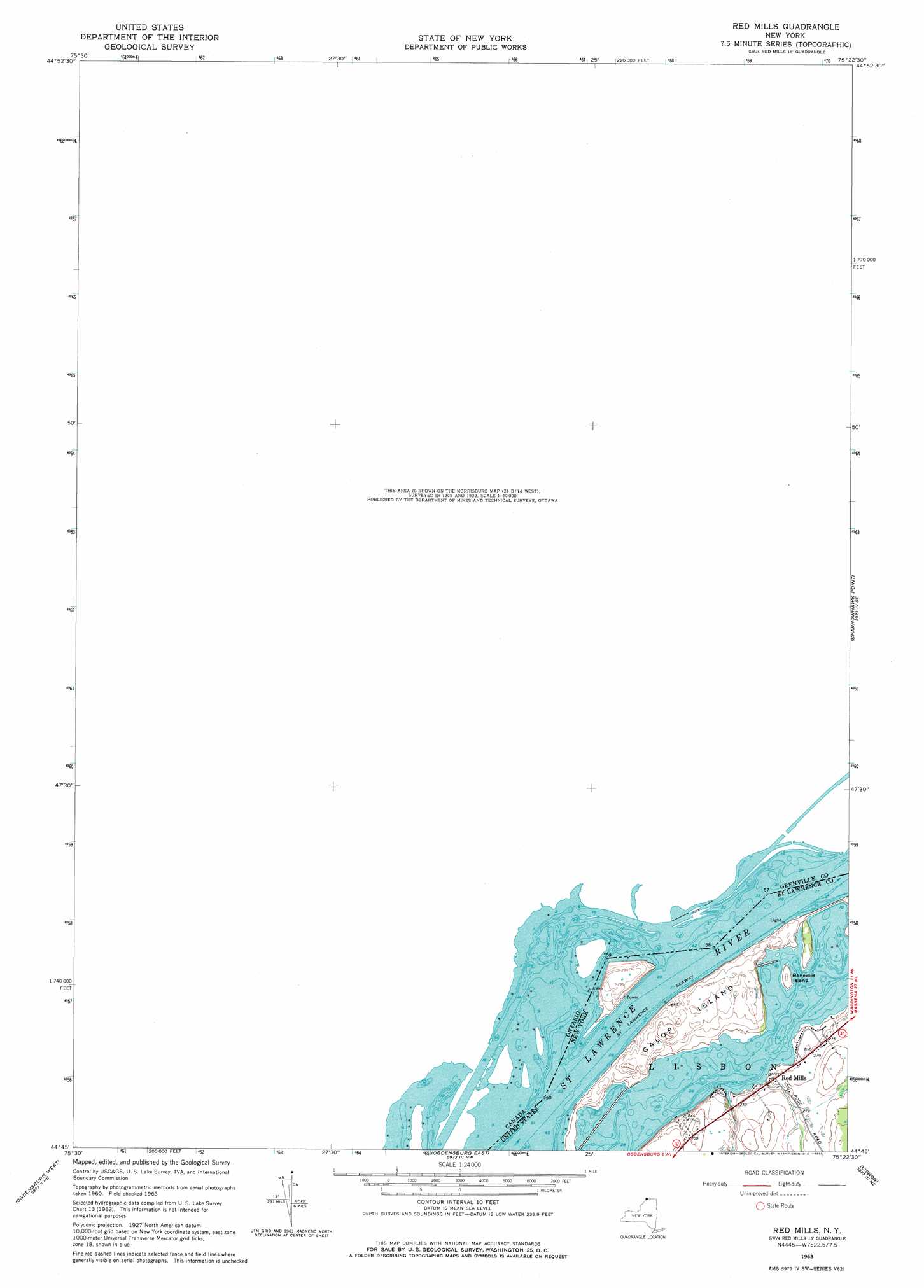
USGS Topo Quad 44075g4 - 1:24,000 scale
| Topo Map Name: | Red Mills |
| USGS Topo Quad ID: | 44075g4 |
| Print Size: | ca. 21 1/4" wide x 27" high |
| Southeast Coordinates: | 44.75° N latitude / 75.375° W longitude |
| Map Center Coordinates: | 44.8125° N latitude / 75.4375° W longitude |
| U.S. State: | NY |
| Filename: | o44075g4.jpg |
| Download Map JPG Image: | Red Mills topo map 1:24,000 scale |
| Map Type: | Topographic |
| Topo Series: | 7.5´ |
| Map Scale: | 1:24,000 |
| Source of Map Images: | United States Geological Survey (USGS) |
| Alternate Map Versions: |
Red Mills NY 1963, updated 1965 Download PDF Buy paper map Red Mills NY 2011 Download PDF Buy paper map Red Mills NY 2013 Download PDF Buy paper map Red Mills NY 2016 Download PDF Buy paper map |
1:24,000 Topo Quads surrounding Red Mills
Morrisburg |
||||
Red Mills |
Sparrowhawk Point |
Waddington |
||
Ogdensburg West |
Ogdensburg East |
Lisbon |
Morley |
|
Morristown |
Edwardsville |
Heuvelton |
Rensselaer Falls |
Canton |
> Back to 44075e1 at 1:100,000 scale
> Back to 44074a1 at 1:250,000 scale
> Back to U.S. Topo Maps home
Red Mills topo map: Gazetteer
Red Mills: Islands
Benedict Island elevation 79m 259′Dillingham Island (historical) elevation 76m 249′
Dixon Island (historical) elevation 73m 239′
Galop Island elevation 88m 288′
Sears Island (historical) elevation 73m 239′
Shoemaker Island elevation 88m 288′
Tick Island (historical) elevation 73m 239′
Twin Island (historical) elevation 73m 239′
Red Mills: Populated Places
Red Mills elevation 83m 272′Red Mills: Rapids
Galop Rapids (historical) elevation 73m 239′Red Mills digital topo map on disk
Buy this Red Mills topo map showing relief, roads, GPS coordinates and other geographical features, as a high-resolution digital map file on DVD:
New York, Vermont, Connecticut & Western Massachusetts
Buy digital topo maps: New York, Vermont, Connecticut & Western Massachusetts