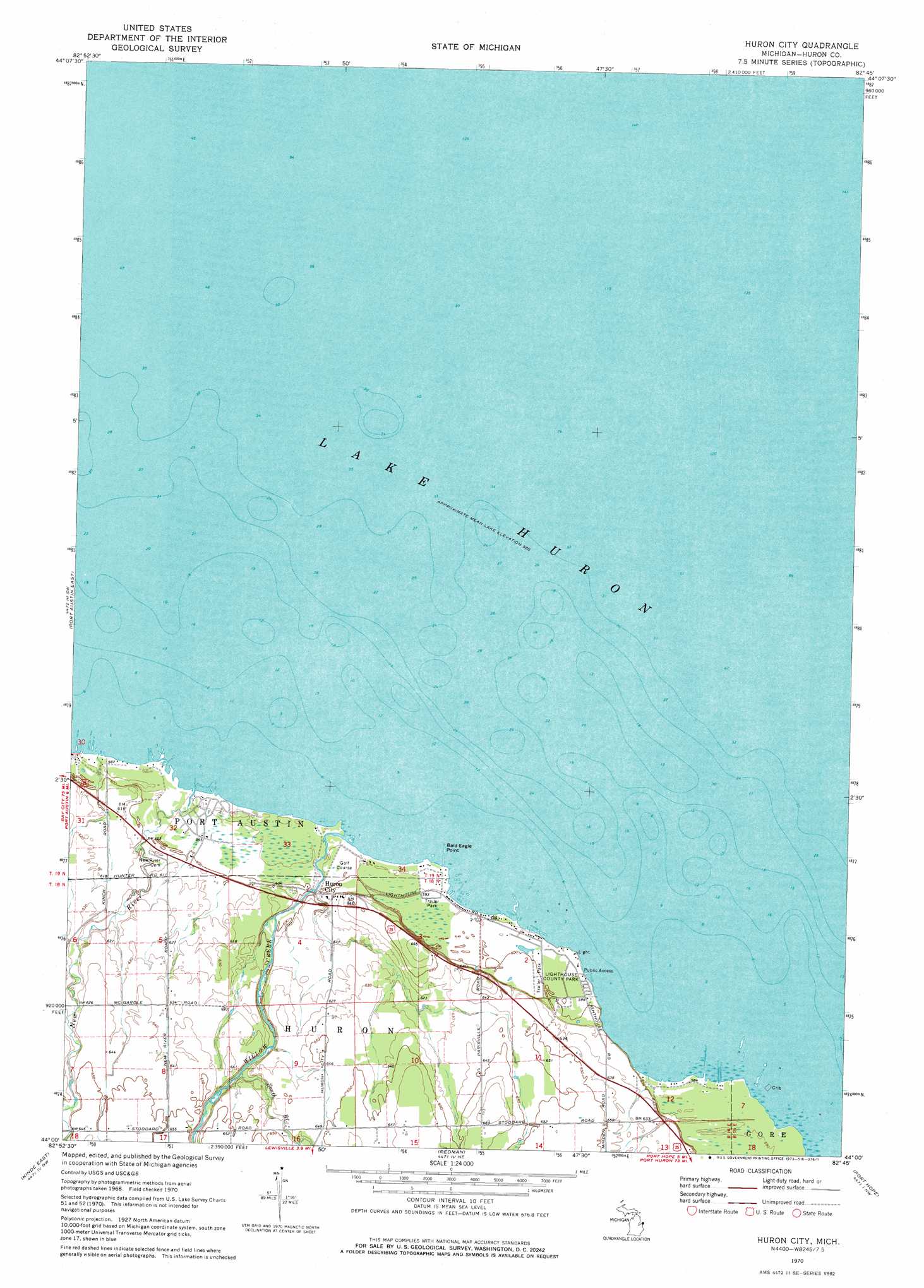
Huron City Topo Map Michigan
To zoom in, hover over the map of Huron City
USGS Topo Quad 44082a7 - 1:24,000 scale
| Topo Map Name: | Huron City |
| USGS Topo Quad ID: | 44082a7 |
| Print Size: | ca. 21 1/4" wide x 27" high |
| Southeast Coordinates: | 44° N latitude / 82.75° W longitude |
| Map Center Coordinates: | 44.0625° N latitude / 82.8125° W longitude |
| U.S. State: | MI |
| Filename: | o44082a7.jpg |
| Download Map JPG Image: | Huron City topo map 1:24,000 scale |
| Map Type: | Topographic |
| Topo Series: | 7.5´ |
| Map Scale: | 1:24,000 |
| Source of Map Images: | United States Geological Survey (USGS) |
| Alternate Map Versions: |
Huron City MI 1970, updated 1973 Download PDF Buy paper map Huron City MI 2011 Download PDF Buy paper map Huron City MI 2014 Download PDF Buy paper map Huron City MI 2016 Download PDF Buy paper map |
1:24,000 Topo Quads surrounding Huron City
Port Austin West |
Port Austin East |
Huron City |
||
Kinde West |
Kinde East |
Redman |
Port Hope |
|
Bad Axe West |
Bad Axe East |
Bad Axe Se |
Harbor Beach |
> Back to 44082a1 at 1:100,000 scale
> Back to 44082a1 at 1:250,000 scale
> Back to U.S. Topo Maps home
Huron City topo map: Gazetteer
Huron City: Capes
Bald Eagle Point elevation 177m 580′Oscabe Point elevation 177m 580′
Oscube Point elevation 180m 590′
Huron City: Islands
Orion Rock elevation 177m 580′Huron City: Lakes
Lake Huron elevation 177m 580′Huron City: Parks
Huron City Historical Marker elevation 191m 626′Lighthouse County Park elevation 182m 597′
Pointe aux Barques Lighthouse Historical Marker elevation 180m 590′
Huron City: Populated Places
Huron City elevation 186m 610′Huron City: Post Offices
Huron Post Office (historical) elevation 186m 610′Huron City: Streams
New River elevation 177m 580′South Branch Willow Creek elevation 187m 613′
Willow Creek elevation 177m 580′
Huron City digital topo map on disk
Buy this Huron City topo map showing relief, roads, GPS coordinates and other geographical features, as a high-resolution digital map file on DVD:
 map DVD")