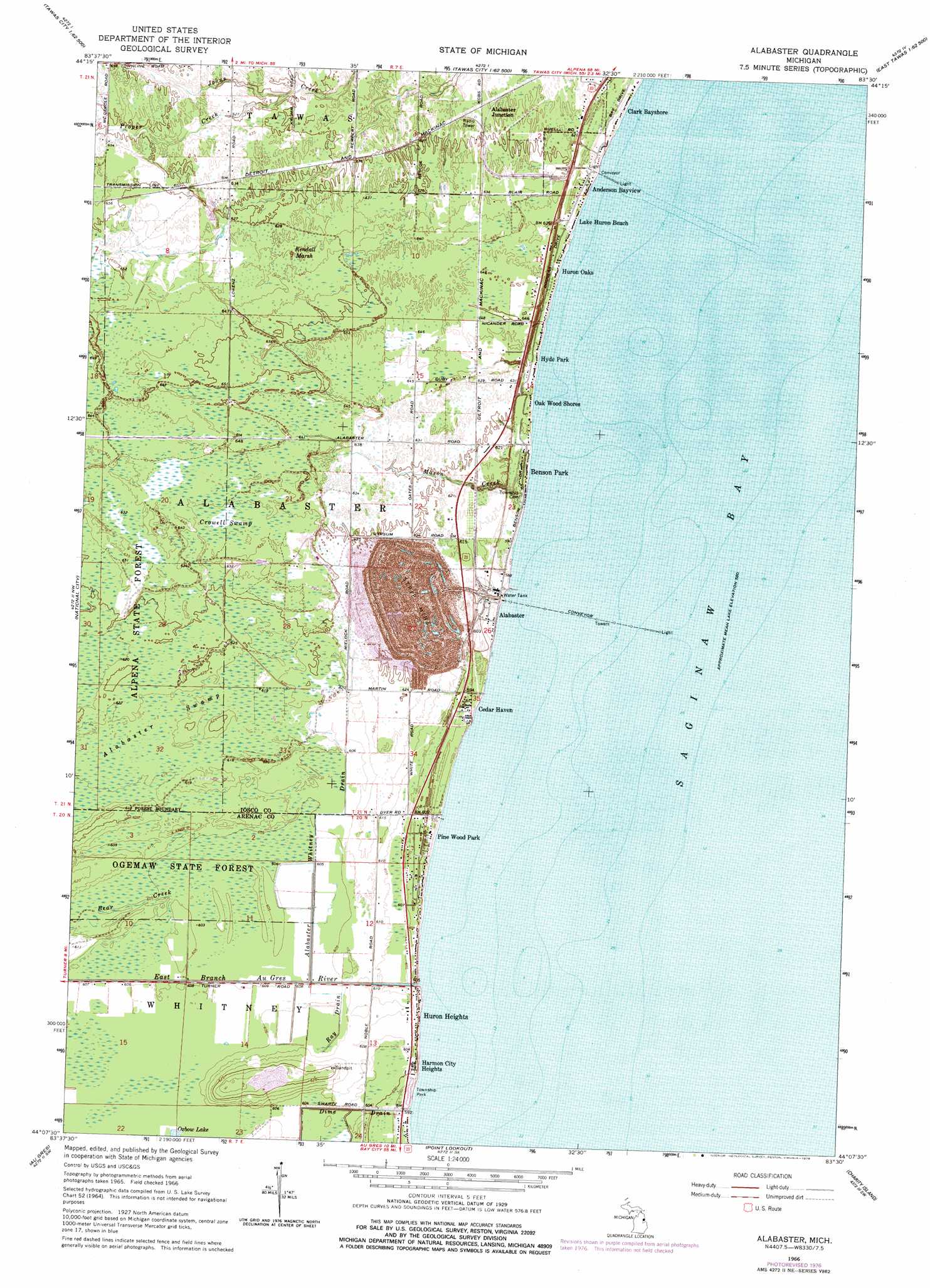
Alabaster Topo Map Michigan
To zoom in, hover over the map of Alabaster
USGS Topo Quad 44083b5 - 1:24,000 scale
| Topo Map Name: | Alabaster |
| USGS Topo Quad ID: | 44083b5 |
| Print Size: | ca. 21 1/4" wide x 27" high |
| Southeast Coordinates: | 44.125° N latitude / 83.5° W longitude |
| Map Center Coordinates: | 44.1875° N latitude / 83.5625° W longitude |
| U.S. State: | MI |
| Filename: | o44083b5.jpg |
| Download Map JPG Image: | Alabaster topo map 1:24,000 scale |
| Map Type: | Topographic |
| Topo Series: | 7.5´ |
| Map Scale: | 1:24,000 |
| Source of Map Images: | United States Geological Survey (USGS) |
| Alternate Map Versions: |
Alabaster MI 1966, updated 1968 Download PDF Buy paper map Alabaster MI 1966, updated 1978 Download PDF Buy paper map Alabaster MI 2011 Download PDF Buy paper map Alabaster MI 2014 Download PDF Buy paper map Alabaster MI 2016 Download PDF Buy paper map |
1:24,000 Topo Quads surrounding Alabaster
Hale |
Loud Dam |
Sid Town |
Foote Site Village |
Oscoda |
Hale Se |
Floyd Lake |
Tawas City |
East Tawas |
Spencer Lake |
Whittemore |
National City |
Alabaster |
||
Omer |
Au Gres |
Point Lookout |
Charity Island |
|
Standish Ne |
Au Gres |
Sand Point |
Caseville |
> Back to 44083a1 at 1:100,000 scale
> Back to 44082a1 at 1:250,000 scale
> Back to U.S. Topo Maps home
Alabaster topo map: Gazetteer
Alabaster: Bars
Ipperwash Scarp elevation 185m 606′Alabaster: Parks
Alabaster Historical Marker elevation 180m 590′Whitney Township Park elevation 181m 593′
Alabaster: Populated Places
Alabaster elevation 180m 590′Alabaster Junction elevation 187m 613′
Anderson Bayview elevation 181m 593′
Benson Park elevation 180m 590′
Cedar Haven elevation 181m 593′
Clark Bayshore elevation 180m 590′
Harmon City Heights elevation 183m 600′
Huron Heights elevation 185m 606′
Huron Oaks elevation 181m 593′
Hyde Park elevation 180m 590′
Lake Huron Beach elevation 180m 590′
Oak Wood Shores elevation 180m 590′
Pine Wood Park elevation 183m 600′
Alabaster: Post Offices
Alabaster Post Office (historical) elevation 180m 590′Alabaster: Streams
Alabaster Whitney Drain elevation 181m 593′Dime Drain elevation 177m 580′
East Branch Au Gres River elevation 177m 580′
Mason Creek elevation 178m 583′
Proper Creek elevation 187m 613′
Ray Drain elevation 182m 597′
Alabaster: Swamps
Alabaster Swamp elevation 188m 616′Crowell Swamp elevation 193m 633′
Kendall Marsh elevation 194m 636′
Alabaster digital topo map on disk
Buy this Alabaster topo map showing relief, roads, GPS coordinates and other geographical features, as a high-resolution digital map file on DVD:
 map DVD")