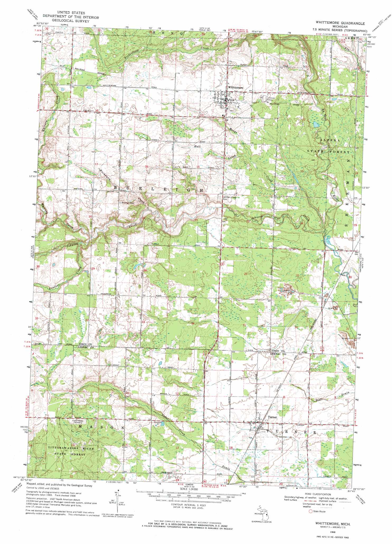
Whittemore Topo Map Michigan
To zoom in, hover over the map of Whittemore
USGS Topo Quad 44083b7 - 1:24,000 scale
| Topo Map Name: | Whittemore |
| USGS Topo Quad ID: | 44083b7 |
| Print Size: | ca. 21 1/4" wide x 27" high |
| Southeast Coordinates: | 44.125° N latitude / 83.75° W longitude |
| Map Center Coordinates: | 44.1875° N latitude / 83.8125° W longitude |
| U.S. State: | MI |
| Filename: | o44083b7.jpg |
| Download Map JPG Image: | Whittemore topo map 1:24,000 scale |
| Map Type: | Topographic |
| Topo Series: | 7.5´ |
| Map Scale: | 1:24,000 |
| Source of Map Images: | United States Geological Survey (USGS) |
| Alternate Map Versions: |
Whittemore MI 1968, updated 1971 Download PDF Buy paper map Whittemore MI 2011 Download PDF Buy paper map Whittemore MI 2014 Download PDF Buy paper map Whittemore MI 2016 Download PDF Buy paper map |
1:24,000 Topo Quads surrounding Whittemore
Rose City |
South Branch |
Hale |
Loud Dam |
Sid Town |
Selkirk |
Sage Lake |
Hale Se |
Floyd Lake |
Tawas City |
Skidway Lake |
Prescott |
Whittemore |
National City |
Alabaster |
Sterling |
Omer Sw |
Omer |
Au Gres |
Point Lookout |
Mount Forest |
Standish |
Standish Ne |
Au Gres |
> Back to 44083a1 at 1:100,000 scale
> Back to 44082a1 at 1:250,000 scale
> Back to U.S. Topo Maps home
Whittemore topo map: Gazetteer
Whittemore: Populated Places
Turner elevation 194m 636′Whittemore elevation 237m 777′
Whittemore: Post Offices
Turner Post Office elevation 194m 636′Whittemore Post Office elevation 237m 777′
Whittemore: Streams
Buchanan Creek elevation 205m 672′Crainer Creek elevation 212m 695′
Hall Creek elevation 210m 688′
Johnson Creek elevation 192m 629′
Mongo Creek elevation 192m 629′
Whitney Creek elevation 211m 692′
Whittemore digital topo map on disk
Buy this Whittemore topo map showing relief, roads, GPS coordinates and other geographical features, as a high-resolution digital map file on DVD:
 map DVD")