Hale Se Topo Map Michigan
To zoom in, hover over the map of Hale Se
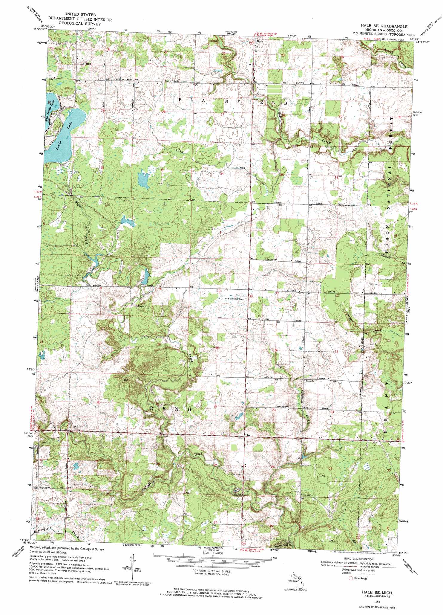
USGS Topo Quad 44083c7 - 1:24,000 scale
| Topo Map Name: | Hale Se |
| USGS Topo Quad ID: | 44083c7 |
| Print Size: | ca. 21 1/4" wide x 27" high |
| Southeast Coordinates: | 44.25° N latitude / 83.75° W longitude |
| Map Center Coordinates: | 44.3125° N latitude / 83.8125° W longitude |
| U.S. State: | MI |
| Filename: | o44083c7.jpg |
| Download Map JPG Image: | Hale Se topo map 1:24,000 scale |
| Map Type: | Topographic |
| Topo Series: | 7.5´ |
| Map Scale: | 1:24,000 |
| Source of Map Images: | United States Geological Survey (USGS) |
| Alternate Map Versions: |
Hale SE MI 1968, updated 1971 Download PDF Buy paper map Hale SE MI 2012 Download PDF Buy paper map Hale SE MI 2014 Download PDF Buy paper map Hale SE MI 2016 Download PDF Buy paper map |
| FStopo: | US Forest Service topo Hale SE is available: Download FStopo PDF Download FStopo TIF |
1:24,000 Topo Quads surrounding Hale Se
Mack Lake |
Goodar |
Alcona Dam Pond |
Glennie |
Sprinkler Creek |
Rose City |
South Branch |
Hale |
Loud Dam |
Sid Town |
Selkirk |
Sage Lake |
Hale Se |
Floyd Lake |
Tawas City |
Skidway Lake |
Prescott |
Whittemore |
National City |
Alabaster |
Sterling |
Omer Sw |
Omer |
Au Gres |
Point Lookout |
> Back to 44083a1 at 1:100,000 scale
> Back to 44082a1 at 1:250,000 scale
> Back to U.S. Topo Maps home
Hale Se topo map: Gazetteer
Hale Se: Lakes
Londo Lake elevation 267m 875′Hale Se: Post Offices
Siloam Post Office (historical) elevation 251m 823′Hale Se: Streams
Addy Drain elevation 243m 797′Hope Creek elevation 220m 721′
Latter Creek elevation 211m 692′
Porterfield Creek elevation 207m 679′
Hale Se digital topo map on disk
Buy this Hale Se topo map showing relief, roads, GPS coordinates and other geographical features, as a high-resolution digital map file on DVD:
 map DVD")