Barton City Topo Map Michigan
To zoom in, hover over the map of Barton City
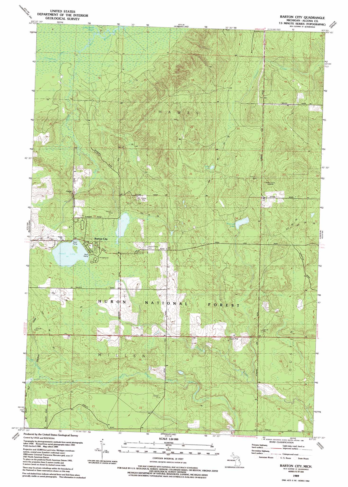
USGS Topo Quad 44083f5 - 1:24,000 scale
| Topo Map Name: | Barton City |
| USGS Topo Quad ID: | 44083f5 |
| Print Size: | ca. 21 1/4" wide x 27" high |
| Southeast Coordinates: | 44.625° N latitude / 83.5° W longitude |
| Map Center Coordinates: | 44.6875° N latitude / 83.5625° W longitude |
| U.S. State: | MI |
| Filename: | o44083f5.jpg |
| Download Map JPG Image: | Barton City topo map 1:24,000 scale |
| Map Type: | Topographic |
| Topo Series: | 7.5´ |
| Map Scale: | 1:24,000 |
| Source of Map Images: | United States Geological Survey (USGS) |
| Alternate Map Versions: |
Barton City MI 1989, updated 1989 Download PDF Buy paper map Barton City MI 2012 Download PDF Buy paper map Barton City MI 2014 Download PDF Buy paper map Barton City MI 2016 Download PDF Buy paper map |
| FStopo: | US Forest Service topo Barton City is available: Download FStopo PDF Download FStopo TIF |
1:24,000 Topo Quads surrounding Barton City
Beaver Lake |
Evans Creek |
Big Ravine Creek |
Ossineke |
South Point |
Mcginn Creek |
Hubbard Lake Sw |
Hubbard Lake |
Spruce |
Black River |
Curran |
Bucks Pond |
Barton City |
Lincoln |
Harrisville |
Alcona Dam Pond |
Glennie |
Sprinkler Creek |
Mikado |
Greenbush |
Hale |
Loud Dam |
Sid Town |
Foote Site Village |
Oscoda |
> Back to 44083e1 at 1:100,000 scale
> Back to 44082a1 at 1:250,000 scale
> Back to U.S. Topo Maps home
Barton City topo map: Gazetteer
Barton City: Lakes
Jewell Lake elevation 250m 820′Maynard Lake elevation 257m 843′
Potter Lake elevation 274m 898′
Barton City: Parks
Burgess Park elevation 258m 846′Barton City: Populated Places
Barton City elevation 253m 830′Barton City: Post Offices
Barton City Post Office elevation 256m 839′Barton City: Streams
Buff Creek elevation 218m 715′Comstock Creek elevation 218m 715′
Little North Creek elevation 222m 728′
Loud Creek elevation 246m 807′
Barton City digital topo map on disk
Buy this Barton City topo map showing relief, roads, GPS coordinates and other geographical features, as a high-resolution digital map file on DVD:
 map DVD")