Ossineke Topo Map Michigan
To zoom in, hover over the map of Ossineke
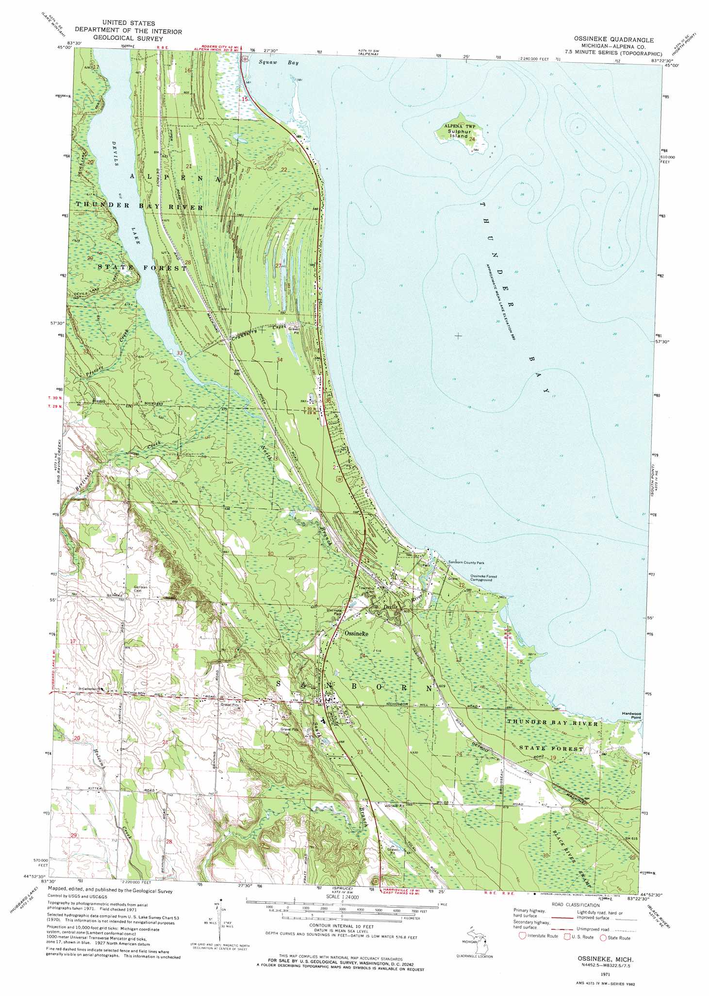
USGS Topo Quad 44083h4 - 1:24,000 scale
| Topo Map Name: | Ossineke |
| USGS Topo Quad ID: | 44083h4 |
| Print Size: | ca. 21 1/4" wide x 27" high |
| Southeast Coordinates: | 44.875° N latitude / 83.375° W longitude |
| Map Center Coordinates: | 44.9375° N latitude / 83.4375° W longitude |
| U.S. State: | MI |
| Filename: | o44083h4.jpg |
| Download Map JPG Image: | Ossineke topo map 1:24,000 scale |
| Map Type: | Topographic |
| Topo Series: | 7.5´ |
| Map Scale: | 1:24,000 |
| Source of Map Images: | United States Geological Survey (USGS) |
| Alternate Map Versions: |
Ossineke MI 1971, updated 1974 Download PDF Buy paper map Ossineke MI 1971, updated 1974 Download PDF Buy paper map Ossineke MI 2011 Download PDF Buy paper map Ossineke MI 2014 Download PDF Buy paper map Ossineke MI 2016 Download PDF Buy paper map |
1:24,000 Topo Quads surrounding Ossineke
Polaski |
Long Lake West |
Long Lake East |
Middle Island |
|
Lachine |
Lake Winyah |
Alpena |
North Point |
Thunder Bay Island |
Evans Creek |
Big Ravine Creek |
Ossineke |
South Point |
|
Hubbard Lake Sw |
Hubbard Lake |
Spruce |
Black River |
|
Bucks Pond |
Barton City |
Lincoln |
Harrisville |
> Back to 44083e1 at 1:100,000 scale
> Back to 44082a1 at 1:250,000 scale
> Back to U.S. Topo Maps home
Ossineke topo map: Gazetteer
Ossineke: Capes
Hardwood Point elevation 177m 580′Ossineke: Islands
Sulphur Island elevation 190m 623′Ossineke: Lakes
Devils Lake elevation 187m 613′Ossineke: Parks
Ossineke Park elevation 185m 606′Sanborn Country Park elevation 177m 580′
Ossineke: Populated Places
Ossineke elevation 199m 652′Riverview Estates Mobile Home Park elevation 205m 672′
Ossineke: Post Offices
Ossineke Post Office elevation 199m 652′Ossineke: Streams
Berlinski Creek elevation 187m 613′Cranberry Creek elevation 177m 580′
Devils River elevation 177m 580′
North Branch Devils River elevation 186m 610′
Precore Creek elevation 187m 613′
South Branch Devils River elevation 186m 610′
Ossineke digital topo map on disk
Buy this Ossineke topo map showing relief, roads, GPS coordinates and other geographical features, as a high-resolution digital map file on DVD:
 map DVD")