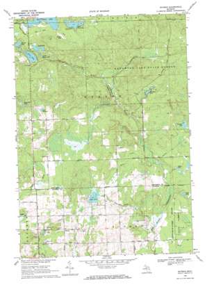
Butman Topo Map Michigan
To zoom in, hover over the map of Butman
USGS Topo Quad 44084b4 - 1:24,000 scale
| Topo Map Name: | Butman |
| USGS Topo Quad ID: | 44084b4 |
| Print Size: | ca. 21 1/4" wide x 27" high |
| Southeast Coordinates: | 44.125° N latitude / 84.375° W longitude |
| Map Center Coordinates: | 44.1875° N latitude / 84.4375° W longitude |
| U.S. State: | MI |
| Filename: | o44084b4.jpg |
| Download Map JPG Image: | Butman topo map 1:24,000 scale |
| Map Type: | Topographic |
| Topo Series: | 7.5´ |
| Map Scale: | 1:24,000 |
| Source of Map Images: | United States Geological Survey (USGS) |
| Alternate Map Versions: |
Burtman MI 1969, updated 1971 Download PDF Buy paper map Butman MI 2011 Download PDF Buy paper map Butman MI 2014 Download PDF Buy paper map Butman MI 2017 Download PDF Buy paper map |
1:24,000 Topo Quads surrounding Butman
> Back to 44084a1 at 1:100,000 scale
> Back to 44084a1 at 1:250,000 scale
> Back to U.S. Topo Maps home
Butman topo map: Gazetteer
Butman: Airports
Sugar Springs Airport elevation 284m 931′Butman: Lakes
Campbell Lake elevation 267m 875′Clear Lake elevation 358m 1174′
Coan Millpond elevation 340m 1115′
Dunham Lake elevation 304m 997′
East Twin Lake elevation 364m 1194′
Eddy Lake elevation 366m 1200′
Knowland Lake elevation 350m 1148′
Lake Four elevation 282m 925′
Little Woods Lake elevation 358m 1174′
Perch Lake elevation 258m 846′
Spring Lake elevation 361m 1184′
West Twin Lake elevation 365m 1197′
Woods Lake elevation 361m 1184′
Butman: Populated Places
Butman elevation 293m 961′Butman: Post Offices
Butman Post Office (historical) elevation 293m 961′Nolan Post Office (historical) elevation 335m 1099′
Butman: Reservoirs
Mikes Lake elevation 264m 866′Butman: Streams
Lake Four Outlet elevation 246m 807′Lost Creek elevation 353m 1158′
Muma Creek elevation 258m 846′
Noren Creek elevation 268m 879′
Butman digital topo map on disk
Buy this Butman topo map showing relief, roads, GPS coordinates and other geographical features, as a high-resolution digital map file on DVD:


