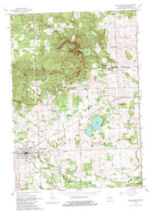
West Branch Topo Map Michigan
To zoom in, hover over the map of West Branch
USGS Topo Quad 44084c2 - 1:24,000 scale
| Topo Map Name: | West Branch |
| USGS Topo Quad ID: | 44084c2 |
| Print Size: | ca. 21 1/4" wide x 27" high |
| Southeast Coordinates: | 44.25° N latitude / 84.125° W longitude |
| Map Center Coordinates: | 44.3125° N latitude / 84.1875° W longitude |
| U.S. State: | MI |
| Filename: | o44084c2.jpg |
| Download Map JPG Image: | West Branch topo map 1:24,000 scale |
| Map Type: | Topographic |
| Topo Series: | 7.5´ |
| Map Scale: | 1:24,000 |
| Source of Map Images: | United States Geological Survey (USGS) |
| Alternate Map Versions: |
West Branch MI 1965, updated 1966 Download PDF Buy paper map West Branch MI 1965, updated 1982 Download PDF Buy paper map West Branch MI 1965, updated 1982 Download PDF Buy paper map West Branch MI 2011 Download PDF Buy paper map West Branch MI 2014 Download PDF Buy paper map West Branch MI 2017 Download PDF Buy paper map |
1:24,000 Topo Quads surrounding West Branch
> Back to 44084a1 at 1:100,000 scale
> Back to 44084a1 at 1:250,000 scale
> Back to U.S. Topo Maps home
West Branch topo map: Gazetteer
West Branch: Forests
Ogemaw State Forest elevation 409m 1341′West Branch: Lakes
Crapo Lake elevation 292m 958′Deer Lake elevation 292m 958′
Engle Pond elevation 309m 1013′
Flowage Lake elevation 271m 889′
Haskell Lake elevation 341m 1118′
Lang Pond elevation 304m 997′
Mud Lake elevation 294m 964′
Peach Lake elevation 275m 902′
Rifle Lake elevation 292m 958′
West Branch: Oilfields
West Branch Oil Field elevation 279m 915′West Branch: Parks
Irons Park elevation 282m 925′West Branch: Populated Places
Campbells Corners elevation 323m 1059′Country Village Estates Mobile Home Park elevation 277m 908′
Twin Pines Mobile Home Park elevation 277m 908′
West Branch elevation 291m 954′
West Branch Travel Trailer Park elevation 276m 905′
West Branch: Post Offices
Campbells Corners Post Office (historical) elevation 324m 1062′West Branch Post Office elevation 293m 961′
West Branch: Springs
Geory Spring elevation 305m 1000′West Branch: Streams
Brewery Creek elevation 281m 921′Crane Creek elevation 294m 964′
Crapo Creek elevation 292m 958′
Grow Creek elevation 250m 820′
Little Klacking Creek elevation 289m 948′
Ogemaw Creek elevation 274m 898′
Peach Lake Creek elevation 253m 830′
Rapid Creek elevation 299m 980′
Rifle Creek elevation 271m 889′
Woods Creek elevation 280m 918′
West Branch: Swamps
Foose Swamp elevation 313m 1026′West Branch digital topo map on disk
Buy this West Branch topo map showing relief, roads, GPS coordinates and other geographical features, as a high-resolution digital map file on DVD:


