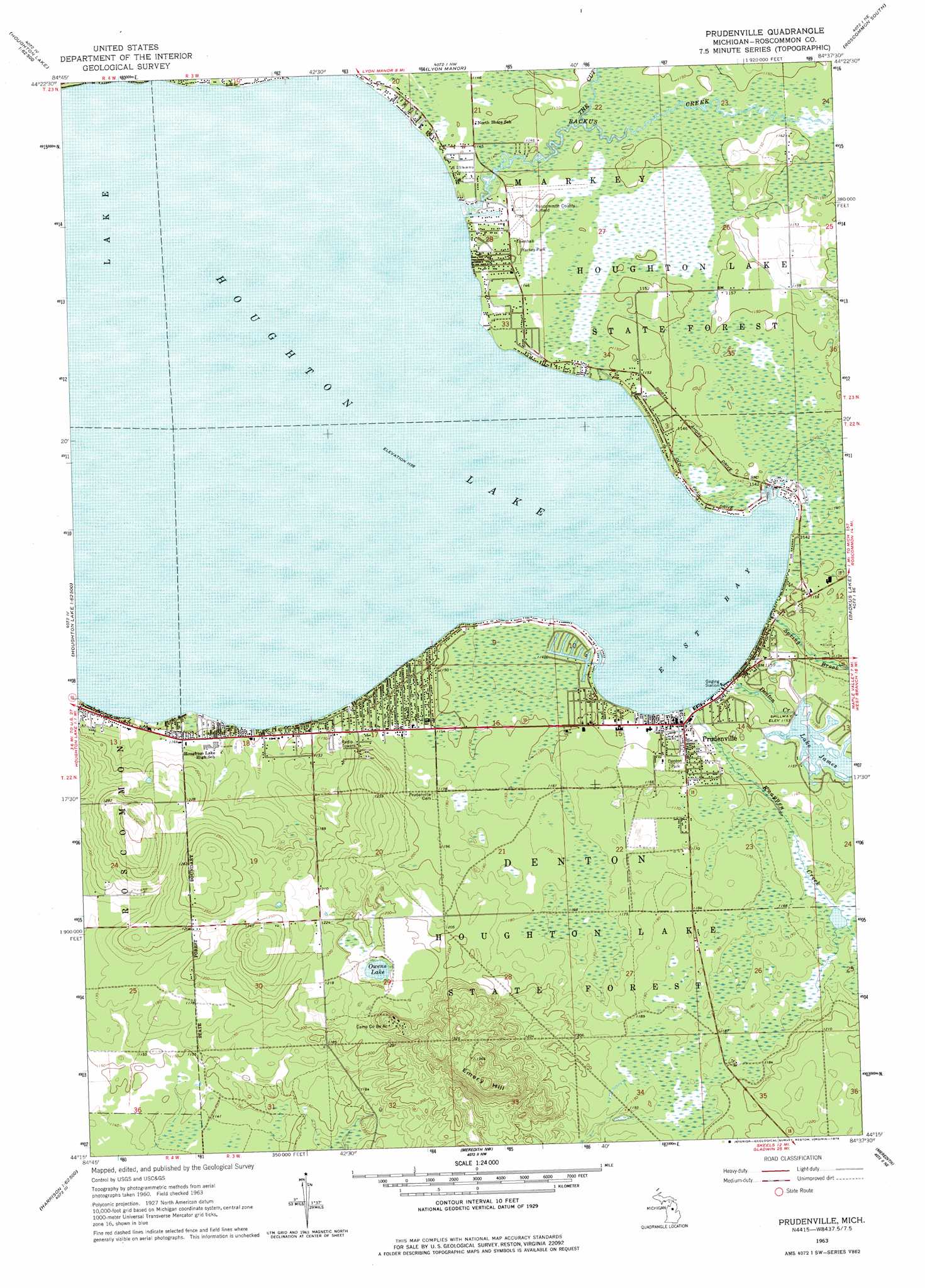
Prudenville Topo Map Michigan
To zoom in, hover over the map of Prudenville
USGS Topo Quad 44084c6 - 1:24,000 scale
| Topo Map Name: | Prudenville |
| USGS Topo Quad ID: | 44084c6 |
| Print Size: | ca. 21 1/4" wide x 27" high |
| Southeast Coordinates: | 44.25° N latitude / 84.625° W longitude |
| Map Center Coordinates: | 44.3125° N latitude / 84.6875° W longitude |
| U.S. State: | MI |
| Filename: | o44084c6.jpg |
| Download Map JPG Image: | Prudenville topo map 1:24,000 scale |
| Map Type: | Topographic |
| Topo Series: | 7.5´ |
| Map Scale: | 1:24,000 |
| Source of Map Images: | United States Geological Survey (USGS) |
| Alternate Map Versions: |
Prudenville MI 1963, updated 1964 Download PDF Buy paper map Prudenville MI 2011 Download PDF Buy paper map Prudenville MI 2014 Download PDF Buy paper map Prudenville MI 2017 Download PDF Buy paper map |
1:24,000 Topo Quads surrounding Prudenville
Fletcher |
Cote Dame Marie |
Pere Cheney |
Roscommon North |
Eldorado |
Addis Creek |
Meads Landing |
Lyon Manor |
Roscommon South |
Saint Helen Nw |
Merritt |
Houghton Lake |
Prudenville |
Backus Lake |
Saint Helen |
Moddersville |
Cooperton |
Meredith Nw |
Meredith |
Butman |
Prestle Creek |
Harrison |
Meredith Sw |
Skeels |
Wagarville |
> Back to 44084a1 at 1:100,000 scale
> Back to 44084a1 at 1:250,000 scale
> Back to U.S. Topo Maps home
Prudenville topo map: Gazetteer
Prudenville: Airports
Roscommon County Airport elevation 350m 1148′Prudenville: Bays
East Bay elevation 347m 1138′Prudenville: Capes
Songers Point elevation 347m 1138′Prudenville: Lakes
Houghton Lake elevation 347m 1138′Lake Co-Be-Ac elevation 364m 1194′
Prudenville: Parks
Denton Park elevation 352m 1154′Markey Park elevation 350m 1148′
Prudenville: Populated Places
Denton Township Trailer Park elevation 352m 1154′Prudenville elevation 349m 1145′
Prudenville: Post Offices
Prudenville Post Office elevation 350m 1148′Prudenville: Reservoirs
Lake James elevation 351m 1151′Prudenville: Streams
Backus Creek elevation 347m 1138′Denton Creek elevation 347m 1138′
Knappen Creek elevation 347m 1138′
Spring Brook elevation 347m 1138′
The Cut elevation 347m 1138′
Prudenville: Summits
Emery Hill elevation 414m 1358′Prudenville digital topo map on disk
Buy this Prudenville topo map showing relief, roads, GPS coordinates and other geographical features, as a high-resolution digital map file on DVD: