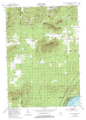
Cote Dame Marie Topo Map Michigan
To zoom in, hover over the map of Cote Dame Marie
USGS Topo Quad 44084e7 - 1:24,000 scale
| Topo Map Name: | Cote Dame Marie |
| USGS Topo Quad ID: | 44084e7 |
| Print Size: | ca. 21 1/4" wide x 27" high |
| Southeast Coordinates: | 44.5° N latitude / 84.75° W longitude |
| Map Center Coordinates: | 44.5625° N latitude / 84.8125° W longitude |
| U.S. State: | MI |
| Filename: | o44084e7.jpg |
| Download Map JPG Image: | Cote Dame Marie topo map 1:24,000 scale |
| Map Type: | Topographic |
| Topo Series: | 7.5´ |
| Map Scale: | 1:24,000 |
| Source of Map Images: | United States Geological Survey (USGS) |
| Alternate Map Versions: |
Cote Dame Marie MI 1950, updated 1953 Download PDF Buy paper map Cote Dame Marie MI 1950, updated 1978 Download PDF Buy paper map Cote Dame Marie MI 1950, updated 1978 Download PDF Buy paper map Cote Dame Marie MI 2011 Download PDF Buy paper map Cote Dame Marie MI 2014 Download PDF Buy paper map Cote Dame Marie MI 2017 Download PDF Buy paper map |
1:24,000 Topo Quads surrounding Cote Dame Marie
> Back to 44084e1 at 1:100,000 scale
> Back to 44084a1 at 1:250,000 scale
> Back to U.S. Topo Maps home
Cote Dame Marie topo map: Gazetteer
Cote Dame Marie: Lakes
Kings Ponds elevation 351m 1151′Cote Dame Marie: Parks
American Legion Park elevation 357m 1171′Beginning of State Reforestation Historical Marker elevation 358m 1174′
North Higgins Lake State Park elevation 355m 1164′
Officer's Club Historical Marker elevation 358m 1174′
Cote Dame Marie: Populated Places
Tent City elevation 364m 1194′Cote Dame Marie: Post Offices
Wellington Post Office (historical) elevation 369m 1210′Cote Dame Marie: Ranges
McLachlan Hills elevation 438m 1437′Cote Dame Marie: Ridges
Vosges Ridge elevation 390m 1279′Cote Dame Marie: Summits
Baker Hill elevation 386m 1266′Copper Range elevation 386m 1266′
Cote Dame Marie elevation 456m 1496′
Crum Hill elevation 413m 1354′
Falk Hill elevation 418m 1371′
Lamb Hill elevation 408m 1338′
McCall Hill elevation 408m 1338′
Olsen Hill elevation 444m 1456′
Regan Hill elevation 385m 1263′
Stafford Hill elevation 395m 1295′
Taylor Hill elevation 439m 1440′
Three Sisters Range elevation 431m 1414′
Westenage Hill elevation 422m 1384′
Cote Dame Marie: Swamps
Grass Lake elevation 364m 1194′Cote Dame Marie digital topo map on disk
Buy this Cote Dame Marie topo map showing relief, roads, GPS coordinates and other geographical features, as a high-resolution digital map file on DVD:


