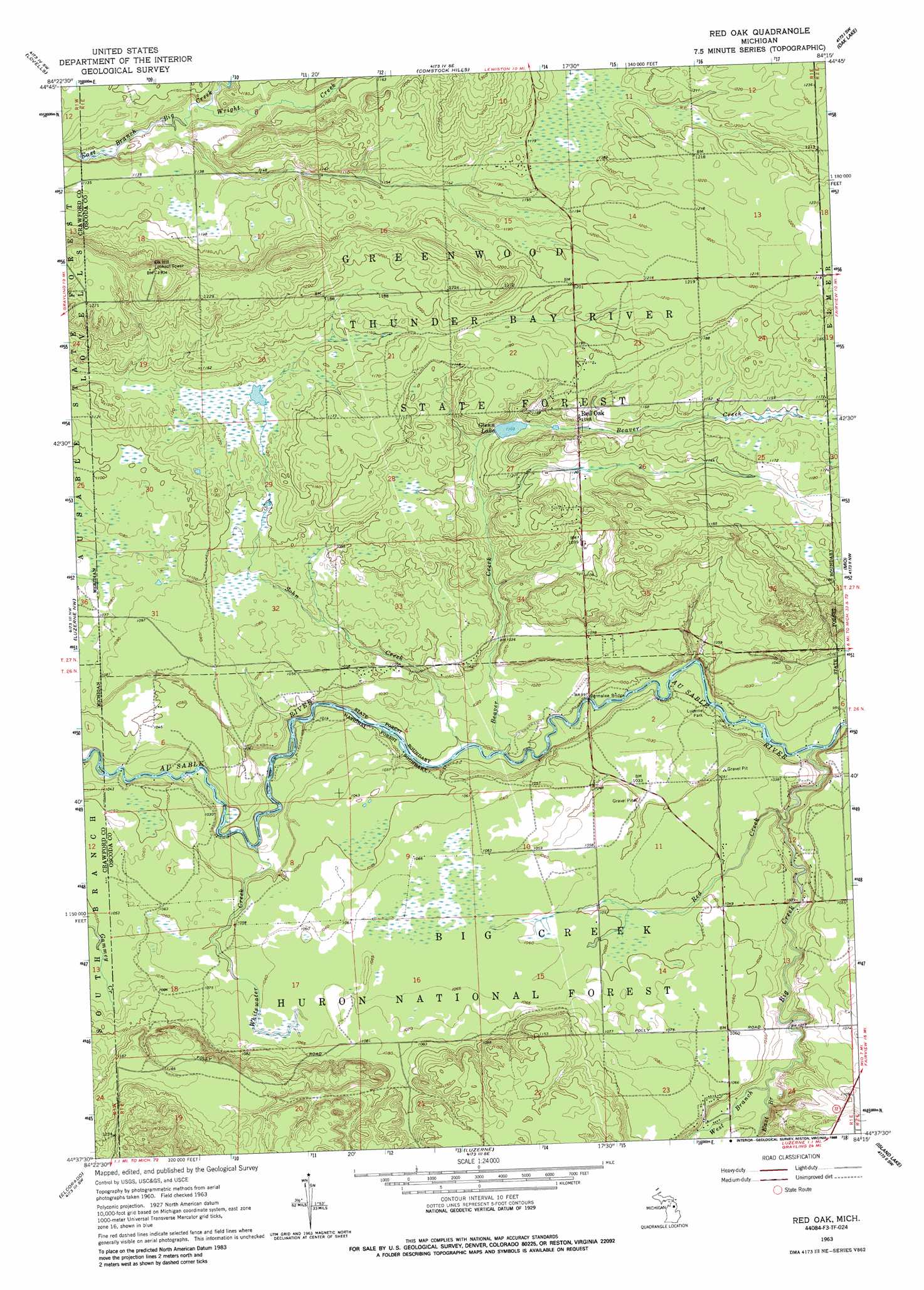
Red Oak Topo Map Michigan
To zoom in, hover over the map of Red Oak
USGS Topo Quad 44084f3 - 1:24,000 scale
| Topo Map Name: | Red Oak |
| USGS Topo Quad ID: | 44084f3 |
| Print Size: | ca. 21 1/4" wide x 27" high |
| Southeast Coordinates: | 44.625° N latitude / 84.25° W longitude |
| Map Center Coordinates: | 44.6875° N latitude / 84.3125° W longitude |
| U.S. State: | MI |
| Filename: | o44084f3.jpg |
| Download Map JPG Image: | Red Oak topo map 1:24,000 scale |
| Map Type: | Topographic |
| Topo Series: | 7.5´ |
| Map Scale: | 1:24,000 |
| Source of Map Images: | United States Geological Survey (USGS) |
| Alternate Map Versions: |
Red Oak MI 1963, updated 1964 Download PDF Buy paper map Red Oak MI 1963, updated 1988 Download PDF Buy paper map Red Oak MI 2012 Download PDF Buy paper map Red Oak MI 2014 Download PDF Buy paper map Red Oak MI 2017 Download PDF Buy paper map |
| FStopo: | US Forest Service topo Red Oak is available: Download FStopo PDF Download FStopo TIF |
1:24,000 Topo Quads surrounding Red Oak
Turtle Lake |
Johannesburg |
Lewiston |
Crooked Lake |
Avery |
K P Lake |
Lovells |
Comstock Hills |
Oak Lake |
Comins |
Wakeley Lake |
Luzerne Nw |
Red Oak |
Mio |
Fairview |
Roscommon North |
Eldorado |
Luzerne |
Island Lake |
Mack Lake |
Roscommon South |
Saint Helen Nw |
Saint Helen Ne |
Damon |
Rose City |
> Back to 44084e1 at 1:100,000 scale
> Back to 44084a1 at 1:250,000 scale
> Back to U.S. Topo Maps home
Red Oak topo map: Gazetteer
Red Oak: Bridges
Parmalee Bridge elevation 301m 987′Red Oak: Lakes
Glenn Lake elevation 336m 1102′Red Oak: Parks
Luzerne Park elevation 303m 994′Red Oak: Populated Places
Red Oak elevation 356m 1167′Red Oak: Post Offices
Red Oak Post Office (historical) elevation 356m 1167′Red Oak: Streams
Beaver Creek elevation 302m 990′Big Creek elevation 298m 977′
East Branch Big Creek elevation 310m 1017′
Red Creek elevation 300m 984′
Sohn Creek elevation 302m 990′
West Branch Big Creek elevation 310m 1017′
Whitewater Creek elevation 304m 997′
Wright Creek elevation 337m 1105′
Red Oak digital topo map on disk
Buy this Red Oak topo map showing relief, roads, GPS coordinates and other geographical features, as a high-resolution digital map file on DVD: