Luther Se Topo Map Michigan
To zoom in, hover over the map of Luther Se
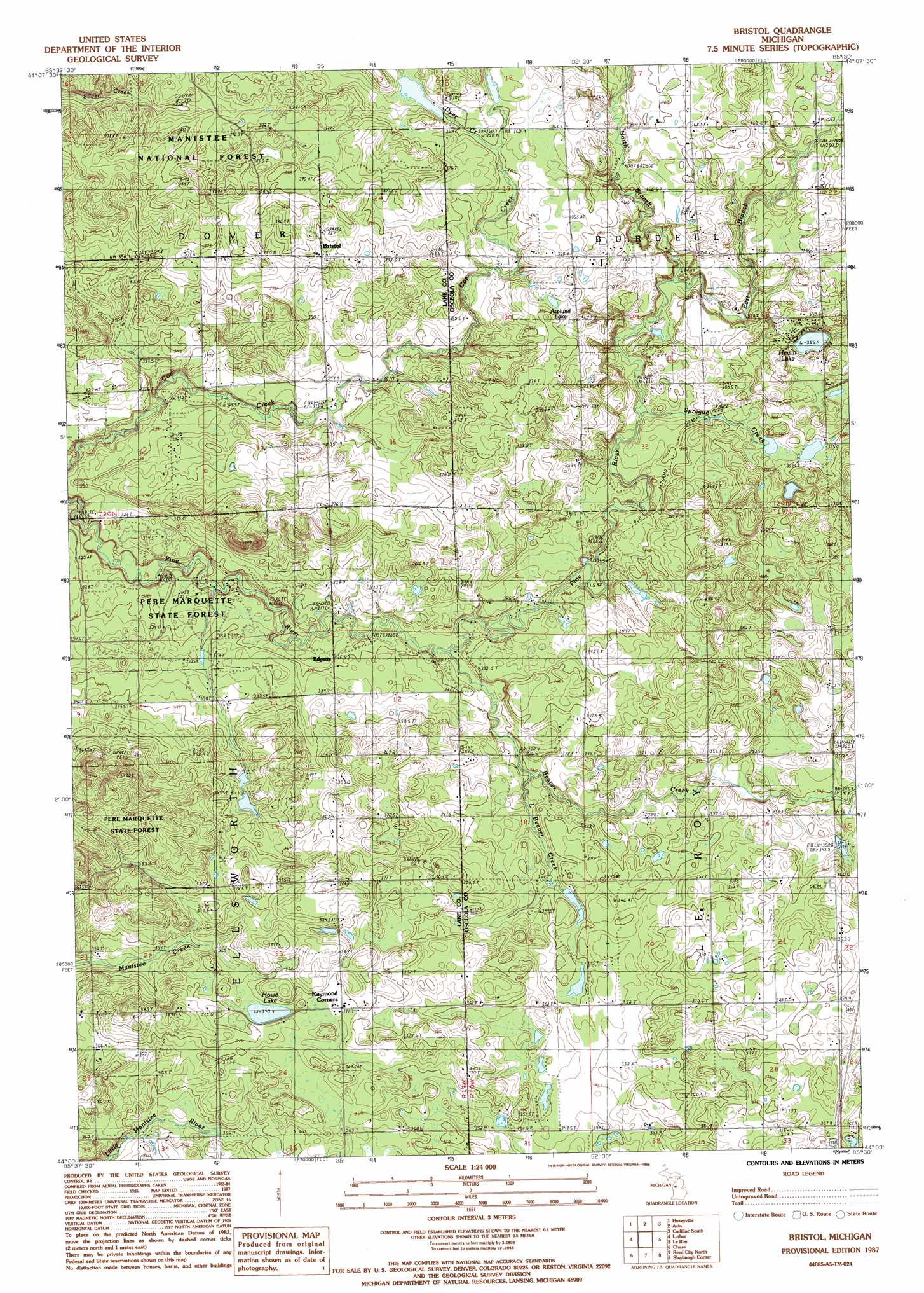
USGS Topo Quad 44085a5 - 1:24,000 scale
| Topo Map Name: | Luther Se |
| USGS Topo Quad ID: | 44085a5 |
| Print Size: | ca. 21 1/4" wide x 27" high |
| Southeast Coordinates: | 44° N latitude / 85.5° W longitude |
| Map Center Coordinates: | 44.0625° N latitude / 85.5625° W longitude |
| U.S. State: | MI |
| Filename: | o44085a5.jpg |
| Download Map JPG Image: | Luther Se topo map 1:24,000 scale |
| Map Type: | Topographic |
| Topo Series: | 7.5´ |
| Map Scale: | 1:24,000 |
| Source of Map Images: | United States Geological Survey (USGS) |
| Alternate Map Versions: |
Bristol MI 1987, updated 1988 Download PDF Buy paper map Bristol MI 2012 Download PDF Buy paper map Bristol MI 2014 Download PDF Buy paper map Bristol MI 2016 Download PDF Buy paper map |
| FStopo: | US Forest Service topo Bristol is available: Download FStopo PDF Download FStopo TIF |
1:24,000 Topo Quads surrounding Luther Se
Yuma |
Harrieta |
Boon |
Cadillac North |
Jennings |
Peacock Ne |
Luther Nw |
Luther Ne |
Cadillac South |
Lucas |
Peacock Se |
Luther Sw |
Luther Se |
Le Roy |
Dighton |
Baldwin |
Chase |
Reed City North |
Slaybaugh Corner |
Evart |
Marlborough |
Whipple Lake |
Reed City South |
Hersey |
Chippewa Lake North |
> Back to 44085a1 at 1:100,000 scale
> Back to 44084a1 at 1:250,000 scale
> Back to U.S. Topo Maps home
Luther Se topo map: Gazetteer
Luther Se: Crossings
Interchange 162 elevation 369m 1210′Luther Se: Lakes
Asplund Lake elevation 368m 1207′Hewitt Lake elevation 355m 1164′
Howe Lake elevation 370m 1213′
Marl Bed Lake elevation 350m 1148′
Luther Se: Populated Places
Bristol elevation 368m 1207′Dewing's (historical) elevation 368m 1207′
Edgetts elevation 328m 1076′
Luther Se: Post Offices
Bristol Post Office (historical) elevation 368m 1207′Dewings Post Office (historical) elevation 368m 1207′
Edgetts Post Office (historical) elevation 328m 1076′
Keenan Post Office (historical) elevation 348m 1141′
Riverbank Post Office (historical) elevation 326m 1069′
Luther Se: Streams
Beaver Creek elevation 320m 1049′Dyer Creek elevation 357m 1171′
East Branch Pine River elevation 337m 1105′
Little Beaver Creek elevation 327m 1072′
North Branch Pine River elevation 341m 1118′
Sprague Creek elevation 332m 1089′
Luther Se digital topo map on disk
Buy this Luther Se topo map showing relief, roads, GPS coordinates and other geographical features, as a high-resolution digital map file on DVD: